1840–41 Royal Engineers maps of Palestine, Lebanon and Syria
The 1840–41 Royal Engineers maps of Palestine, Lebanon and Syria was an early scientific mapping of Palestine (including a detailed mapping of Jerusalem), Lebanon and Syria.
| 1840–41 Royal Engineers maps of Palestine, Lebanon and Syria | |
|---|---|
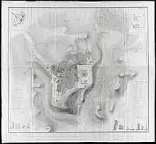
 The Aldrich and Symonds map of Jerusalem | |
| Created | 1840-41 |
| Location | The National Archives (United Kingdom) |
| Author(s) | Royal Engineers |
It represented the second modern, triangulation-based, attempt at surveying Palestine.[1]
It has occasionally been mislabeled as an Ordnance Survey map; in fact none of the officers worked for the Ordnance Survey, which was a separate organization.[2] The Ordnance Survey of Jerusalem, carried out almost 25 years later, was a separate and materially more detailed endeavor.
Jerusalem map
The Jerusalem map was printed privately for the Board of Ordnance in August 1841. It was published in a reduced form in Alderson's ‘’Professional Papers of the Royal Engineers’’ in 1845,[3] and subsequently as a supplement to the 1849 second edition of George Williams’ The Holy City: Historical, Topographical, and Antiquarian Notices of Jerusalem together with a 130-page memoir on the plan.[4][5] The memoir contained a three-page appendix defending the plan from criticism received from Edward Robinson. [4]
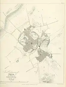
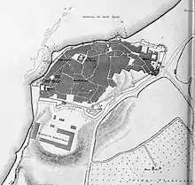
Regional maps
The regional maps were never published in their entirety.[1] A private printing for the British Foreign Office was produced in 1846.[6] The only published map, Map 2, was published in Charles Henry Churchill's book on Mount Lebanon.[6] Map 3 was used in the creation of Van de Velde's map.[1]
Charles Wilson later explained that the data "was in too fragmentary a state for publication". [7]
Criticism
The survey contained a number of flaws. The theodolite was often operated by Symonds alone, miscalculations were made around heights (e.g. on the Sea of Galilee), and the outlines of the Haram es-Sharif in Jerusalem were known to have been miscalculated. As such, scholars such as Edward Robinson and August Petermann chose not to trust the work.[8]
List of officers involved in the survey
- Edward Aldrich
- Julian Symonds[9]
- Charles Rochfort Scott
- Ralph Carr Alderson
- Frederick Robe
- Charles Francis Skyring
- Richard Wilbraham
Gallery
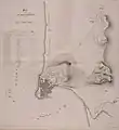
Regional maps
 Sheet 2: Mount Lebanon
 Sheet 3: Palestine
Bibliography
Primary sources
- Alderson, Ralph Carr (1843). "Notes on Acre and Some of the Coast Defences of Syria". Papers on subjects connected with the duties of the corps of Royal Engineers. 6.
Secondary sources
- Moscrop, John James (1 January 2000). Measuring Jerusalem: The Palestine Exploration Fund and British Interests in the Holy Land. A&C Black. ISBN 978-0-7185-0220-1.
- Chapman, Rupert, "British Archaeology and the Holy Land in the 19th Century: sources and a framework for study'", Britain and the Holy Land 1800–1914
- Goren, Haim; Faehndrich, Jutta; Schelhaas, Bruno (28 February 2017). Mapping the Holy Land: The Foundation of a Scientific Cartography of Palestine. Bloomsbury Publishing. ISBN 978-0-85772-785-5.CS1 maint: ref=harv (link)
- Jones, Yolande (1973). "British Military Surveys of Palestine and Syria 1840-1841" (PDF). The Cartographic Journal. 10 (1): 29–41. doi:10.1179/caj.1973.10.1.29.CS1 maint: ref=harv (link)
- British surveyors in Palestine and Syria, 1840–1841', International Cartographic Conference A Coruña 2005
- Tobler, Titus (1858). Planography of Jerusalem: memoir to accompany the new ground-plan of the city of Jerusalem and the environs, constructed anew by C.W.M. Vande Velde. Justus Perthes.
- van de Velde, Carel Willem Meredith (1858). Memoir to Accompany the Map of the Holy Land. Justus Perthes.
- Goren, Haim (2002). "Sacred, but Not Surveyed: Nineteenth-Century Surveys of Palestine". Imago Mundi. 54: 87–110. doi:10.1080/03085690208592960. JSTOR 1151507.CS1 maint: ref=harv (link)
- Schelhaas, Bruno; Faehndrich, Jutta; Goren, Haim (28 February 2017). Mapping the Holy Land: The Foundation of a Scientific Cartography of Palestine. Bloomsbury Publishing. ISBN 978-0-85772-785-5.
References
- Goren, Faehndrich & Schelhaas 2017, p. 66.
- Jones 1973, p. 30.
- ”Addition to ‘Notes on Acre’”, Papers on Subjects connected with the Duties of the Corps of Royal Engineers, VII, 1845, 46-47
- Williams, George (1849). "Supplement: Memoir on the Plan of Jerusalem". The Holy City: Historical, Topographical, and Antiquarian Notices of Jerusalem. J.W. Parker. pp. 1–130.
- Jones 1973, p. 32.
- Jones 1973, p. 37.
- Goren 2002, p. 90.
- Goren, Faehndrich & Schelhaas 2017, p. 102-103.
- Note that Yolande Jones' 1973 publication mislabels Lt. Symonds as "John", a mistake repeated by other authors.
| Wikimedia Commons has media related to 1840–41 Royal Engineers maps of Palestine and Syria. |


.jpg.webp)
