Acarigua
Acarigua (Spanish pronunciation: [akaˈɾiɣwa]), founded as San Miguel de Acarigua, is a city in northwestern Venezuela, in the northern part of the state of Portuguesa.
Acarigua | |
|---|---|
City | |
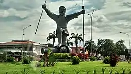 Statue of Portuguesa in December 5 Square (Plaza del 5 de Diciembre) | |
 Flag 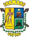 Coat of arms | |
.svg.png.webp) Acarigua Location in Venezuela 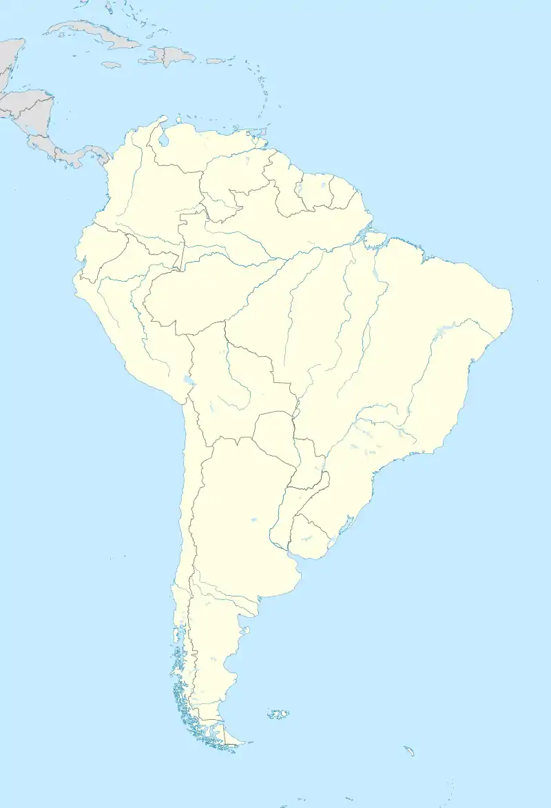 Acarigua Acarigua (South America) | |
| Coordinates: 9°33′35″N 69°12′7″W | |
| Country | |
| State | Portuguesa State |
| Municipality | Páez Municipality |
| Founded | September 29, 1620 |
| Area | |
| • City | 175 km2 (68 sq mi) |
| Elevation | 195 m (640 ft) |
| Population (2012) | |
| • City | 203,358 |
| • Density | 1,200/km2 (3,000/sq mi) |
| • Metro | 208,495 |
| Demonym(s) | Acarigüeño (a) |
| Time zone | UTC-4:30 (VST) |
| Postal code | 3301 |
| Area code(s) | 0255 |
| Climate | Aw |
| Website | Municipal website |
Formerly the state capital, it is a major commercial center for the northern Llanos region of South America. It is contiguous with the neighboring city of Araure.
Demographics
The city's population was 116,551 in 1990 and was estimated at 208,495 in 2008.[1]
Religion
Its Cathedral Catedral de Nuestra Señora de la Corteza is the episcopal see of the Roman Catholic Diocese of Acarigua–Araure.
Climate
| Climate data for Acarigua (1971–1990) | |||||||||||||
|---|---|---|---|---|---|---|---|---|---|---|---|---|---|
| Month | Jan | Feb | Mar | Apr | May | Jun | Jul | Aug | Sep | Oct | Nov | Dec | Year |
| Record high °C (°F) | 36.2 (97.2) |
37.6 (99.7) |
38.3 (100.9) |
39.5 (103.1) |
37.7 (99.9) |
34.9 (94.8) |
34.6 (94.3) |
35.1 (95.2) |
35.6 (96.1) |
36.1 (97.0) |
36.4 (97.5) |
35.7 (96.3) |
39.5 (103.1) |
| Average high °C (°F) | 33.0 (91.4) |
33.9 (93.0) |
34.4 (93.9) |
33.0 (91.4) |
31.1 (88.0) |
30.2 (86.4) |
30.2 (86.4) |
30.7 (87.3) |
31.1 (88.0) |
31.7 (89.1) |
32.2 (90.0) |
32.3 (90.1) |
32.0 (89.6) |
| Daily mean °C (°F) | 25.9 (78.6) |
26.7 (80.1) |
27.4 (81.3) |
27.0 (80.6) |
26.0 (78.8) |
25.1 (77.2) |
24.9 (76.8) |
25.0 (77.0) |
25.2 (77.4) |
25.6 (78.1) |
25.8 (78.4) |
25.6 (78.1) |
25.8 (78.4) |
| Average low °C (°F) | 22.0 (71.6) |
22.8 (73.0) |
23.5 (74.3) |
23.5 (74.3) |
22.8 (73.0) |
22.0 (71.6) |
21.7 (71.1) |
21.7 (71.1) |
21.8 (71.2) |
22.0 (71.6) |
22.1 (71.8) |
21.8 (71.2) |
22.3 (72.1) |
| Record low °C (°F) | 17.3 (63.1) |
17.5 (63.5) |
20.5 (68.9) |
18.2 (64.8) |
19.3 (66.7) |
19.4 (66.9) |
17.7 (63.9) |
18.1 (64.6) |
18.9 (66.0) |
19.1 (66.4) |
18.5 (65.3) |
17.5 (63.5) |
17.3 (63.1) |
| Average precipitation mm (inches) | 6 (0.2) |
15 (0.6) |
25 (1.0) |
106 (4.2) |
193 (7.6) |
238 (9.4) |
218 (8.6) |
197 (7.8) |
162 (6.4) |
177 (7.0) |
111 (4.4) |
37 (1.5) |
1,485 (58.5) |
| Average precipitation days (≥ 0.1 mm) | 1.6 | 1.1 | 2.1 | 7.7 | 14.7 | 18.0 | 18.1 | 15.7 | 13.3 | 12.9 | 8.7 | 4.6 | 118.5 |
| Average relative humidity (%) | 68 | 66 | 65 | 72 | 81 | 85 | 85 | 86 | 85 | 84 | 80 | 74 | 78 |
| Mean monthly sunshine hours | 254.2 | 229.6 | 229.4 | 159.0 | 148.8 | 150.0 | 182.9 | 195.3 | 189.0 | 201.5 | 216.0 | 235.6 | 2,391.3 |
| Mean daily sunshine hours | 8.2 | 8.2 | 7.4 | 5.3 | 4.8 | 5.0 | 5.9 | 6.3 | 6.3 | 6.5 | 7.2 | 7.6 | 6.6 |
| Source: NOAA[2] | |||||||||||||
Ecology
Fauna
The Thysania agrippina is one of the world's largest moths, with wings 32 centimetres (13 in) in size.
Flora
The saman or Samanea saman is the most widespread tree throughout the city.
Protected areas
- Parque Musiu Carmelo
- Parque Mittar Nakichenovich
- Balneario Sabanetica
- Balneario el Mamón
- Parque Curpa, popularly known as José Antonio Páez Park.
Notable people
- Luis Antonio Herrera Campins (1925-2007), was President of Venezuela[3]
Media
Acarigua is home to 3 regional newspapers, and the community TV station Siguaraya TV.
Transport
Acarigua is served by the Oswaldo Guevara Mujica Airport.
Sports
It is home to Portuguesa FC, whose home stadium is the Estadio General José Antonio Paez.
References
- "www.world-gazetteer.com". Archived from the original on 2012-02-09.
- "Acarigua Climate Normals 1961–1990". National Oceanic and Atmospheric Administration. Retrieved 3 February 2019.
- Gaceta Oficial de Venezuela, period 1979-1984.
External links
| Wikivoyage has a travel guide for Acarigua. |
| Wikimedia Commons has media related to Acarigua. |