Adie Inlet
Adie Inlet (66°25′S 62°20′W) is an ice-filled inlet, 25 miles (40 km) long in a northwest–southeast direction, lying east of Churchill Peninsula along the east coast of Graham Land. Charted by the Falkland Islands Dependencies Survey (FIDS) and photographed from the air by the Ronne Antarctic Research Expedition (RARE) during 1947. Named by the FIDS for R.J. Adie, South African geologist with FIDS, 1947–49.
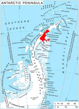
Location of Oscar II Coast on Antarctic Peninsula.
Further reading
• Tony Soper, A guide to the wildlife
• I. L. MILLAR, R. J. PANKHURST & C. M. FANNING, Basement chronology of the Antarctic Peninsula: recurrent magmatism and anatexis in the Palaeozoic Gondwana Margin, Journal of the Geological Society, London, Vol. 159, 2002, pp. 145–157
• Daniel McGrath, Konrad Steffen, Paul R. Holland, Ted Scambos, Harihar Rajaram, Waleed Abdalati, Eric Rignot, The structure and effect of suture zones in the Larsen C Ice Shelf, Antarctica, 12 February 2014, https://doi.org/10.1002/2013JF002935
• R. L. Oliver, P. R. James, J. B. Jago, editors Antarctic Earth Science, P 370
• International Symposium on Antarctic Earth, Geological Evolution of Antarctica, P 372
References
![]() This article incorporates public domain material from the United States Geological Survey document: "Adie Inlet". (content from the Geographic Names Information System)
This article incorporates public domain material from the United States Geological Survey document: "Adie Inlet". (content from the Geographic Names Information System)
This article is issued from Wikipedia. The text is licensed under Creative Commons - Attribution - Sharealike. Additional terms may apply for the media files.