Aguaro-Guariquito National Park
The Aguaro-Guariquito National Park[1] (Spanish: Parque nacional Aguaro-Guariquito)[2] Also Aguaro Guariquito National Park Is a protected area[3] with the status of national park in the South American country of Venezuela[4] located in the region of the central plains of the south in the Guárico state. It extends over the municipalities of Francisco de Miranda and Las Mercedes. It was established on March 7, 1974. It is spread over an area of 585,750 hectares (5857 km²).
| Aguaro-Guariquito National Park Parque Nacional Aguaro-Guariquito | |
|---|---|
IUCN category II (national park) | |
 | |
.jpg.webp) Location | |
| Location | |
| Coordinates | 8°17′N 66°42′W |
| Area | 5,857 km2 (2,261 sq mi) |
| Established | March 7, 1974 |
In 1974, the Venezuelan government, presided over by President Rafael Caldera, created the Aguaro-Guariquito National Park on an area of land located south of the Guárico State, in the jurisdiction of the municipalities Las Mercedes del Llano and Miranda. This large plain park comprises 569,000 ha.
It was therefore imperative that a sample of this natural formation be protected under the National Park regime, in order to preserve forever its original conditions for the benefit of present and future generations.
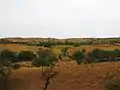
It is warm and presents two very marked seasons: the summer or drought, from November to March, the rainy or winter, which runs from April to October, during which the vegetation takes on an aspect of great frontiality.
Gallery


References
- Parque nacional Aguaro-Guariquito
- Novo, Isabel (1997-01-01). Ciencia y Conservación en el Sistema de Parques Nacionales de Venezuela: Una Experiencia de Cooperación Interinstitucional (in Spanish). EcoNatura. ISBN 9789800742495.
- Hoyt, Erich (2012-10-02). Marine Protected Areas for Whales, Dolphins and Porpoises: A World Handbook for Cetacean Habitat Conservation and Planning. Routledge. ISBN 9781136538308.
- Nature Conservation Status Survey for Xiddle America. Bib. Orton IICA / CATIE.