Aix-en-Diois
Aix-en-Diois (French pronunciation: [ɛks ɑ̃ djwa]) is a former commune in the Drôme department in southeastern France. On 1 January 2016, it was merged into the new commune Solaure-en-Diois.[2]
Aix-en-Diois | |
|---|---|
Part of Solaure-en-Diois | |
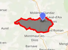
Location of Aix-en-Diois 
| |
 Aix-en-Diois  Aix-en-Diois | |
| Coordinates: 44°42′38″N 5°24′07″E | |
| Country | France |
| Region | Auvergne-Rhône-Alpes |
| Department | Drôme |
| Arrondissement | Die |
| Canton | Le Diois |
| Commune | Solaure-en-Diois |
| Area 1 | 16.49 km2 (6.37 sq mi) |
| Population (2017)[1] | 345 |
| • Density | 21/km2 (54/sq mi) |
| Time zone | UTC+01:00 (CET) |
| • Summer (DST) | UTC+02:00 (CEST) |
| Postal code | 26150 |
| Elevation | 433–1,259 m (1,421–4,131 ft) (avg. 444 m or 1,457 ft) |
| 1 French Land Register data, which excludes lakes, ponds, glaciers > 1 km2 (0.386 sq mi or 247 acres) and river estuaries. | |
History
Aix-en-Diois belonged to the counts and later to the bishops of Die (twelfth century). Later, it belonged to the Princes of Orange, and finally to the La Tour du Pin family (seventeenth century). The commune contains the remains of Roman baths and the ruins of a 13th-century medieval castle with a polygonal enclosure and corner towers, rebuilt in the 16th century.[3] The castle hall dates from the 17th century and is the former summer residence of the Bishop of Die. The main church is the Church of the Immaculate Conception.
Population
| Year | Pop. | ±% |
|---|---|---|
| 2006 | 330 | — |
| 2007 | 341 | +3.3% |
| 2008 | 351 | +2.9% |
| 2009 | 359 | +2.3% |
| 2010 | 357 | −0.6% |
| 2011 | 357 | +0.0% |
| 2012 | 358 | +0.3% |
| 2013 | 358 | +0.0% |
See also
References
- Téléchargement du fichier d'ensemble des populations légales en 2017, INSEE
- Arrêté préfectoral 18 December 2015 (in French)
- Michèle Bois et Chrystèle Burgard, Fortifications et châteaux dans la Drôme, éditions Créaphis, 192 p, 2004
This article is issued from Wikipedia. The text is licensed under Creative Commons - Attribution - Sharealike. Additional terms may apply for the media files.