Ala de la Piedra
Ala de la Piedra is a barrio in the municipality of Orocovis, Puerto Rico. Its population in 2010 was 419.[3][4][5]
Ala de la Piedra | |
|---|---|
Barrio | |
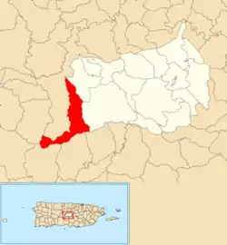 Location of Ala de la Piedra within the municipality of Orocovis shown in red | |
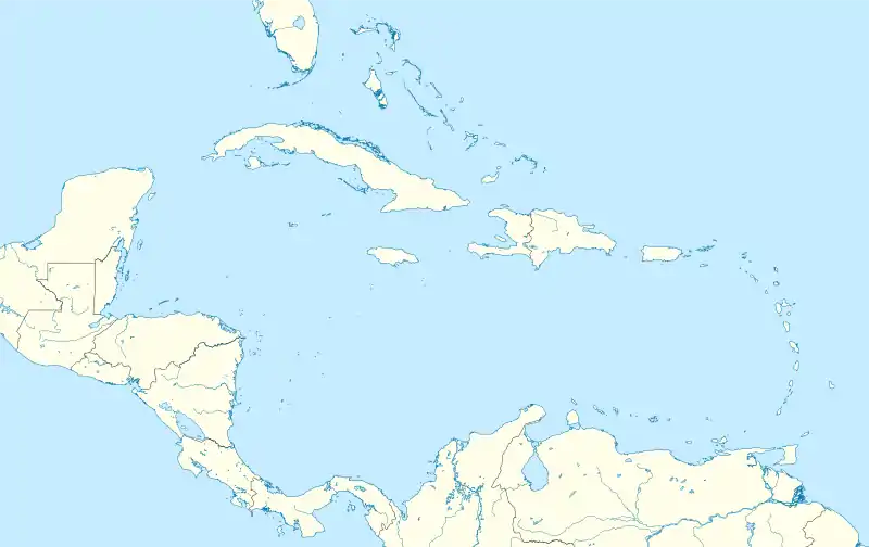 Ala de la Piedra Location of Puerto Rico | |
| Coordinates: 18°10′47″N 66°30′38″W[1] | |
| Commonwealth | |
| Municipality | |
| Area | |
| • Total | 5.56 sq mi (14.4 km2) |
| • Land | 5.51 sq mi (14.3 km2) |
| • Water | 0.05 sq mi (0.1 km2) |
| Elevation | 2,123 ft (647 m) |
| Population (2010) | |
| • Total | 419 |
| • Density | 76/sq mi (29/km2) |
| Source: 2010 Census | |
| Time zone | UTC−4 (AST) |
History
Puerto Rico was ceded by Spain in the aftermath of the Spanish–American War under the terms of the Treaty of Paris of 1898 and became an unincorporated territory of the United States. In 1899, the United States conducted its first census of Puerto Rico finding that the combined population of Ala de la Piedra and Orocovis barrios was 1,403.[6]
| Historical population | |||
|---|---|---|---|
| Census | Pop. | %± | |
| 1980 | 390 | — | |
| 1990 | 449 | 15.1% | |
| 2000 | 418 | −6.9% | |
| 2010 | 419 | 0.2% | |
| U.S. Decennial Census[7] 1899 (shown as 1900)[8] 1910-1930[9] 1930-1950[10] 1980-2000[11] 2010[12] | |||
There is a camping site managed by a community center at Ala de la Piedra.[13]
See also
References
- "US Gazetteer 2019". US Census. US Government.
- U.S. Geological Survey Geographic Names Information System: Ala de la Piedra barrio
- Picó, Rafael; Buitrago de Santiago, Zayda; Berrios, Hector H. Nueva geografía de Puerto Rico: física, económica, y social, por Rafael Picó. Con la colaboración de Zayda Buitrago de Santiago y Héctor H. Berrios. San Juan Editorial Universitaria, Universidad de Puerto Rico,1969.
- Gwillim Law (20 May 2015). Administrative Subdivisions of Countries: A Comprehensive World Reference, 1900 through 1998. McFarland. p. 300. ISBN 978-1-4766-0447-3. Retrieved 25 December 2018.
- Puerto Rico:2010:population and housing unit counts.pdf (PDF). U.S. Dept. of Commerce, Economics and Statistics Administration, U.S. Census Bureau. 2010.
- Joseph Prentiss Sanger; Henry Gannett; Walter Francis Willcox (1900). Informe sobre el censo de Puerto Rico, 1899, United States. War Dept. Porto Rico Census Office (in Spanish). Imprenta del gobierno. p. 165.
- "U.S. Decennial Census". United States Census Bureau. Archived from the original on February 13, 2020. Retrieved September 21, 2017.
- "Report of the Census of Porto Rico 1899". War Department Office Director Census of Porto Rico. Archived from the original on July 16, 2017. Retrieved September 21, 2017.
- "Table 3-Population of Municipalities: 1930 1920 and 1910" (PDF). United States Census Bureau. Archived (PDF) from the original on August 17, 2017. Retrieved September 21, 2017.
- "Table 4-Area and Population of Municipalities Urban and Rural: 1930 to 1950" (PDF). United States Census Bureau. Archived (PDF) from the original on August 30, 2015. Retrieved September 21, 2014.
- "Table 2 Population and Housing Units: 1960 to 2000" (PDF). United States Census Bureau. Archived (PDF) from the original on July 24, 2017. Retrieved September 21, 2017.
- Puerto Rico:2010:population and housing unit counts.pdf (PDF). U.S. Dept. of Commerce Economics and Statistics Administration U.S. Census Bureau. 2010. Archived (PDF) from the original on 2017-02-20. Retrieved 2019-08-02.
- "Comunidad Ala de la Piedra Camping Site". Discover Puerto Rico. Retrieved 23 June 2020.
This article is issued from Wikipedia. The text is licensed under Creative Commons - Attribution - Sharealike. Additional terms may apply for the media files.