Aldrich Mountains
The Aldrich Mountains are a mountain range in Grant County, Oregon, United States.[3] An east–west range rising south of the John Day River valley, the mountains are bounded on the west by the South Fork John Day River, on the south by Murderers Creek and the Bear Valley, and on the east by Canyon Creek.[1][3] Most of the Aldrich Mountains and the mountainous terrain south of them are contained within the Malheur National Forest. The highest point in the range is Fields Peak at 7,362 feet (2,244 m), and the nearest human settlement is Mount Vernon, located in the John Day River valley.[1][4] Across the South Fork John Day River to the west are the Ochoco Mountains, while across Canyon Creek to the east is the Strawberry Range.[1]
| Aldrich Mountains | |
|---|---|
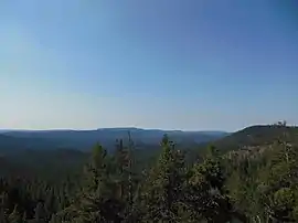 The Aldrich Mountains just south of Fields Peak | |
| Highest point | |
| Peak | Fields Peak[1] |
| Elevation | 7,362 ft (2,244 m) |
| Coordinates | 44°20′19″N 119°15′30″W [2] |
| Geography | |
| Country | United States |
| State | Oregon |
| County | Grant |
| Range coordinates | 44°18′55″N 119°18′29″W [3] |
| Topo map | USGS Big Weasel Springs |

References
- Oregon Road & Recreation Atlas (Map) (Third ed.). Medford, Oregon: Benchmark Maps. 2006. pp. 65–66. ISBN 0-929591-88-7.
- "Fields Peak". Geographic Names Information System. United States Geological Survey. November 28, 1980. Retrieved July 27, 2018.
- "Aldrich Mountains". Geographic Names Information System. United States Geological Survey. November 28, 1980. Retrieved July 27, 2018.
- "Field's Peak Trail #212". U.S. Forest Service. Retrieved July 27, 2018.
This article is issued from Wikipedia. The text is licensed under Creative Commons - Attribution - Sharealike. Additional terms may apply for the media files.