Allston
Allston is an officially recognized neighborhood within the City of Boston, Massachusetts, United States. It was named after the American painter and poet Washington Allston. It comprises the land covered by the zip code 02134.[1] For the most part, Allston is administered collectively with the adjacent neighborhood of Brighton. The two are often referred to together as "Allston–Brighton." Boston Police Department District D-14 covers the Allston-Brighton area and a Boston Fire Department Allston station is located in Union Square which houses Engine 41 and Ladder 14. Engine 41 is nicknamed "The Bull" to commemorate the historic stockyards of Allston.
Allston | |
|---|---|
 | |
| Nicknames: Allston, Rat City, Rock City | |
| Country | United States |
| State | Massachusetts |
| County | Suffolk |
| Neighborhood of | Boston |
| Time zone | UTC−5 (Eastern) |
| Zip Code | 02134 |
| Area code(s) | 617 & 857 |
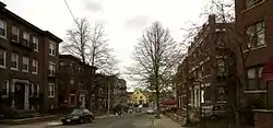
Housing stock varies but largely consists of brick apartment buildings, especially on Commonwealth Avenue and the streets directly off it, while areas further down Brighton Avenue, close to Brighton, are largely dotted with wooden triple-deckers. Lower Allston, across the Massachusetts Turnpike from the southern portion of Allston, consists of mostly 1890–1920s single-family and multi-family Victorian homes.
Demographics

The estimated population of Allston is 29,196, according to the 2010 Census.[2] The median home cost is $317,000, a decline of 0.97% in the last year. The cost of living is 9.81% higher than the national average. The population density is 18,505/mi2, about 50% higher than the citywide average of 12,166. The median age is 29.2. 76.45% of residents list status as single.[1]
Allston is home to many immigrant populations, the largest groups being from Russia, East Asia (particularly Korea), South Asia, and South America (particularly Brazil and Colombia).
Young adults (age 18-34) make up 78.3% of the neighborhood's population (as compared to 39.4% for the city of Boston as a whole).[3] The high concentration of students and "twenty-somethings" has created tension between some long-time residents and the student population which constantly cycles in and out as students matriculate and graduate from Boston's many colleges and universities. In addition to nightly dancing and live music at area bars, house parties abound on surrounding streets, particularly during the school year. This has long been a sore point among other Allston residents.[4]
The largest religious affiliation is Catholic (44.96%), followed by Protestant (4.77%), unspecified Christian (4.62%), Jewish (3.58%), Baptist (2.10%), and Muslim (1.97%).[1]
Race
| Race | Percentage of 02134 population |
Percentage of Massachusetts population |
Percentage of United States population |
ZIP Code-to-State Difference |
ZIP Code-to-USA Difference |
|---|---|---|---|---|---|
| White | 62.8% | 81.3% | 76.6% | –18.5% | –13.8% |
| White (Non-Hispanic) | 56.6% | 72.1% | 60.7% | –15.5% | –4.1% |
| Asian | 21.3% | 6.9% | 5.8% | +14.4% | +15.5% |
| Hispanic | 12.7% | 11.9% | 18.1% | +0.8% | –5.4% |
| Black | 6.2% | 8.8% | 13.4% | –2.6% | –7.2% |
| Native Americans/Hawaiians | 0.3% | 0.6% | 1.5% | –0.3% | –1.2% |
| Two or more races | 4.0% | 2.4% | 2.7% | +1.6% | +1.3% |
| Race | Percentage of 02163 population |
Percentage of Massachusetts population |
Percentage of United States population |
ZIP Code-to-State Difference |
ZIP Code-to-USA Difference |
|---|---|---|---|---|---|
| White | 65.5% | 81.3% | 76.6% | –15.8% | –11.1% |
| White (Non-Hispanic) | 56.8% | 72.1% | 60.7% | –15.3% | –3.9% |
| Asian | 21.5% | 6.9% | 5.8% | +14.6% | +15.7% |
| Hispanic | 10.2% | 11.9% | 18.1% | –1.7% | –7.9% |
| Black | 7.5% | 8.8% | 13.4% | –1.3% | –5.9% |
| Native Americans/Hawaiians | 0.3% | 0.6% | 1.5% | –0.3% | –1.2% |
| Two or more races | 4.2% | 2.4% | 2.7% | +1.8% | +1.5% |
Ancestry
According to the 2012-2016 American Community Survey 5-Year Estimates, the largest ancestry groups in ZIP Codes 02134 and 02163 are:[8][9]
| Ancestry | Percentage of 02134 population |
Percentage of Massachusetts population |
Percentage of United States population |
ZIP Code-to-State Difference |
ZIP Code-to-USA Difference |
|---|---|---|---|---|---|
| Irish | 13.90% | 21.16% | 10.39% | –7.25% | +3.52% |
| Chinese | 12.32% | 2.28% | 1.24% | +10.04% | +11.08% |
| Italian | 9.15% | 13.19% | 5.39% | –4.04% | +3.76% |
| English | 6.28% | 9.77% | 7.67% | –3.49% | –1.38% |
| German | 5.40% | 6.00% | 14.40% | –0.61% | –9.00% |
| Asian Indian | 4.13% | 1.39% | 1.09% | +2.74% | +3.04% |
| Puerto Rican | 3.85% | 4.52% | 1.66% | –0.67% | +2.19% |
| Russian | 3.74% | 1.65% | 0.88% | +2.09% | +2.86% |
| French | 3.64% | 6.82% | 2.56% | –3.19% | +1.08% |
| Polish | 3.45% | 4.67% | 2.93% | –1.22% | +0.52% |
| American | 2.31% | 4.26% | 6.89% | –1.95% | –4.58% |
| French Canadian | 1.97% | 3.91% | 0.65% | –1.94% | +1.31% |
| Scottish | 1.76% | 2.28% | 1.71% | –0.52% | +0.05% |
| European | 1.69% | 1.08% | 1.23% | +0.61% | +0.46% |
| Sub-Saharan African | 1.40% | 2.00% | 1.01% | –0.60% | –0.38% |
| Swedish | 1.34% | 1.67% | 1.23% | –0.33% | +0.11% |
| Mexican | 1.34% | 0.67% | 11.96% | +0.67% | –10.62% |
| West Indian | 1.27% | 1.96% | 0.90% | –0.68% | +0.37 |
| Brazilian | 1.23% | 1.03% | 0.12% | +0.20% | +1.11% |
| Arab | 1.10% | 1.10% | 0.59% | +0.00% | +0.51% |
| Ancestry | Percentage of 02163 population |
Percentage of Massachusetts population |
Percentage of United States population |
ZIP Code-to-State Difference |
ZIP Code-to-USA Difference |
|---|---|---|---|---|---|
| German | 9.36% | 6.00% | 14.40% | +3.36% | –5.04% |
| Chinese | 8.62% | 2.28% | 1.24% | +6.34% | +7.38% |
| Italian | 8.47% | 13.19% | 5.39% | –4.72% | +3.07% |
| Irish | 8.16% | 21.16% | 10.39% | –13.00% | –2.23% |
| Asian Indian | 6.45% | 1.39% | 1.09% | +5.06% | +5.36% |
| English | 4.93% | 9.77% | 7.67% | –4.84% | –2.74% |
| Arab | 3.34% | 1.10% | 0.59% | +2.24% | +2.75% |
| Welsh | 3.18% | 0.36% | 0.57% | +2.83% | +2.62% |
| Russian | 3.15% | 1.65% | 0.88% | +1.50% | +2.27% |
| Austrian | 2.99% | 0.24% | 0.22% | +2.75% | +2.77% |
| Japanese | 2.95% | 0.15% | 0.25% | +2.80% | +2.70% |
| Polish | 2.87% | 4.67% | 2.93% | –1.79% | –0.06% |
| Norwegian | 2.33% | 0.51% | 1.40% | +1.82% | +0.93% |
| French Canadian | 2.14% | 3.91% | 0.65% | –1.77% | +1.48% |
| French | 2.06% | 6.82% | 2.56% | –4.77% | –0.50% |
| West Indian | 2.02% | 1.96% | 0.90% | +0.06% | +1.02% |
| Lebanese | 1.98% | 0.48% | 0.16% | +1.50% | +1.82% |
| British | 1.86% | 0.48% | 0.43% | +1.38% | +1.43% |
| Dutch | 1.83% | 0.62% | 1.32% | +1.21% | +0.51% |
| Sub-Saharan African | 1.71% | 2.00% | 1.01% | –0.29% | +0.69% |
| Mexican | 1.59% | 0.67% | 11.96% | +0.92% | –10.37% |
| American | 1.51% | 4.26% | 6.89% | –2.75% | –5.38% |
| Eastern European | 1.48% | 0.42% | 0.17% | +1.06% | +1.31% |
| Portuguese | 1.44% | 4.40% | 0.43% | –3.96% | +1.01% |
| European | 1.40% | 1.08% | 1.23% | +0.32% | +1.17% |
| Brazilian | 1.32% | 1.03% | 0.12% | +0.29% | +1.20% |
| Israeli | 1.32% | 0.05% | 0.04% | +1.27% | +1.28% |
| Swiss | 1.32% | 0.16% | 0.29% | +1.16% | +1.03% |
| Danish | 1.17% | 0.24% | 0.41% | +0.93% | +0.76% |
| Ugandan | 1.01% | 0.04% | 0.00% | +0.97% | +1.01% |
Area description
The neighborhood of Allston borders the Boston Neighborhoods of Fenway/Kenmore and Brighton, as well as the Town of Brookline. Allston is bordered on the east and north by the Charles River; and the City of Cambridge is accessible via several bridges. The area north of the turnpike near the Charles river is known as Lower Allston (or North Allston). It consists of streets north of Cambridge Street and the Turnpike, all the way to the Charles River. It extends westward to Everett Street and eastward to the Charles River. In its center is Allston Square at the crossroads of Western Avenue and North Harvard Street. Allston is named for the great painter and 1800 Harvard graduate, Washington Allston, "The Father of American Romanticism". Allston Square is appropriately located halfway between Harvard Square in the North and Allston Village, Boston's 'Greenwich Village' in the South. Allston claims to be the only community in America named for an artist.[10]
Lower Allston is a small neighborhood that consists of a mix of young professionals, blue-collar tradesmen, members of the educational community, homeowners, and long-term residents. Unlike the rest of Allston, Lower Allston has far fewer students. The neighborhood is very quiet, has extremely low crime, and is an easy walk to Allston Village or Harvard Square.[11]
Lower Allston has close proximity to Route 2, the Mass Pike, Storrow Drive, and Soldiers Field Road. Public transportation includes the Red Line at Harvard Square, the Green Line at Packard's Corner or Harvard Avenue and Commonwealth Avenue and the 57, 66, 70, 71, and 86 bus connections on North Harvard Street and Western Avenue.[12]
In the early 21st century, Harvard University announced dramatic expansion plans that called for major building projects, including the demolition of existing businesses, to prepare for the construction of new biology and science buildings in the northern sections of Lower Allston.[13] While the existing building stock was demolished and businesses were evicted, the financial crisis of 2008 and the resultant decrease in Harvard's endowment caused the university to suspend the expansion projects. In 2016, Harvard began building again, has completed two new buildings and is starting on the new, state-of-the-art Paulson School of Engineering and Applied Sciences on Western Avenue west of Allston Square by the Charles River. Later, it will begin construction of the "Gateway" building on the northeast corner of Allston Square.[14]
History
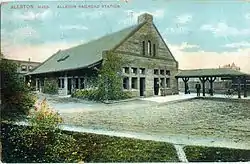
Allston was an eastern section of the former town of Brighton.
In 1867 a new railroad depot for the Boston and Albany Railroad opened. In 1868 the station and post office in Brighton's eastern portion were given the name "Allston" after Washington Allston, the noted painter who had lived and worked across the Charles River in the Cambridgeport section of Cambridge.[15] It can even be said to have been named for a specific painting: Washington Allston's "Fields West of Boston."
Allston has never existed as a separate political entity in its own right. The Town of Brighton was annexed by the City of Boston in 1874. Henry Wadsworth Longfellow owned several properties in Allston. In 1887 the wooden depot was replaced by the station depicted at the right. In 1888 Boston's first trolley route began there, running a route through Coolidge Corner, Brookline, to Boylston Street, to downtown Boston.[16]
The Allston community developed largely around large railroad and livestock operations. The Boston and Albany Railroad operated a major rail yard. Stockyards and a large abattoir operated nearby in the northern part of Brighton. All livestock activity ended by the mid-20th century, although much of the rail yard remained in use until 2013 as CSX Transportation's Beacon Park Yard.
A strip running from Brighton Avenue in Allston out Commonwealth Avenue toward Kenmore Square was Boston's original "Automile", lined with automobile dealerships. Packard's Sales Stable and Riding School[17] gave Packard's Corner its name, which was then perpetuated by the presence of an opulent Packard dealership. Only a Toyota dealer and a Vespa dealer remain, but the windowed buildings along the eastern end of Brighton Avenue reflect this history.
The Massachusetts Turnpike Extension, built largely on part of the Boston and Albany right-of-way, opened through Allston in 1964 and 1965.[18]
Culture
Allston is home to numerous small businesses and restaurants. Brighton Avenue, between Packard's Corner and Allston Street, boasts various ethnic and national cuisines from around the world. Harvard Avenue hosts a number of furniture stores, thrift shops, and stores that offer items for resale, due to the large student body and high residential turnover.
The section of the neighborhood that lies immediately south of the turnpike and centers on the stretch of Harvard Avenue between Commonwealth Avenue and Cambridge Street also houses many shops, bars, and restaurants. Recent business promotion initiatives have dubbed this area "Allston Village."[19]
Allston "Christmas"
While the term is a misnomer, annually during days leading up to and following September 1, Allston, the Fenway-Kenmore area, the Longwood area, Mission Hill, and Brighton (among many others in Greater Boston) experience a period known as Allston Christmas.[20][21][22] This period is referred to as such because it is the time of year when renters (many of whom are college students) move out their things so new renters (also frequently college students) can move in.
A large number of rental agreements in Greater Boston expire on September 1, just before the Labor Day weekend, causing large numbers of tenants to move to their new quarters simultaneously. This synchronized mass movement also makes it difficult to rent large vehicles during the weeks surrounding September 1. The renters who are leaving often put their unwanted possessions out in the streets for those who may want the items, which include bedding, couches, tables, kitchenware, and clothing. Unsalvaged items also contribute to unusually large trash and recycling pickups scheduled around the time.[23][24]
Music
Music venues in Allston include Brighton Music Hall (formerly Harpers Ferry), Great Scott, O'Brien's Pub, Paradise Rock Club, Scullers Jazz Club, and Wonder Bar.[25][26]
Several recording studios are located in the neighborhood, such as Galaxy Park, established in 1999.[27] Allston's music scene includes a DIY community. The annual Allston-Brighton parade and annual Allston DIY Fest feature many of the neighborhood's musical acts.
Sports
Major League Baseball's Boston Braves played at Braves Field (now Boston University's Nickerson Field) at Allston's eastern edge, from 1915 to 1952. The Boston Patriots of the American Football League (now the New England Patriots of the National Football League) played four seasons in Allston: at Nickerson Field in 1960 through 1962; and at Harvard Stadium in 1970.
Education
Public schools
Public schools in Allston are part of the school district of Boston Public Schools.
Gardner Pilot Academy (also called the Thomas Gardner School), located on Athol Street, serves Allston residents pre-kindergarten through grade five.[28] In April 2008 a science teacher at Gardner Pilot Academy won the "Ultimate Science Classroom", a raffle prize furnished annually by the National Science Teachers Association. The school received approximately $40,000 in science teaching materials and apparatus.[29]
The Horace Mann School for the Deaf and Hard of Hearing, located on Armington Street, is the oldest public school for the hearing impaired in the United States.[30] The school was attended by Helen Keller (Shichtman, 23) and Alexander Graham Bell's work at the school inspired him to begin experiments in an apparatus to help deaf children hear. These experiments eventually led to the telephone (MacKenzie, 56-57). The school serves the hearing impaired in Boston from pre-kindergarten through twelfth grade.
Jackson Mann School, also on Armington Street, serves residents from kindergarten through eighth grade.
Colleges and universities
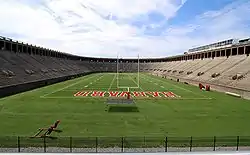
Allston lies near three major universities. A substantial part of the campus of Harvard University, including Harvard Business School and most athletic facilities (such as the Bright-Landry Hockey Center, Harvard Stadium, and the Lavietes Pavilion), are in North Allston. Harvard also owns large portions of other land in North Allston, much of which it plans to develop as an academic campus, particularly for the Harvard John A. Paulson School of Engineering and Applied Sciences, as well as an auxiliary site for the Harvard Medical School and other healthcare-related programs. Eventually, Harvard's Allston campus will be physically larger than their original Cambridge campus.
Boston University lies along Commonwealth Avenue to the east, with numerous schools and facilities extending from Kenmore Square to Packards Corner. The New Balance Field of Boston University symbolizes further integration of BU into the Allston community and is the first in a series of projects that have included the creation of a major new dormitory building in the area.[31] Berklee College of Music also has a practice and rehearsal building near Commonwealth Avenue, on Fordham Road, which runs between Commonwealth Avenue and Brighton Avenue.
Transportation
The B branch of the Boston MBTA subway Green Line runs through the neighborhood along Commonwealth Avenue. The former "A Line" of the Green Line to Watertown Square ran along Brighton Avenue, and was replaced by MBTA bus route 57. From 2014 to March 2016, the MBTA included bus route 57 in its late night service, running until 3 am.[32] The City of Boston and the MBTA plan to install a bus-only lane for the 57 between Union Square and Packard's Corner beginning in 2019 to alleviate congestion and speed up bus travel times.[33] Other MBTA bus lines serve Allston, including routes 64, 66, 70 and 86. 34.2% of Allston residents commute by mass transit, while 24.3% commute by walking and another 6.6% commute by bicycle.[34]
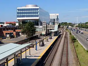
Until 2013, the CSX Railroad operated the large Beacon Park freight yard which runs adjacent to the Massachusetts Turnpike; the land has been purchased by Harvard. In May 2006, Harvard officials said that they would like to establish a commuter rail stop in Allston on the Framingham/Worcester line.[35] This would restore service lacking since the closure of the long-dormant Allston train depot. As of 2009, there had been actions by the state legislature to restore train service in the area.[36] In June 2012, plans were announced for a station to be called Boston Landing, located in Brighton, to serve the Allston-Brighton area. Originally intended to open in 2014, the station finally opened in 2017.
In September 2014, plans for a $25 million commuter rail station called West Station[37] were announced. The station's construction will coincide with a plan to straighten the Massachusetts Turnpike over the former CSX rail yard. The new station will initially operate exclusively on the Worcester/Framingham line, but will be constructed with four platforms to accommodate future uses that may include rapid-transit service to North Station via the existing Grand Junction rail line through Cambridge and Somerville.[37][38]
Events
- Allston Squirt Gun Day is an unsanctioned event organized by young residents and held yearly in late August. Participants are asked to wear green and gather at the intersection of Harvard Avenue and Brighton Avenue.[39] The event is typically short-lived as it creates a panic among those unaware of what is going on.[40] In 2009, the Squirt Gun festivities continued as a sanctioned event at nearby Ringer Park.
- In 2005, the New England Foundation for the Arts selected a site in Allston for its Art & Community Landscapes program.[41] The artist team of Legge Lewis Legge[42] was chosen to design this site which is known as the Lincoln Street Green Strip.[43]
- Each year the community hosts the Allston Village Street Fair on Harvard Avenue between Brighton Avenue and Cambridge Street. The fair features live performances, international food, and local businesses, along with family-friendly activities.[44]
- In 2012, Aerosmith played a set in front of their former residence at 1325 Commonwealth Avenue. They were introduced by the New England Patriots players (most notably Tom Brady), owner Robert Kraft, and cheerleaders.[45]
In popular culture
- Allston's ZIP Code "02134" is famously identified due to a recurring musical piece on the PBS children's series ZOOM,[46] whose originating station, WGBH, was located on Western Avenue east of Allston Square until 2008.
- Big D and the Kids Table, a ska band, makes multiple references to Allston within their songs.
- Massachusetts grindcore band Anal Cunt has written several contemptuous songs that reference Allston in a pejorative way, such as "You Live in Allston", "Everyone in Allston Should be Killed" and "I Just Saw the Gayest Guy on Earth".[47][48][49]
References
Notes
- "Best Places to Live in the United States". bestplaces.net. Archived from the original on 2008-12-16.
- (PDF) https://web.archive.org/web/20120729071443/http://www.bostonredevelopmentauthority.org/pdf/ResearchPublications//AllstonSF1NBHD.pdf. Archived from the original (PDF) on July 29, 2012. Retrieved September 13, 2012. Missing or empty
|title=(help) - "Boston by the Numbers 2015". Boston Redevelopment Authority. Boston Redevelopment Authority. pp. 23–26. Archived from the original on 5 June 2016. Retrieved 19 October 2016.
- Fulton, Deirdre (November 2005). "The party's over? Using Operation Student Shield, the city and the colleges are teaming up to bust house parties". The Boston Phoenix. Archived from the original on 29 June 2016. Retrieved 19 October 2016.
- "ACS DEMOGRAPHIC AND HOUSING ESTIMATES 2012-2016 American Community Survey 5-Year Estimates". US Census Bureau. Retrieved August 25, 2018.
- "Massachusetts QuickFacts from the US Census Bureau". census.gov.
- "ACS DEMOGRAPHIC AND HOUSING ESTIMATES 2012-2016 American Community Survey 5-Year Estimates". US Census Bureau. Retrieved August 25, 2018.
- "PEOPLE REPORTING ANCESTRY 2012-2016 American Community Survey 5-Year Estimates". US Census Bureau. Retrieved August 25, 2018.
- "ACS DEMOGRAPHIC AND HOUSING ESTIMATES 2012-2016 American Community Survey 5-Year Estimates". US Census Bureau. Retrieved August 25, 2018.
- "Lower Allston Website, Lower Allston, MA 02134". lowerallston.com.
- "11 Royal St". Walk Score.
- RDVO, Inc. "MBTA Trip Planner > Find the Best Way to Get to Your Destination". mbta.com. Archived from the original on 2006-12-29.
- https://web.archive.org/web/20101019210130/http://www.construction.harvard.edu/allston/westernaveutilities/project-updates.html. Archived from the original on October 19, 2010. Retrieved January 23, 2011. Missing or empty
|title=(help) - GOODNOUGH, ABBY (May 9, 2009). "Slump Revives Town-Gown Divide Across U.S., May 8, 2009". NYT. Retrieved 2011-01-23.
- "Harvard Avenue History". Brighton Allston Historical Society. Archived from the original on March 20, 2012. Retrieved April 10, 2012.
- "Important Allston Brighton Dates". Brighton Allston Historical Society. Archived from the original on April 15, 2012. Retrieved April 10, 2012.
- "Packard's Corner History". bahistory.org.
- "Massachusetts Turnpike (I-90)". bostonroads.com.
- "Allston Village Main Streets". allstonvillage.com.
- Levenson, Eric (31 August 2015). "The massive move-in extravaganza of 'Allston Christmas,' explained". Boston.com. Archived from the original on 19 October 2016. Retrieved August 25, 2016.
- DeCosta-Klipa, Nik (1 September 2018). "A brief guide to staying sane during the madness of Allston Christmas—whether you're moving or not". Boston Globe. Retrieved 31 May 2019.
[T]he spectacle is hardly isolated to Allston…The Fenway-Kenmore area had the highest off-campus student population…Allston was second…followed by the Longwood area, Mission Hill, and Brighton…The City of Boston's data on moving truck permits show how, in addition to the Allston-Brighton area, Back Bay, Beacon Hill, the North End, South End, and Southie are also places where the streets will be crowded with movers.
- Diamant, Anita (31 August 2018). "'Tis The Season Of Sidewalk Trash — But Sometimes You Find A Treasure". WBUR. Retrieved 31 May 2019.
September 1 is called 'Allston Christmas'...but that's a misnomer and a gross understatement; it happens all over greater Boston and goes on for a solid two weeks.
- Laskowski, Amy (30 January 2015). "Allston Christmas: the Most Wonderful Time of the Year". BU Today. Archived from the original on 28 August 2016. Retrieved August 25, 2016.
- Mennicken, William (September 2, 2015). "Students Find Trash, Treasure on 'Allston Christmas' Move-In Day". The Heights. Archived from the original on 20 September 2016. Retrieved August 25, 2016.
- Tomlinson, Sarah (27 August 2004). "Rock city revival". The Boston Globe. Archived from the original on 19 October 2016. Retrieved 24 February 2014.(subscription required)
- Marotta, Michael (20 September 2013). "Top 10 live music venues in Boston". The Guardian. Archived from the original on 12 June 2016. Retrieved 19 October 2016.
- "Recording Studios In Boston, MA, Galaxy Park Studios - Massachusetts". galaxypark.com.
- https://web.archive.org/web/20090109145520/http://www.bostonpublicschools.org/node/442. Archived from the original on January 9, 2009. Retrieved September 10, 2009. Missing or empty
|title=(help) - "Archived copy". Archived from the original on 2012-07-29. Retrieved 2009-09-10.CS1 maint: archived copy as title (link)
- "Hmsboston.org".
- "New Balance Field". bu.edu.
- "Late night service". MBTA. MassDOT. Retrieved 24 April 2014.
- City of Boston (April 2019). "Brighton Avenue Bus Lane". www.boston.gov.
- Boston Planning & Development Agency (January 2019). "Boston In Context: Neighborhoods - 2013-2017 American Community Survey". www.bostonplans.org.
- Harvard Crimson, "University Plans Allston T Stop", May 10, 2006. Archived August 6, 2009, at the Wayback Machine
- "State approves two spots for Allston commuter rail station". Wicked Local.
- "New Commuter Rail station coming to Allston, will serve Worcester Line". masslive.com.
- https://www.bostonglobe.com/metro/2014/09/30/weststation/ZB4d0trnj1VGo66u7kkkZP/story.htm%5B%5Dl
- "AllstonSquirtGunDay on Myspace". Myspace. Retrieved 3 April 2018.
- Dunn, Gabrielle T. (August 24, 2008). "Police put damper on water balloon fight in Allston". The Boston Globe.
- NEFA site Archived February 19, 2006, at the Wayback Machine
- "Legge Lewis Legge.html". leggelewislegge.com.
- "Lincoln Street Green Strip". tripod.com.
- "Allston Village Street Fair". allstonvillagestreetfair.com.
- Rocheleau, Matt (5 November 2012). "Aerosmith draws sea of fans to Allston streets". The Boston Globe.
- "Zoom Season 4 Send It to Zoom Clip 1974-1975". Retrieved December 13, 2019 – via YouTube.
- I Like It When You Die Liner Notes
- "I Like It When You Die - Anal Cunt".
- "40 More Reasons to Hate Us - Anal Cunt".
Further reading
- MacKenzie, Catherine. Alexander Graham Bell Kessinger Publishing, LLC., 2003. ISBN 0-7661-4385-6.
- Marchione, William P. The Bull in the Garden: A History of Allston-Brighton. Boston Public Library, pub., 1986. ISBN 0-89073-078-4.
- Shichtman, Sandra H. Helen Keller: out of a dark and silent world Millbrook Press, 2002. ISBN 0-7613-2550-6.
External links
| Wikimedia Commons has media related to Allston, Boston. |

