Amamoor
Amamoor is a rural town and locality in the Gympie Region, Queensland, Australia.[2][3] In the 2016 census the locality of Amamoor had a population of 636 people.[1]
| Amamoor Queensland | |||||||||||||||
|---|---|---|---|---|---|---|---|---|---|---|---|---|---|---|---|
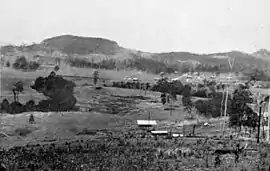 Amamoor township, circa 1931 | |||||||||||||||
 Amamoor | |||||||||||||||
| Coordinates | 26.3452°S 152.675°E | ||||||||||||||
| Population | 636 (2016 census locality)[1] | ||||||||||||||
| • Density | 18.43/km2 (47.75/sq mi) | ||||||||||||||
| Postcode(s) | 4570 | ||||||||||||||
| Area | 34.5 km2 (13.3 sq mi) | ||||||||||||||
| Time zone | AEST (UTC+10:00) | ||||||||||||||
| LGA(s) | Gympie Region | ||||||||||||||
| State electorate(s) | Gympie | ||||||||||||||
| Federal Division(s) | Wide Bay | ||||||||||||||
| |||||||||||||||
Geography
Amamoor is 18 kilometres (11 mi) south of Gympie. The Bruce Highway passes to the east of the town and the Amamoor Forest Reserve is to the west.
Amamoor is situated on the Amamoor Creek which is a tributary of the Mary River. It is one of a chain of towns in the Mary Valley also including Imbil, Dagun, and Kandanga.
History
The town is named after a pastoral run held by J.D. McTaggart in the late 1850s.[4] It is an Aboriginal word meaning swimming in water or a swimming creek.[5]
When the construction of a railway line between Brisbane and Gympie was being contemplated in 1884–5, one of the routes being considered was through the Mary Valley. However, this was not the route chosen, and the residents of the valley who were disappointed at missing out on rail connection agitated for many years until the Mary Valley branch line was built. The first section south from Monkland to Kandanga (via Amamoor) was completed in October 1914 with Amamoor railway station (26.3432°S 152.6741°E) serving the locality.[6] The second stage to Brooloo was completed in April 1915. The final stage to Kenilworth was to be built in 1920 but was never completed.[7]
Amamoor Post Office opened around 1920.[8]
Amamoor State School opened on 10 October 1921.[9] It was relocated to its current location in Elizabeth Street in the 1950s.[10]
In 1993, the services on the Mary Valley railway line were reduced, terminating at Melawondi, and the entire line was closed in 1994, ending Amamoor's rail connection.[7]
In the 2016 census the locality of Amamoor had a population of 636 people.[1]
Heritage listings
Amamoor has heritage-listed sites, including:
- Aramoor Street (26.34706°S 152.67320°E): Aramoor Cream Shed at the former Aramoor railway station, one of the Mary Valley Railway Cream Sheds[11]
- 4 Busby Street (26.34386°S 152.67310°E): Amamoor General Store[12]
- 10 Busby Street (26.34448°S 152.67376°E): Amamoor Butcher Shop[13]
- 31-33 Busby Street (26.34609°S 152.67581°E): Amamoor Hall[14]
- 2 Elizabeth Road (26.34706°S 152.67320°E): Amamoor State School[15]
Education
Amamoor State School is a government primary (Prep-6) school for boys and girls at 2 Elizabeth Street (26.3464°S 152.6731°E).[16][17] In 2018, the school had an enrolment of 78 students with 7 teachers (5 full-time equivalent) and 6 non-teaching staff (4 full-time equivalent).[18]
There are no secondary schools in Amamoor. The nearest secondary school is Mary Valley State College in Imbil to the south, but it only offers secondary schooling to Year 10. For secondary schooling to Year 12, the nearest secondary school is Gympie State High School in Gympie to the north.[19]
Events
Amamoor Creek State Forest Park is host to the annual Gympie Muster, a country music festival.[20]
Attractions
The Amamoor railway station is part of the Mary Valley Rattler.
References
- Australian Bureau of Statistics (27 June 2017). "Amamoor (SSC)". 2016 Census QuickStats. Retrieved 20 October 2018.

- "Amamoor – town in Gympie Region (entry 492)". Queensland Place Names. Queensland Government. Retrieved 27 December 2020.
- "Amamoor – locality in Gympie Region (entry 49837)". Queensland Place Names. Queensland Government. Retrieved 27 December 2020.
- "Amamoor (entry 492)". Queensland Place Names. Queensland Government. Retrieved 15 March 2014.
- "ETYMOLOGICAL". Gympie Times And Mary River Mining Gazette. XLIV (5761). Queensland, Australia. 2 December 1911. p. 7. Archived from the original on 18 January 2021. Retrieved 21 October 2019 – via National Library of Australia.
- "Railway stations and sidings - Queensland". Queensland Open Data. Queensland Government. 2 October 2020. Archived from the original on 5 October 2020. Retrieved 5 October 2020.
- "About MVHR". Mary Valley Heritage Railway. Archived from the original on 25 January 2014. Retrieved 16 March 2014.
- Premier Postal History. "Post Office List". Premier Postal Auctions. Archived from the original on 15 May 2014. Retrieved 10 May 2014.
- "Opening and closing dates of Queensland Schools". Queensland Government. Retrieved 18 April 2019.
- "Welcome to Amamoor State School". Amamoor State School. Archived from the original on 16 March 2014. Retrieved 16 March 2014.
- "Mary Valley Railway Cream Sheds (entry 602792)". Queensland Heritage Register. Queensland Heritage Council. Retrieved 8 July 2013.
- "Amamoor General Store" (PDF). Local Heritage Register. Gympie Regional Council. Archived (PDF) from the original on 17 January 2021. Retrieved 17 January 2021.
- "Amamoor Butcher Shop" (PDF). Local Heritage Register. Gympie Regional Council. Archived (PDF) from the original on 17 January 2021. Retrieved 17 January 2021.
- "Amamoor Hall" (PDF). Local Heritage Register. Gympie Regional Council. Archived (PDF) from the original on 17 January 2021. Retrieved 17 January 2021.
- "Amamoor State School" (PDF). Local Heritage Register. Gympie Regional Council. Archived (PDF) from the original on 17 January 2021. Retrieved 17 January 2021.
- "State and non-state school details". Queensland Government. 9 July 2018. Archived from the original on 21 November 2018. Retrieved 21 November 2018.
- "Amamoor State School". Archived from the original on 16 March 2020. Retrieved 21 November 2018.
- "ACARA School Profile 2018". Australian Curriculum, Assessment and Reporting Authority. Archived from the original on 27 August 2020. Retrieved 28 January 2020.
- "Queensland Globe". State of Queensland. Retrieved 18 January 2021.
- "The Muster Site". Gympie Music Muster. Archived from the original on 16 March 2014. Retrieved 15 March 2014.
External links
- "Amamoor". Queensland Places. Centre for the Government of Queensland, University of Queensland.
- Amamoor State School