Angel Arch
Angel Arch is the largest natural arch located within Canyonlands National Park, in San Juan County, Utah.[1][2] Some consider it the most beautiful and spectacular arch in the park, if not the entire canyon country.[3] It is situated in a side canyon of Salt Creek Canyon, in the Needles District of the park. Precipitation runoff from Angel Arch drains north into the nearby Colorado River via Salt Creek. A 29-mile round-trip hike to Angel Arch leads to a viewpoint, and an additional 0.75-mile trail scrambles up into the arch opening. The arch's descriptive name comes from its resemblance to an angel with wings folded, and standing with its back to the arch opening.[4] This feature's name was officially adopted in 1963 by the U.S. Board on Geographic Names.[1] The first ascent was made in June 1993, by John Markel and Kevin Chase.[5]
| Angel Arch | |
|---|---|
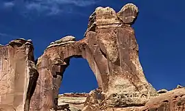 East aspect in the morning light | |
| Highest point | |
| Elevation | 5,692 ft (1,735 m) [1] |
| Coordinates | 38°03′07″N 109°45′18″W [1] |
| Geography | |
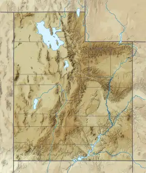 Angel Arch Location in Utah  Angel Arch Angel Arch (the United States) | |
| Location | Canyonlands National Park San Juan County, Utah, U.S. |
| Topo map | USGS Druid Arch |
| Geology | |
| Age of rock | Permian |
| Type of rock | Cedar Mesa Sandstone |
| Climbing | |
| First ascent | 1993 |
Geology
This geological formation is an eroded fin composed of Cedar Mesa Sandstone, which is the remains of coastal sand dunes deposited about 245–286 million years ago, during the early Permian period.[6] The top of the formation rises 450 feet (140 m) above the canyon floor, and the opening has a height of 135 feet (41 m), and a width of 120 feet (37 m).[7]
Climate
Spring and fall are the most favorable seasons to visit Angel Arch. According to the Köppen climate classification system, it is located in a Cold semi-arid climate zone, which is defined by the coldest month having an average mean temperature below −0 °C (32 °F) and at least 50% of the total annual precipitation being received during the spring and summer. This desert climate receives less than 10 inches (250 millimeters) of annual rainfall, and snowfall is generally light during the winter.
Gallery
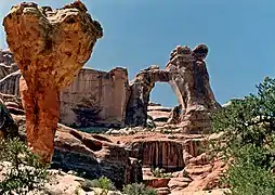 The Molar (left) and Angel Arch at mid-day
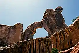 East aspect in afternoon
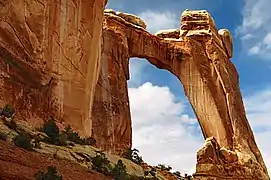 SE aspect
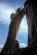 SW aspect
See also
References
- "Angel Arch". Geographic Names Information System. United States Geological Survey. Retrieved 2020-08-29.
- Mike White / Douglas Lorain, Best Backpacking Trips in Utah, Arizona, and New Mexico, University of Nevada Press, 2016
- S. W. Lohman, The Geologic Story of Canyonlands National Park, Geological Survey Bulletin 1327, U.S. Government Printing Office, 1974, page 68.
- Ron Adkinson, Utah's National Parks, Wilderness Press, 2001.
- https://www.deserttowersbook.com/first-ascentssince-1911
- "Canyonlands National Park - Cedar Mesa Sandstone". National Park Service. Retrieved 29 August 2020.
- Bob Fagley, Angel Arch
External links
| Wikimedia Commons has media related to Angel Arch (Canyonlands National Park). |
- Canyonlands National Park National Park Service
- Angel Arch weather forecast
- Angel Arch: YouTube