Antonio Millo
Antonio Millo, also mentioned as Antonio da Millo[1] or Antonio Milo, active during 1557–1590, was captain and cartographer with significant work in map making, isolarios and portolan charts.[2]


He was born during the 16th century in Milos and he lived part of his life in Venice as shown from records of the Greek community of Venice. According to the first Book of Marriages 1599–1701 of the Greek community of Venice, someone called "Antonio Damilos" was married on 10 August 1599.[3]
Apart from cartographer, he was a captain and navigator. In an isolario of 1590, he is mentioned as Armiralgio al Zante.[4] In another isolario of 1591 he is mentioned as Armiralgio in Candia[5] and in another he is mentioned as Antonius de Melo Cosmographus.[6]
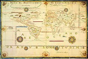
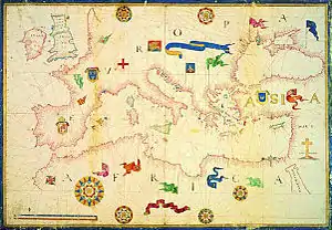
He created many maps with great detail. Several of his works have been saved in Venice (in Biblioteca Marciana di Venezia and Museo Correr), in Rome (Biblioteca Nazionale Centrale di Roma), at Berlin (Staatsbibliothek) in London (British Library) and Warsaw (National Library).[7]
References
- Revisiting the projective properties of historic nautical maps of the Mediterranean and the Aegean, Caterina Balletti, Chryssoula Boutoura, in "ICC 2001, BeiJing China", The 20th International Cartographic Conference, BeiJing International Convention Center, Beijing, China, August 6–10,2001
- Johannes Leonclavius, Annales Sultanorum Othmanidarum, 1588
«[…] senex multarum rerum peritus. Antonius Meliensis, Graeco parte natus in Melo insula, conductus a navarcho ut index itineris esset» - Η Βενετία των Ελλήνων, Χρύσα Μαλτέζου, copyright Εκδόσεις Γένους Άλιμος,Εκδόσεις Μίλητος, ISBN 960-8460-14-X, σελ 455 (2005)
1st Book of Marriages 1599–1701
August10
Nr. 2 / 1599
Αντώνιος Νταμήλος Μηλιώτης εστεφανώθη την Άντζολα θυγάτηρ Τζόρτζη Ντεπάρηζε και Μπαλσαμήνας υπ'εμού Διονυσίου ιερομονάχου. Κουμπάροι ser Ορέλιος Στέλας, ser Ανδρέας μπαρμπέρης Σαάνιο
Antonio Damilo from Milos married Anjola daughter of Giorgi Deparize and Balsamina by me Dionysius, monk. Best men ser Orelio Stela, ser Andrea barber Saanio - Arte del Navigar de Antonio Millo Armiralgio dal Zante nel qual si contiene tuta quale chosa qual richiende… perfetto marichante… con la distancia di tuta le isola dal mar Egeo. Fecit Ano MDLXXXX: Zenaro. Isulario de tuto el Mare Mediteraneo, Venice, Bibl. Naz. Marciana, MSS It Cl 4 No 2 (= 5540)
- Arte del Navicar de Antonio Millo Armiralgio in Candia: nel qual si contian tute quele cose qual si richiole a uno perfetto marnaro, si di la praticha come di la siencia con tute le sue dicerie…Ano MDLXXXXI και Isulario de tuto el Mare Medeteraneo, London, British Museum, Add. 10.365, ff. 36–95
- Portolan chart of the Mediterranean and the Atlantic coastlines of Europe and North Africa, 1567, in Chicago, The Newberry Library, Ayer ms 15
- Ewelina Bykuc, Geographicae tabvlae in charta pergamena, Antonius Millo's Nautical Atlas Archived 2018-02-12 at the Wayback Machine, work about an atlas of 1583 held in National Atlas in Warsaw, contains list of works of Millo's
Sources
External links
- Maps of Antonio Millo at Pandektis, Digital Thesaurus of Primary Sources for Greek History and Culture.