Appenzell Alps
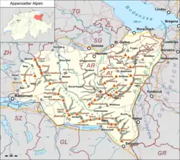
The Appenzell Alps (German: Appenzeller Alpen) are a mountain range in Switzerland on the northern edge of the Alps. They extend into the cantons of Appenzell Ausserrhoden, Appenzell Innerrhoden and St. Gallen and are bordered by the Glarus Alps to the west and the Rätikon to the south-east.
| Appenzell Alps | |
|---|---|
 Churfirsten group, with the Schibestoll, Zuestoll, Brisi, Frümsel, and Selun (left to right) | |
| Highest point | |
| Peak | Säntis |
| Elevation | 2,502 m (8,209 ft) |
| Coordinates | 46°38′28″N 8°25′6″E |
| Naming | |
| Native name | Appenzeller Alpen (German) |
| Geography | |
| |
| Country | Switzerland |
| Cantons | Appenzell Ausserrhoden, Appenzell Innerrhoden, St. Gallen and Zurich |
| Parent range | Western Alps |
| Borders on | Glarus Alps, Rätikon and Schwyz Alps |
| Topo map | Swiss Federal Office of Topography swisstopo |
Sub-ranges
The range is split up into six sub-ranges:
- Alpstein, central group, highest summit: Altmann, 2,435 m
- Alpstein, northern group, highest summit: Säntis, 2,502 m
- Alpstein, southern group, highest summit: Roslen- or Saxerfirst, 2,151 m
- Alviergruppe, highest summit: Gamsberg, 2,385 m
- Churfirsten, highest summit: Hinterrugg, 2,306 m
- Speer - Mattstock, highest summit: Speer, 1,950 m
Geography
Principal summits
The principal summits of the Appenzell Alps are:
- Säntis, 2,502 m
- Girenspitz, 2,448 m
- Altmann, 2,436 m
- Gamsberg, 2,385 m
- Fulfirst, 2,384 m
- Wildhuser Schafberg, 2,373 m
- Wisswand, 2,346 m
- Alvier, 2,343 m
- Gauschla, 2,310 m
- Hinterrugg, 2,306 m
- Brisi, 2,279 m
- Frümsel, 2,267 m
- Zuestoll, 2,235 m
- Margelchopf, 2,163 m
- Silberplatten, 2,158 m
- Schibestoll, 2,136 m
- Leistchamm, 2,101 m
- Gamser Rugg, 2,076 m
- Kreuzberge, 2,065 m
- Lütispitz, 1,987 m
- Speer, 1,950 m
- Mattstock, 1,936 m
- Schäfler, 1,924 m
- Federispitz, 1,865 m
- Gonzen, 1,830 m
- Hoher Kasten, 1,795 m
- Gulmen, 1,789 m
- Stockberg, 1,781 m
- Kronberg, 1,663 m
- Ebenalp, 1,640 m
- Hochalp, 1,521 m
Gallery
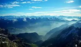
 Säntis from Schwägalp
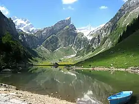
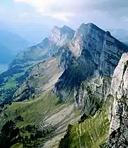 Summit of Churfirsten
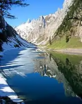
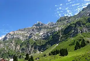
 Near Ebenalp
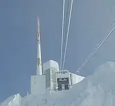 Summit of Säntis
See also
External links
This article is issued from Wikipedia. The text is licensed under Creative Commons - Attribution - Sharealike. Additional terms may apply for the media files.