Aroab
Aroab is a village with a population of approximately 5,000 in the ǁKaras Region of southern Namibia. It is situated about 170 kilometres (110 mi) south-east of Keetmanshoop on the edge of the Kalahari desert; the average annual rainfall is about 150–200 mm. Aroab is the district centre of the Keetmanshoop Rural electoral constituency.[2]
Aroab | |
|---|---|
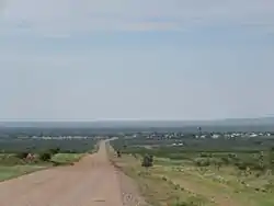 Skyline image of Aroab | |
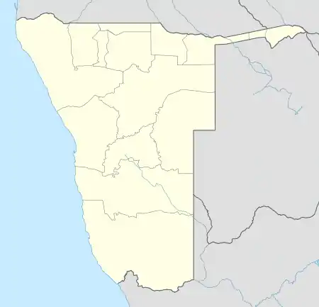 Aroab Location in Namibia | |
| Coordinates: 26°48′S 19°39′E | |
| Country | |
| Region | ǁKaras Region |
| Constituency | Keetmanshoop Rural |
| Government | |
| • CEO | Elsa Laubscher |
| Population (2016)[1] | |
| • Total | c. 5,000 |
| Time zone | UTC+2 (SAST) |
Origin
In 1900 Misters Blaauw and Oppermann, supposedly of German descent, traded Aroab and the surrounding area from an indigenous Nama tribe for sheep and rifles. A quarrel about a ground dam resulted in the two gentlemen splitting the land in two - Aroab and Streitdamm, the ranch adjoining Aroab to the west.
Economy and infrastructure
The vast majority of income is generated on ranches in the surrounding area and stem from sheep, goat and cattle ranching for meat production purposes. The most common sheep breed ranched with is the Dorper, with Persian, Damara, Van Rooy, Karakul and others to a lesser extent. Popular cattle breeds for this area are Nguni, Bonsmara, Brahman and various others to a lesser extent. Various sheep, cattle and goat stud breeders are registered in the area.
During the months of May - Aug (winter) meat hunting takes place widely. Huntable species are Oryx (gemsbok), Springbok and Kudu. To a lesser extent trophy hunting is also available.
Aroab is only reachable via gravel road - the C16 170 km from Keetmanshoop and 35 km from the Klein Menasse / Rietfontein borderpost, the C11 182 km from Karasburg and 142 km from Koës. An unmanned gravel landing strip for light aircraft is situated northwest of the village.
Aroab has surprisingly many schools for such a small place. There are government primary schools (grades 1-7), a Roman Catholic school, a government senior secondary school (grades 8-12) and a private school. There is also a Roman Catholic clinic that provides basic medical services, a post office, Police station, Village Council, a library and various churches (among others Dutch Reformed & Roman Catholic). Other businesses include a farmer's cooperative, general dealer, windpump repairs & engineering and a small abattoir and butchery.
Although plagued by a high unemployment rate, Aroab is well-developed compared to other places in Namibia's south. The village is completely electrified, has no shacks, and all 500 households are connected to the water and sewerage system. The village further operates a public pool.[1]
Politics
Aroab is governed by a village council that currently has five seats.[3] In the 2010 local authority election, the Democratic Turnhalle Alliance (DTA) received the most votes in the town with 260. SWAPO finished in 2nd place with 211 votes, followed by the Rally for Democracy and Progress (RDP, 112 votes) and the Congress of Democrats (CoD, 40 votes).[4] The 2015 local authority election was narrowly won by SWAPO party which gained two seats (267 votes). The DTA finished second and also gained two seats (216 votes), and the remaining seat went to the RDP with 86 votes.[5]
Willem Appollus, an Aroab native, represented Keetmanshoop Rural in the Regional Council of Karas Region and the National Council of Namibia from 2004-2010. He also served on the Aroab Local Authority from 1998-2004.[6]
References
- Smith, Patience (4 October 2016). "Aroab a beacon of hope". The Namibian. p. 6.
- Sasman, Catherine (10 November 2010). "Karas profile". New Era.
- "Know Your Local Authority". Election Watch (3). Institute for Public Policy Research. 2015. p. 4.
- Local Authority results Archived July 17, 2011, at the Wayback Machine Electoral Commission of Namibia
- "Local elections results". Electoral Commission of Namibia. 28 November 2015. p. 3. Archived from the original on 10 December 2015. Retrieved 4 September 2017.
- Willem Appollus Archived 2011-06-11 at the Wayback Machine Namibian Institute for Democracy