Aulos, Ariège
Aulos is a former commune in the Ariège department in the Occitanie region of south-western France. On 1 January 2019, it was merged into the new commune Aulos-Sinsat.[2]
Aulos | |
|---|---|
Part of Aulos-Sinsat | |
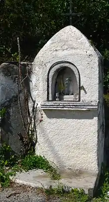
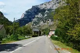 The entry to Aulos | |
Location of Aulos 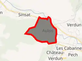
| |
 Aulos  Aulos | |
| Coordinates: 42°47′36″N 1°40′33″E | |
| Country | France |
| Region | Occitanie |
| Department | Ariège |
| Arrondissement | Foix |
| Canton | Haute-Ariège |
| Commune | Aulos-Sinsat |
| Area 1 | 1.04 km2 (0.40 sq mi) |
| Population (2017)[1] | 54 |
| • Density | 52/km2 (130/sq mi) |
| Time zone | UTC+01:00 (CET) |
| • Summer (DST) | UTC+02:00 (CEST) |
| Postal code | 09310 |
| Elevation | 513–968 m (1,683–3,176 ft) (avg. 612 m or 2,008 ft) |
| 1 French Land Register data, which excludes lakes, ponds, glaciers > 1 km2 (0.386 sq mi or 247 acres) and river estuaries. | |
The inhabitants of the commune are known as Aulosois or Aulosoises.[3]
Geography
Aulos is located some 12 km south-east of Tarascon-sur-Ariège and 22 km north-west of Ax-les-Thermes. Access to the commune is by Route nationale 20 from Sinsat in the north-west passing through the north of the commune and continuing south-east to Luzenac. Access to the village is by the D522 road which branches off the N20 in the commune and goes south-east through the village continuing to Les Cabannes. A railway line passes through the commune with the nearest station at Les Cabannes. Most of the commune is heavily forested with a strip of farmland along the N20 and the D522.[4]
The river Ariège forms the whole eastern border of the commune with no tributaries passing through the commune.[4]
Neighbouring communes and villages
Places adjacent to Aulos, Ariège | |
|---|---|
Administration
List of Successive Mayors[5]
| From | To | Name | Party | Position |
|---|---|---|---|---|
| 2001 | 2019 | Jean-Yves Cencigh |
(Not all data is known)
Demography
In 2012 the commune had 56 inhabitants.
|
| ||||||||||||||||||||||||||||||||||||||||||||||||||||||||||||||||||||||||||||||||||||||||||||||||||||||||||||
| Source: EHESS[6] and INSEE[7] | |||||||||||||||||||||||||||||||||||||||||||||||||||||||||||||||||||||||||||||||||||||||||||||||||||||||||||||
See also
References
- Téléchargement du fichier d'ensemble des populations légales en 2017, INSEE
- "Arrêté du 27 septembre 2018 portant création de la commune nouvelle d'Aulos-Sinsat" (PDF). ariege.gouv.fr. 27 September 2018. Retrieved 13 October 2018.
- Inhabitants of Ariège (in French)
- Google Maps
- List of Mayors of France (in French)
- Données Cassini, EHESS
- Populations légales 2012, INSEE
External links
- Aulos on the old IGN website (in French)
- Aulos on Lion1906
- Aulos on Géoportail, National Geographic Institute (IGN) website (in French)
- Aulos on the 1750 Cassini Map
| Wikimedia Commons has media related to Aulos (Ariège). |
| Authority control |
|---|