Bøvra
The Bøvra, also known as the Bævra,[1][2] is a river in the municipality of Surnadal in Møre og Romsdal county and in the municipalities of Rindal and Heim in Trøndelag county, Norway. The 27-kilometre (17 mi) long river runs through the Bøver Valley and empties into Hamnesfjord[3] at the village of Bøverfjorden, where the high-water mark lies 650 meters (2,130 ft) upstream from the mouth of the river. Its drainage basin covers 243 square kilometers (94 sq mi)[4] and receives about 1,500 millimeters (59 in) of precipitation annually.
| Bøvra Bævra | |
|---|---|
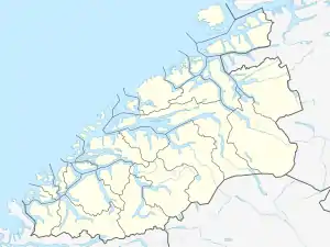 Location of the river 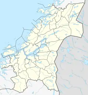 Bøvra (Trøndelag)  Bøvra (Norway) | |
| Location | |
| Country | Norway |
| Counties | Møre og Romsdal, Trøndelag |
| Municipalities | Surnadal, Rindal, Heim |
| Physical characteristics | |
| Source | Bjørnadalen |
| • location | Heim, Trøndelag |
| • coordinates | 63.1519271°N 8.9040451°E |
| • elevation | 590 metres (1,940 ft) |
| 2nd source | Holavatnet |
| • location | Rindal, Trøndelag |
| • coordinates | 63.13394°N 8.9721179°E |
| • elevation | 529 metres (1,736 ft) |
| Mouth | Hamnesfjord |
• location | Bøverfjorden, Surnadal |
• coordinates | 63.0212293°N 8.590772°E |
• elevation | 0 metres (0 ft) |
| Length | 27 km (17 mi) |
| Basin size | 243 km2 (94 sq mi) |
| Basin features | |
| Tributaries | |
| • left | Svorka, Litlbævra |
| • right | Toreseterelva, Neverholtelva, Gravvollsagelva, Geitåa, Skvættå |
The main river has a natural salmon population up to 20 kilometers (12 mi) from the fjord, and salmon can also be found 1 kilometer (0.62 mi) into the Svorka River, a tributary. After regulation of the river, salmon fishing has been limited to downstream from the Svorka power station. In 1986 salmon flukes, a parasite, were detected and the river was treated with rotenone in 1986 and 1989. After the treatment, the river was reopened for fishing in 1994. In addition to salmon, sea trout also travel up the river.[5]
The lower part of the Bøvra Valley is a U-shaped valley and the course of the river creates meanders. Upstream, from the Bjørnåssetra farm to the Brattset farm, the river runs through a relatively narrow canyon for a length of about 5 kilometers (3.1 mi).[6]
The watercourse was regulated in 1963 and it has several power stations along it, including the Svorka Power Station.[7] Due to the regulation, water flow was reduced in two tributaries, the Svorka and Litlbævra (or Lille-Bøvra). Around 43% of the river's catchment area is used for the Svorka Power Station. Below the Svorka Power Station and 3.7 kilometers (2.3 mi) from the fjord the total water flow is the same as before the regulation, but varies with the operation of the power plant and the water flow becomes very small when the power plant stops completely.[1][5] The Nordsvorka Power Station came into operation in 2007. The water flow in the upper part of the river between the mouth of the Litlbævra and the Svorka Power Station has also been greatly reduced as a result of regulation.[8]
According to Amund Helland, the fjord was formerly called Bifrafjǫrðr after the river, which was formerly called Bifr.[9]
See also
References
- Høgstavoll, Ole-Ottar. 2013. Frå eitt tonn til fem fisk. NRK (April 9).
- "Bøvra, Surnadal (Møre og Romsdal)" (in Norwegian). yr.no. Retrieved March 28, 2017.
- Store norske leksikon: Surnadal.
- Johnsen, Bjørn Ove, & Nils Arne Hvidsten. 1995. Evaluering av utsettingspålegg i Surna og Bævra. Trondheim: Norsk institutt for naturforskning, pp. 4, 9, 27.
- Ugedal, Ola, et al. 2014. Fiskebiologiske undersøkelser i Bævra. Sluttrapport for perioden 2009–2013. Trondheim: Norsk institutt for naturforskning.
- Møre og Romsdal fylke. 1984. Bævra. Vassdragsrapport. Møre og Romsdal fylke.
- "Svorka Produksjon - Svorka". svorka.no. Retrieved March 31, 2017.
- Kjærstad, Gaute. 2014. Bunndyrundersøkelser i Bævra, 2010–2013. Trondheim: NTNU Vitenskapsmuseet naturhistorisk rapport 2014–5.
- Helland, Amund. 1911. Norges land og folk: topografisk-statistisk beskrevet: topografisk-statistisk beskrivelse over. 15 D. 2: Romsdals Amt Byerne og herrederne. Kristiania: Aschehoug.