Balbins
Balbins is a former commune in the Isère department in the Auvergne-Rhône-Alpes region of south-eastern France. On 1 January 2019, it was merged into the new commune Ornacieux-Balbins.[2]
Balbins | |
|---|---|
Part of Ornacieux-Balbins | |
 The Balbins Cemetery oil painting in 1888 by Johan Barthold Jongkind | |
Location of Balbins 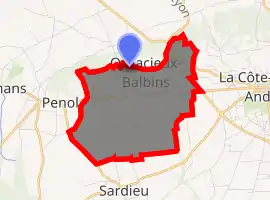
| |
 Balbins  Balbins | |
| Coordinates: 45°23′40″N 5°13′00″E | |
| Country | France |
| Region | Auvergne-Rhône-Alpes |
| Department | Isère |
| Arrondissement | Vienne |
| Canton | Bièvre |
| Commune | Ornacieux-Balbins |
| Area 1 | 7.26 km2 (2.80 sq mi) |
| Population (2017)[1] | 440 |
| • Density | 61/km2 (160/sq mi) |
| Time zone | UTC+01:00 (CET) |
| • Summer (DST) | UTC+02:00 (CEST) |
| Postal code | 38260 |
| Elevation | 347–530 m (1,138–1,739 ft) (avg. 150 m or 490 ft) |
| 1 French Land Register data, which excludes lakes, ponds, glaciers > 1 km2 (0.386 sq mi or 247 acres) and river estuaries. | |
The inhabitants of the commune are known as Balbinois or Balbinoises.[3]
Geography
Balbins is located some 40 km north-west of Grenoble just west of La Côte-Saint-André. Access to the commune is by the D73 from La Côte-Saint-André which passes through the commune just south of the village and continues west to Penol. The D518A passes through the east of the commune linking the D71 south of La Côte-Saint-André to the D518 north-west of La Côte-Saint-André. The commune is almost entirely farmland with urban area of the village merging with that of Ornacieux.[4]
Administration
| From | To | Name | Party | Position |
|---|---|---|---|---|
| 2008 | 2019 | Anne Marie Amice |
(Not all data is known)
Demography
In 2012 the commune had 394 inhabitants.
|
| |||||||||||||||||||||||||||||||||||||||||||||||||||||||||||||||||||||||||||||||||||||||||||||||||||||||||||||||
| Source: EHESS[6] and INSEE[7] | ||||||||||||||||||||||||||||||||||||||||||||||||||||||||||||||||||||||||||||||||||||||||||||||||||||||||||||||||
Sites and monuments
- The Buissonnière Tower is the last vestige of the fortified house that stood there; it was the possession of Miribel, Salignon, and Côte Saint-André.
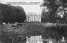
- The Chateau of Armanet was a former Templar fortified house
Notable people linked to the commune
- Félicien de Mons de Savasse, born in the Chateau of Armanet, Knight and Commander of the Order of Malta in 1760.
See also
References
- Téléchargement du fichier d'ensemble des populations légales en 2017, INSEE
- Arrêté préfectoral 26 September 2018, p. 236 (in French)
- Inhabitants of Isère (in French)
- Google Maps
- List of Mayors of France (in French)
- Des villages de Cassini aux communes d'aujourd'hui: Commune data sheet Balbins, EHESS. (in French)
- Populations légales 2012, INSEE