Bald Mountain (Uinta Range)
Bald Mountain is a 11,949-foot (3,642 m) peak[2] in the western Uinta Mountain Range in the Uinta-Wasatch-Cache National Forest on the border between Summit and Wasatch counties in northeastern Utah, United States.
| Bald Mountain | |
|---|---|
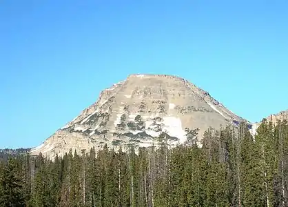 The east face of Bald Mountain, July 2008 | |
| Highest point | |
| Elevation | 11,948 ft (3,642 m) NAVD 88[1] |
| Prominence | 1,823 ft (556 m) [1] |
| Coordinates | 40°41′56″N 110°54′09″W [2] |
| Geography | |
 Bald Mountain Location in Utah | |
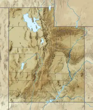
| Location | Duchesne / Summit counties, Utah United States |
| Parent range | Uinta Mountains |
| Topo map | USGS Mirror Lake |
| Climbing | |
| Easiest route | Hike |
Description
The mountain has a prominence of 1,823 feet (556 m)[1] and is home to mountain goats, pika, and a number of species of wildflowers. Utah State Route 150 (SR‑150) passes just east of the mountain.[3]
.jpg.webp)
Bald Mountain Trail
The summit can be reached by the Bald Mountain Trail (National Forest Trail 3202),[4][5] beginning at Bald Mountain Pass on SR‑150,.[3] The trail provides views of the surrounding areas. The maintained trail[4] gains 1,250 feet (381 m) of elevation in 1.4 miles (2.3 km) and due to the high elevation (the trailhead is about 10,700 feet [3,300 m] above sea level) it is a moderately strenuous hike with no shade. The hike to the summit can be completed in 2 to 3 hours round trip. The trail does commonly have snow.
References
- "Bald Mountain, Utah". Peakbagger.com. Retrieved 8 Mar 2020.
- U.S. Geological Survey Geographic Names Information System: Bald Mountain
- Google (8 Mar 2020). "Bald Mountain, Utah 84031" (Map). Google Maps. Google. Retrieved 8 Mar 2020.
- "Bald Mountain". SummitPost.org. Retrieved 8 Mar 2020.
- "Forest Service Interactive Visitor Map" (Map). fs.fec.us. United States Forest Service. Retrieved 8 Mar 2020.
External links
| Wikimedia Commons has media related to Bald Mountain (Uinta Range). |
- "Bald Mountain". SummitPost.org.
- "Bald Mountain, Utah". Peakbagger.com.
- Mirror Lake quadrangle, Utah (Map). 1:24000. 7.5 Minute Topographic. USGS.
- "Bald Mountain Uintas". UtahPictures.com. Archived from the original on 8 February 2009.