Barhara
Barhara, also spelled Badahar, Barahara, or Barahra, is a village and corresponding community development block in Bhojpur District of Bihar, India. It is situated on the bank of the river Ganges. By the time of July–August most of the villages under this block are affected by deluge. As of 2011, its population was 6,889, in 927 households, while the total block population was 240,636, in 35,185 households.[2]
Barhara | |
|---|---|
Village | |
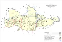 Map of Barhara block | |
 Barhara Location in Bihar, India  Barhara Barhara (India) | |
| Coordinates: 25.686683°N 84.722464°E[1] | |
| Country | |
| State | Bihar |
| District | Bhojpur |
| Area rank | 0.193 |
| Elevation | 74 m (243 ft) |
| Population | |
| • Total | 6,889 |
| Languages | |
| • Official | Bhojpuri, Hindi |
| Time zone | UTC+5:30 (IST) |
| PIN | 802311[2] |
| Telephone code | 91-6182 |
| Vehicle registration | BR-03 |
Demographics
The sex ratio of Barhara block, as of 2011, was 878, which was the lowest in Bhojpur district. The sex ratio was higher in the 0-6 age group, with 906 females for every 1000 males. Members of scheduled castes made up 12.05% of block residents and members of scheduled tribes made up 0.88%. The literacy rate in Barhara block was 69.11% (80.5% among men and 56.04% among women).[2]
A majority of Barhara block's workforce was engaged in agriculture in 2011, with 17.70% being cultivators who owned or leased their own land and a further 47.25% being agricultural labourers who worked another person's land for wages. An additional 8.44% were household industry workers, and the remaining 26.61% were other workers.[2]
Administration
Barhara village is administered by Mukhiya through its gram panchayat, who is elected representative of village as per constitution of India and Panchyati Raj Act.[3]
| Particulars | Total | Male | Female |
|---|---|---|---|
| Total No. of Houses | 927 | ||
| Population | 6889 | 3649 | 3240 |
Villages
Barhara block contains the following 79 villages:[2]
| Village name | Total land area (hectares) | Population (in 2011) |
|---|---|---|
| Piparpanti | 671 | 3,697 |
| Balua | 396 | 7,829 |
| Nargada | 259 | 2,771 |
| Majhauli | 185 | 1,572 |
| Keotia | 159 | 954 |
| Sohra | 626 | 11,474 |
| Khawaspur | 0 | 0 |
| Khawaspur | 0 | 0 |
| Khawaspur | 0 | 0 |
| Khawaspur | 0 | 0 |
| Nurpur | 186 | 803 |
| Parasrampur | 291 | 1,548 |
| Kudaria | 151 | 1,012 |
| Jagatpur | 110 | 1,975 |
| Jokahri | 252 | 1,362 |
| Galchaur | 177.3 | 2,630 |
| Jhokipur | 34 | 975 |
| Saraiya | 501 | 12,464 |
| Krishnagarh | 248 | 1,924 |
| Pakri | 387 | 2,444 |
| Milki | 20 | 1,748 |
| Ghanghar | 31 | 697 |
| Sinha | 982 | 13,186 |
| Chhinegaon | 124 | 5,375 |
| Sanjoel | 189 | 806 |
| Gyanpur | 157 | 2,381 |
| Semaria Jionarain | 89 | 1,684 |
| Nathmalpur | 334 | 6,966 |
| Gazipur Farhada | 701 | 4,652 |
| Shivpur | 150 | 2,084 |
| Gunri | 449 | 4,534 |
| Gunri | 1,164 | 13,910 |
| Paiga | 314 | 3,456 |
| Lauhar | 152 | 1,739 |
| Turki | 96 | 730 |
| Pharna | 193 | 3,850 |
| Bhusahula | 50 | 1,170 |
| Karja | 334 | 2,306 |
| Lauhar | 369 | 2,503 |
| Milki Mir Chhaka | 66 | 0 |
| Bakhorapur English | 86 | 0 |
| Bakhorapur | 304 | 4,903 |
| Gangauli | 72 | 101 |
| Keshopur | 42 | 1,153 |
| Semaria Pararia | 432 | 5,433 |
| Mariam Chak | 61 | 0 |
| Dost Muhammad Chak | 20 | 0 |
| Barhara (block headquarters) | 193 | 6,889 |
| Akauna | 605 | 7,597 |
| Bishambharpur | 408 | 1,292 |
| Kuiya | 121 | 1,235 |
| Rampur | 210 | 1,944 |
| Kazi Chak | 98 | 1349 |
| Chatar | 247 | 3,408 |
| Ram Shahar | 380 | 4,337 |
| Matukpur | 36 | 2,724 |
| Ramsagar | 116 | 2,130 |
| Deorath | 76 | 645 |
| Panditpur | 66 | 877 |
| Agarpura | 60 | 738 |
| Babhangawan | 151 | 2,731 |
| Babura | 1,842 | 28,412 |
| Bishunpur | 225 | 4,457 |
| Molna Chak | 57 | 0 |
| Khawaspur | 21 | 146 |
| Latif Chak | 11 | 0 |
| Mah Chak | 51 | 0 |
| Faizullah Chak | 2 | 0 |
| Achhai Chak | 23 | 0 |
| Jalali Chak | 10 | 0 |
| Humaun Chak | 28 | 0 |
| Raepur Binganwan | 607 | 2,486 |
| Khawaspur (Unsurveyed) | 0 | 15,074 |
| Mahazi Dokti (Unsurveyed) | 0 | 0 |
| Dokti (Unsurveyed) | 0 | 0 |
| Rampur Kondarha (Unsurveyed) | 0 | 0 |
| Kondarha Uparwar (Unsurveyed) | 0 | 0 |
| Raghunathpur (Unsurveyed) | 0 | 0 |
| Sheo Diara (Unsurveyed) | 3,549 | 11,634 |
Notes and references
- "Barhara map". google.co.in. Retrieved 22 July 2017. This is the map and coordinates for Barahra, not Badahar.
- "Census of India 2011: Bihar District Census Handbook - Bhojpur, Part A (Village and Town Directory)". Census 2011 India. pp. 46, 63, 81–83, 90, 92, 308–347, 753, 808–809. Retrieved 18 August 2020.
- "Population of Barhara". census2011.co.in. Retrieved 22 July 2017.