Bata, Equatorial Guinea
Bata (Spanish pronunciation: [ˈbata]) is a port city in the Litoral province of Equatorial Guinea. With a 2005 estimated population of 173,046, it is the largest city in Equatorial Guinea. It lies on the Atlantic Ocean coast of Río Muni. Bata was formerly capital of Equatorial Guinea and is a transport hub and port, from which ferries sail to Malabo and Douala, while fliers can land at Bata Airport. Bata is also known for its nightlife and market.
Bata | |
|---|---|
| Bata | |
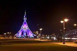 Torre de La Libertad standing by the promenade along the coast | |
.png.webp) Coat of arms | |
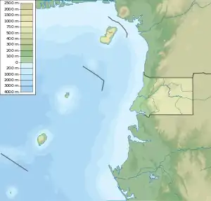 Bata Location in Equatorial Guinea 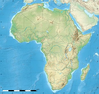 Bata Bata (Africa) | |
| Coordinates: 1°51′N 9°45′E | |
| Country | |
| Province | Litoral |
| Elevation | 5 m (16 ft) |
| Population (2012) | |
| • Total | 250,770 |
| Demonym(s) | Batengo |
| Area code(s) | 08 |
| Climate | Am |
| HDI (2019) | 0.626[1] medium |
History
After the anti-Spanish riots of 1969, the European population declined in Bata, and severe economic stagnation affected Bata in the 1970s and early 1980s.[2] The recent oil boom of the country in the late 1980s and 1990s has boosted the development of the city.[3]
Economy
Bata has one of the deepest seaports in the region. Despite this, Bata has no natural harbor and a jetty was built to facilitate offshore handling of ships' cargoes. The principal exports are timber and coffee.[4]
Climate
Bata, like most of Equatorial Guinea, has a tropical monsoon climate (Köppen Am). It is much less gloomy than Malabo, and has its dry season in the opposite months to insular Equatorial Guinea but in the same months as neighbouring Gabon due to the Benguela Current. There is also a minor depression in rainfall between December and February when the Intertropical Convergence Zone is at its most southerly, and unlike the true dry season in July and August, this is accompanied by increased sunshine. The rainiest months are April, May, October and November, when monthly totals of 300 millimetres or 12 inches are typical, although October averages as much as 457 millimetres or 18.0 inches.
| Climate data for Bata (1956–1965) | |||||||||||||
|---|---|---|---|---|---|---|---|---|---|---|---|---|---|
| Month | Jan | Feb | Mar | Apr | May | Jun | Jul | Aug | Sep | Oct | Nov | Dec | Year |
| Record high °C (°F) | 33.5 (92.3) |
35.6 (96.1) |
34.1 (93.4) |
34.1 (93.4) |
33.2 (91.8) |
32.8 (91.0) |
31.8 (89.2) |
31.5 (88.7) |
32.5 (90.5) |
32.0 (89.6) |
32.4 (90.3) |
33.0 (91.4) |
35.6 (96.1) |
| Average high °C (°F) | 30.5 (86.9) |
31.1 (88.0) |
31.3 (88.3) |
31.0 (87.8) |
30.7 (87.3) |
29.7 (85.5) |
28.8 (83.8) |
28.9 (84.0) |
29.1 (84.4) |
29.1 (84.4) |
29.6 (85.3) |
30.1 (86.2) |
30.0 (86.0) |
| Daily mean °C (°F) | 25.6 (78.1) |
25.8 (78.4) |
25.7 (78.3) |
25.6 (78.1) |
25.6 (78.1) |
25.0 (77.0) |
24.1 (75.4) |
24.2 (75.6) |
24.6 (76.3) |
24.8 (76.6) |
25.2 (77.4) |
25.0 (77.0) |
25.1 (77.2) |
| Average low °C (°F) | 20.7 (69.3) |
20.4 (68.7) |
20.1 (68.2) |
20.1 (68.2) |
20.6 (69.1) |
20.2 (68.4) |
19.4 (66.9) |
19.6 (67.3) |
20.0 (68.0) |
20.5 (68.9) |
20.8 (69.4) |
20.0 (68.0) |
20.2 (68.4) |
| Record low °C (°F) | 15.3 (59.5) |
13.7 (56.7) |
14.5 (58.1) |
12.5 (54.5) |
12.5 (54.5) |
15.5 (59.9) |
12.5 (54.5) |
14.2 (57.6) |
15.6 (60.1) |
15.5 (59.9) |
14.5 (58.1) |
14.5 (58.1) |
12.5 (54.5) |
| Average rainfall mm (inches) | 116 (4.6) |
102 (4.0) |
205 (8.1) |
292 (11.5) |
285 (11.2) |
90 (3.5) |
25 (1.0) |
26 (1.0) |
221 (8.7) |
457 (18.0) |
306 (12.0) |
109 (4.3) |
2,234 (87.9) |
| Average rainy days (≥ 0.1 mm) | 9 | 8 | 14 | 16 | 17 | 7 | 3 | 5 | 16 | 24 | 18 | 10 | 147 |
| Mean monthly sunshine hours | 201.5 | 192.1 | 173.6 | 177.0 | 189.1 | 147.0 | 142.6 | 142.6 | 114.0 | 114.7 | 141.0 | 186.0 | 1,921.2 |
| Mean daily sunshine hours | 6.5 | 6.8 | 5.6 | 5.9 | 6.1 | 4.9 | 4.6 | 4.6 | 3.8 | 3.7 | 4.7 | 6.0 | 5.3 |
| Source: Deutscher Wetterdienst[5] | |||||||||||||
Education
The Colegio Nacional Enrique Nvó Okenve has campuses here and in Malabo.[6]
The Colegio Español, a Spanish international school, is the city's sole international school.
Places of worship
Among the places of worship, they are predominantly Christian churches and temples (Catholic: Roman Catholic Diocese of Bata, Protestant, Evangelical Christian: Assemblies of God).[7]
Transport
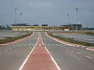
Bata Airport is located north of Bata.
Notable residents
- Regina Mañe Ela (1954–2015), politician and opposition campaigner
References
- "Sub-national HDI - Area Database - Global Data Lab". hdi.globaldatalab.org. Retrieved 2018-09-13.
- Britannica, Bata, britannica.com, USA, accessed on July 7, 2019
- Britannica, Bata, britannica.com, USA, accessed on July 7, 2019
- Encyclopædia Britannica, Retrieved on June 18, 2008
- "Klimatafel von Bata / Insel Mbini / Äquatorial-Guinea" (PDF). Baseline climate means (1961-1990) from stations all over the world (in German). Deutscher Wetterdienst. Retrieved 25 January 2016.
- "TECHNICAL SUPPORT PROJECT FOR SOCIAL INVESTMENT AND CAPACITY BUILDING IN EQUATORIAL GUINEA", Design and Implementation Plan, Contract No. DFD-I-00-05-0020 TO #2, (September 2006 through August 2008).
- J. Gordon Melton, Martin Baumann, ‘‘Religions of the World: A Comprehensive Encyclopedia of Beliefs and Practices’’, ABC-CLIO, USA, 2010, p. 989