Beitstadfjorden
Beitstadfjorden (Urban East Norwegian: [ˈbæ̂ɪtstɑˌfjuːɳ]) is the innermost arm of the Trondheimsfjord in Trøndelag county, Norway. It is located in the municipalities of Steinkjer, Inderøy, and a small part extends into Indre Fosen. The fjord has a length of 28 kilometres (17 mi) from southwest to northeast, and a width of about 6 to 8 kilometres (3.7 to 5.0 mi).
| Beitstadfjorden | |
|---|---|
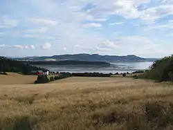 View of the fjord | |
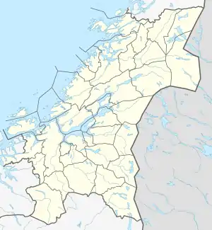 Beitstadfjorden Location of the fjord  Beitstadfjorden Beitstadfjorden (Norway) | |
| Location | Trøndelag county, Norway |
| Coordinates | 63.9342°N 11.1079°E |
| Type | Fjord |
| Primary outflows | Trondheimsfjorden |
| Basin countries | Norway |
| Max. length | 28 kilometres (17 mi) |
| Max. width | 6 to 8 km (3.7 to 5.0 mi) |
The fjord begins at the Skarnsund strait in the south and extends northeast to the city of Steinkjer. On the far western part of the fjord, the Verrasundet strait extends south to the village of Verrabotn in Indre Fosen, while in the north the Beitstad strait stretches northward past the villages of Malm, Beitstad, and Vellamelen. In Inderøy, the villages of Kjerknesvågen and Breivika are located along the shoreline. Follafoss is located along the north side of the fjord.[1]
See also
References
- Thorsnæs, Geir, ed. (2017-12-21). "Beitstadfjorden". Store norske leksikon (in Norwegian). Kunnskapsforlaget. Retrieved 2018-04-08.