Bell Rock (Arizona)
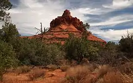
Bell Rock is a butte just north of the Village of Oak Creek, Arizona, south of Sedona in Yavapai County. With an elevation at its summit of 4,919 feet (1,499 m), it is just west of Courthouse Butte. Its panoramic views make it a popular landmark and tourist attraction.
| Bell Rock | |
|---|---|
 | |
| Highest point | |
| Elevation | 4,919 ft (1,499 m) NGVD 29[1] |
| Prominence | 479 ft (146 m) [1] |
| Coordinates | 34°48′01″N 111°45′53″W [2] |
| Geography | |
 Bell Rock | |
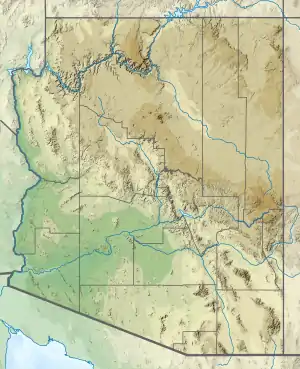
| Location | Yavapai, Arizona, U.S. |
| Topo map | USGS Sedona |
The most popular route is a moderate hike that reaches a small plateau on the northwest face of the butte. A challenging unmarked trail must be taken to reach the summit.[3]
Geology
Bell Rock is a butte composed of horizontally bedded sedimentary rock of the Permian Supai Formation.[4][5]
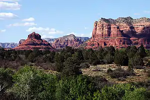
Bell Rock (at left), with Courthouse Butte to its right.
References
- "Bell Rock, Arizona". Peakbagger.com. Retrieved 2014-02-02.
- "Bell Rock". Geographic Names Information System. United States Geological Survey. Retrieved 2014-02-02.
- "Hike | Bell Rock Loop | Sedona". Arizona Hikers Guide. Retrieved 2021-02-08.
- Weir, G.W.; Ulrich, G.E.; Nealey, L.D. (1989). Geologic map of the Sedona 30' X 60' quadrangle, Yavapai and Coconino Counties, Arizona.
- DeForest, Lisa (2006). "Bell Rock, A Sedona landmark". azcentral.com.
External links
| Wikimedia Commons has media related to Bell Rock (Sedona). |
This article is issued from Wikipedia. The text is licensed under Creative Commons - Attribution - Sharealike. Additional terms may apply for the media files.