Berbice River
The Berbice River, located in eastern Guyana, is one of the country's major rivers. It rises in the highlands of the Rupununi region and flows northward for 595 kilometres (370 mi)[1] through dense forests to the coastal plain. The river's tidal limit is between 160 and 320 km (99–199 mi) from the sea.
Geography
Obstructed by shallows at its estuary, the Berbice River's mouth is the location of Crab Island, opposite the mouth of the Canje River, the Berbice's main tributary.
Quantity of water based on the streamflow of the gauging station at Itabu Falls (04'52'N0'50'13'W) is 40,800 litres per minute.[2]
History
The Dutch established a foothold on the Berbice River as early as 1629 for trading with the Amerindians. Plantations formed along the river, and it later became the location of a major slave uprising.[3] In 1627, the settlement of Nassau (the name was used for many of the Dutch forts in the seventeenth century) was founded by the Dutch West India Company. The area was passed over to the British in 1815 and merged with the neighboring British Guiana.[4]
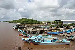
The town of New Amsterdam is situated on the river's east bank, approximately four miles inside the river's estuary, where it enters the Atlantic Ocean. A new bridge over the river joins New Amsterdam to Rosignol. Other communities on the Berbice River include Everton, Mara, Takama, Kalkuni and Kwakwani.
The river has served to transport Bauxite from the major mine at Kwakwani (currently owned by Rusal).[5]
Infrastructure
A ferry service transferred goods and people between Kwakwani and New Amsterdam, but was discontinued in the 1990s.[6]
Torani Canal was built to allow water to flow from the Berbice River into the Canje River for maintaining water levels for irrigation purposes.[7]
On December 23, 2008, construction of the Berbice Bridge linking D’Edward Village, Crab Island, and the Courantyne Highway was completed.[8]
See also
References
- "Berbice River | river, Guyana". Encyclopedia Britannica. Retrieved 2021-01-03.
- "WATER RESOURCES ASSESSMENT OF GUYANA" (PDF). US Army Corps of Engineers Mobile District & Topographic Engineering Center. December 1998. Retrieved 2020-01-03.
- "In 'Blood On The River,' The Berbice Rebellion Foreshadows Later Insurgencies". NPR.org. Retrieved 2021-01-03.
- "Map of the Colony of Berbice Located in Batavian Guiana in America between the Colonies of Demerara and Suriname". www.wdl.org. 1802. Retrieved 2021-01-03.
- "Jobs are Labour Ministry's main target with RUSAL -Min. Hamilton". Department of Public Information. 2020-10-22. Retrieved 2021-01-03.
- "Berbice River communities facing economic challenges, community differences". Stabroek News. 2016-07-01. Retrieved 2021-01-03.
- "Torani Canal becoming shallower as banks slide into water". Stabroek News. 2013-02-03. Retrieved 2021-01-03.
- "Archived copy". Archived from the original on 2011-07-21. Retrieved 2010-03-16.CS1 maint: archived copy as title (link)
Further reading
- A Journey on the Berbice River and Wieroonie Creek by Ernest Glaisher (1885).