Bessel Fjord, NW Greenland
Bessel Fjord, also known as Bessels Bay, is a fjord in northwestern Greenland.[1] Administratively it belongs to the Avannaata municipality.
| Bessel Fjord | |
|---|---|
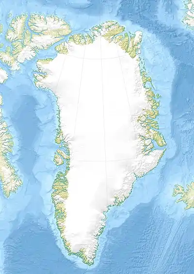 Bessel Fjord Location | |
| Location | Arctic |
| Coordinates | 80°55′N 63°5′W |
| Ocean/sea sources | Kennedy Channel Nares Strait |
| Basin countries | Greenland |
| Max. length | 60 km (37 mi) |
| Max. width | 3.5 km (2.2 mi) |
| Frozen | Most of the year |
| Settlements | Uninhabited |
Knud Rasmussen described the fjord entrance in the following terms:
We passed Bessel Fjord in a fresh breeze, and the peculiar indentation, surrounded on all sides by steep mountains intersected by hanging tongues of ice, looked eerie and desolate.[2]
Geography
Bessel Fjord stretches roughly from north to south for about 60 km. It is a long and narrow fjord lined with high mountains rising steeply from the shore. Hannah Island, a small island, lies in the area of its mouth by the Kennedy Channel, Cape Bryan is on the western side of the mouth and Cape Maynard on the northeastern.[3]
This fjord is located northeast of Washington Land, at the northern end of Daugaard-Jensen Land. The Petermann Peninsula forms its eastern shore. There are large ice caps on both landmasses flanking the fjord.[1]
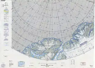 Map of part of Ellesmere Island and far Northern Greenland. |
Bibliography
- H.P. Trettin (ed.), Geology of the Innuitian Orogen and Arctic Platform of Canada and Greenland. Geological Survey of Canada (1991) ISBN 978-0660131313
See also
References
- "Bessel Fjord". Mapcarta. Retrieved 7 March 2019.
- Rasmussen, Knud, Greenland by the Polar Sea; the story of the Thule expedition from Melville bay to Cape Morris Jesup.
- Prostar Sailing Directions 2005 Greenland and Iceland Enroute, p. 93