Bhatapara
Bhatapara is a city and a Nagar Palika (municipality) in the Baloda Bazar-Bhatapara district of the state of Chhattisgarh, India.
Bhatapara | |
|---|---|
city, town | |
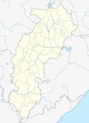 Bhatapara Location in Chhattisgarh, India  Bhatapara Bhatapara (India) | |
| Coordinates: 21.73°N 81.93°E | |
| Country | |
| State | Chhattisgarh |
| District | Balodabazar-Bhatapara District |
| Elevation | 261 m (856 ft) |
| Population (2011) | |
| • Total | 57,537 |
| Languages | |
| • Official | Hindi, Chhattisgarhi |
| Time zone | UTC+5:30 (IST) |
| Vehicle registration | CG |
| Website | https://www.instagram.com/bhataparaa |
History
During the British rule from 1854 to 1864, Baloda Bazar and Bhatapara were part of the Raipur district. Later, these areas were included in the Bilaspur district in 1864.[1] Bhatapara later became its own district in 1903 after local British Officers relocated their telegraph office there from Simga. Baloda Bazaar would then become a Gram Panchayat in 1949, following the Local Government Act implemented by the newly independent Indian Government.
Governance
The municipality, split into multiple wards, holds elections every five years. The city has a municipal administrative body, Bhatapara Municipal Council, which supplies water and sewage services for domestic, industrial, and commercial purposes, constructs new highways, collects property taxes, and provides other fundamental services.
Geography
Bhatapara, located at 21.73°N 81.93°E.,[2] has an average elevation of 261 meters (856 feet), and has a typically humid and warm climate, with 875.27 hectares of forest.[3]
Demographics
According to the 2011 Indian census, Bhatapara City had a population of 57,537.[4] Within the ages of 0-6 were 7,961 children, comprising 13.84% of the total populace. Males constituted 51% of the population, while females represented 49%. In Bhatapara, the male literacy rate is around 88.74%, while the female literacy rate is 72.96%.
In 2011, Bhatapara Municipality encompassed 27 Wards and 12,148 dwellings, to which it supplies basic amenities like water and sewage.[5] It is also authorized to build roads within Municipality limits and impose taxes on properties under its jurisdiction.
Culture
Bhatapara is known for its mill, the Simaria Ghat Mela, and the religious festivals held during the week-long Ram Naam Saptah.[6]
Transport
Bhatapara railway station is on the Howrah-Nagpur-Mumbai line in the South-East Central Railway zone, a major station on the border between Bilaspur and Raipur. It is connected by rail to the nearby stations of Hathband, Tilda, Nipania, Dagori, and Bilha. Bilaspur City is 57 kilometres (35 mi) away and can also be reached by regular transport. Bhatapara is on state highway connecting Nandghat to gidhouri. District headquarters (Baloda-bazar) is 21 kilometers away and Raipur is 85 kilometers away. Raipur-Bilaspur expressway is just 17 kilometers way. Buses are available for nearby towns like Bemetara, Baloda-bazaar, Mungeli, Nawagarh, kharora.
References
- "History | District Balodabazar - Bhatapara | India". Retrieved 4 August 2020.
- Falling Rain Genomics, Inc - Bhatapara
- "Natural Resource | District Balodabazar - Bhatapara | India". Retrieved 12 August 2020.
- "Bhatapara City Population - Raipur, Chhattisgarh". Censusindia2011.com. Retrieved 15 July 2020.
- "Bhatapara City Population - Raipur, Chhattisgarh". Censusindia2011.com. Retrieved 24 July 2020.
- "Bhatapara Master Plan 2031 Report, Bhatapara 2031 Maps & Detailed Info". Affordable Housing Live. 3 June 2017. Retrieved 24 July 2020.