Bhogadi
Bhogadi is a town within the limits of the Mysore Urban Development Authority, and Mysuru metropolitan area in Mysore district, Karnataka.[6]
Bhogadi | |
|---|---|
Town[1] | |
 Sharadha School Bogadhi with Skyline | |
.svg.png.webp) Bhogadi Bogadi,Mysuru, karnataka,india,asia,world | |
| Coordinates: 12.3°N 76.6°E | |
| Country | |
| State | Karnataka |
| District | Mysore |
| Government | |
| • Type | Town Panchayat [2][3][4] |
| • Body | Bogadi town panchayat |
| Area | |
| • Total | 32.35 km2 (12.49 sq mi) |
| Elevation | 710 m (2,330 ft) |
| Population (2011) | |
| • Total | 23,410[5] |
| Languages | |
| • Official | English and Kannada |
| Time zone | UTC+5:30 (IST) |
| Vehicle registration | KA09 KA55 and KA 45 |
Geography
Bhogadi is located on the westren edge of Greater Mysuru, 15 kilometers from the foothills of the Chamundi hills, beyond the first ring road surrounding Mysore. Bhogadi covers a total area of 32.35 square kilometers.[7] According to the 2011 census, the combined greater Bhogadi area had a total population of 23,410.[8][9]
Transportation
There are five city bus lines which connect to Mysore; they are the 69J, 69G, 245,68, and 91G, and stop at Christ school, Bogadi town.
Demographics
According to the 2011 Indian census,[10] Bhogadi had a population of 9,041. The surrounding villages of Madagalli consisted of 2,617 people, Hemmanahalli consisted of 1,207 people, Maratikyathanahalli had 5,122 people, Jattihundi had 1,322 people, Kergalli had 4,068 people and Kemmanapura had 37 people bringing the total population to 23,407. Males constitute 53% of the population and females 47%. Bhogadi has an average literacy rate of 64%, higher than the national average of 59.5%, with male literacy of 70% and female literacy of 57%. 11% of the population is under 6 years of age.
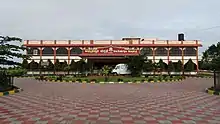
Image gallery
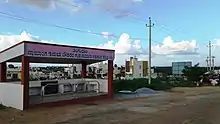
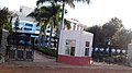
- Sharada Public School
 Hari Vidyalaya
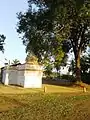
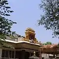 Temple in Bhogadi
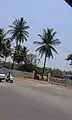 Ringroad
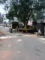
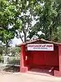
References
- https://censusindia.gov.in/2011census/dchb/2923_PART_A_DCHB_MYSORE.pdf
- https://starofmysore.com/hootagalli-cmc-to-be-formed/
- https://www.thenewsminute.com/article/mysuru-city-corporation-limits-expanded-137578
- https://citytoday.news/cm-yediyurappa-okays-development-of-5-ulbs-in-mysuru/
- https://censusindia.gov.in/2011census/dchb/2923_PART_A_DCHB_MYSORE.pdf
- "Hootagalli CMC and four Town Panchayats formed: Govt. issues Gazette notification". Star of Mysore. 26 November 2020. Retrieved 6 December 2020.
- "Hootagalli CMC and four Town Panchayats formed: Govt. issues Gazette notification". Star of Mysore. 26 November 2020. Retrieved 6 December 2020.
- "Census 2011 Handbook Mysore" (PDF).
- "Gazette Notification" (PDF).
- "Census of India 2001: Data from the 2001 Census, including cities, villages and towns (Provisional)". Census Commission of India. Archived from the original on 16 June 2004. Retrieved 1 November 2008.