Blackwater Valley Path
The Blackwater Valley Path follows the River Blackwater from its source in the Rowhill Nature Reserve in Aldershot to just beyond the point where it joins the River Whitewater near Swallowfield to become the Broadwater.[1] This long-distance route covers 23 miles (37 km) and closely follows the River Blackwater using public rights-of-way as well as permissive footpaths and is waymarked. It is looked after by the Blackwater Valley Countryside Partnership.[2]
| Blackwater Valley Path | |
|---|---|
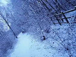 Blackwater Valley Path in winter. | |
| Length | 23 mi (37 km) |
| Location | Hampshire, Surrey, Berkshire. |
| Trailheads | Rowhill Nature Reserve, Aldershot Swallowfield51.380°N 0.957°W |
| Use | Hiking |
The Surrey Heath section includes informal parks on reclaimed land at Blackwater Park and Watchmoor.
See also
- Recreational walks in Hampshire
- Long-distance footpaths in the UK
References
- "Blackwater Valley Path". LDWA. Retrieved 10 March 2019.
- "Blackwater Valley Countryside". Blackwater Valley Countryside Partnership. Archived from the original on 19 October 2018.
External links
- Blackwater Valley Countryside
- Blackwater Valley map with links
- Surrey Heath borough council
- Blackwater Valley runners - Running club that runs the BlackWater Valley path
This article is issued from Wikipedia. The text is licensed under Creative Commons - Attribution - Sharealike. Additional terms may apply for the media files.