Blue Creek Canyon
Blue Creek Canyon is a narrow, steep-walled canyon in Gunnison County, Colorado. It lies between Fitzpatrick Mesa and Blue Mesa and is south of Morrow Point Reservoir and southeast of Cimarron, Colorado. U.S. Highway 50 goes through the canyon. Gunnison County Road 867 (also called Alpine Plateau Road and Forest Service Road 867) intersects with Highway 50 near the middle of the canyon.[2]
| Blue Creek Canyon | |
|---|---|
| Little Blue Creek Canyon | |
.JPG.webp) | |
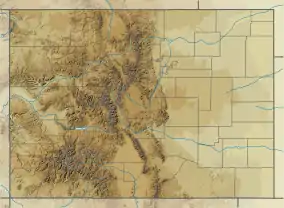 Blue Creek Canyon Location in Colorado | |
| Floor elevation | 2,492 m (8,176 ft)[1] |
| Length | 3.8 mi (6.1 km) N-S |
| Geography | |
| Location | Gunnison County, Colorado |
| Country | United States |
| State | Colorado |
| Borders on | Fitzpatrick Mesa and Blue Mesa |
| Coordinates | 38°24′16″N 107°24′28″W [1] |
| Topo map | Curecanti Needle |
| Traversed by | |
| Rivers | Blue Creek, Little Blue Creek and Big Blue Creek |
Upcoming highway construction
The highway through the canyon is narrow and winding. Because of this, many accidents have occurred there. The U.S. Department of Transportation and various other agencies plan to make safety improvements to the 3.8 mile section of the highway in Blue Creek Canyon (which U.S. DOT websites refer to as Little Blue Creek Canyon). The work is scheduled to begin in spring 2021 and last through fall 2022. The construction — which will involve widening the highway, widening and paving the shoulders, replacing guardrail, and adding new signage and striping — will require frequent and long-duration closures of the highway.[3][4]
Blue Creek
Inside the canyon, Little Blue Creek[1] and Big Blue Creek[5] merge to form Blue Creek.[6] The confluence is adjacent to the intersection of Highway 50 and Alpine Plateau Road, next to the bridge. Immediately after the confluence, Blue Creek flows under the bridge, flows north along the highway's west side, and then separates from the highway heading northwest and eventually empties into Morrow Point Reservoir at the Curecanti Needle.
Geology
The canyon walls are made of metamorphic rocks and are filled with big and small pegmatite dikes. Some of the dikes contain large, intergrown crystals of feldspar and pink quartz.[7]
References
- "Little Blue Creek". Geographic Names Information System. United States Geological Survey.
- "How to get here". Arrowhead Mountain Lodge. Retrieved 2020-03-12.
- "US 50 Little Blue Creek Canyon Information Sheet" (PDF). United States Department of Transportation, Federal Highway Administration, Office of Federal Lands Highway. 2019-04-23. Retrieved 2020-03-12.
- "Little Blue Creek Canyon". United States Department of Transportation. 2019-04-23. Retrieved 2020-03-12.
- "Big Blue Creek". Geographic Names Information System. United States Geological Survey.
- "Blue Creek". Geographic Names Information System. United States Geological Survey.
- Williams, Felicie; Chronic, Halka (2014). Roadside geology of Colorado (3rd ed.). Missoula, Montana: Mountain Press Publishing Company. p. 251. ISBN 9780878426096. LCCN 2013025258.