Boon Township, Indiana
Boon Township is one of ten townships in Warrick County, Indiana, United States. As of the 2010 census, its population was 12,755 and it contained 5,529 housing units.[1]
Boon Township Warrick County | |
|---|---|
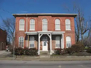 Old Warrick County Jail, a historic place in Boonville | |
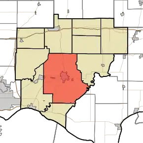 Location in Warrick County | |
| Coordinates: 38°02′23″N 87°16′38″W | |
| Country | United States |
| State | Indiana |
| County | Warrick |
| Government | |
| • Type | Indiana township |
| Area | |
| • Total | 84.93 sq mi (220.0 km2) |
| • Land | 83.45 sq mi (216.1 km2) |
| • Water | 1.48 sq mi (3.8 km2) 1.74% |
| Elevation | 423 ft (129 m) |
| Population (2010) | |
| • Total | 12,755 |
| • Density | 152.8/sq mi (59.0/km2) |
| ZIP codes | 47601, 47610, 47630 |
| GNIS feature ID | 453124 |
History
Boon Township was established in 1816 from land given by Anderson Township.[2] It was named for settler Ratliff Boon.[3]
Geography
According to the 2010 census, the township has a total area of 84.93 square miles (220.0 km2), of which 83.45 square miles (216.1 km2) (or 98.26%) is land and 1.48 square miles (3.8 km2) (or 1.74%) is water.[1]
Unincorporated towns
- Bullocktown at 37.974769°N 87.222781°W
- Center at 38.048656°N 87.343064°W
- New Hope at 37.989769°N 87.222503°W
- Pelzer at 37.989213°N 87.257226°W
- Rolling Acres at 38.066714°N 87.270839°W
(This list is based on USGS data and may include former settlements.)
Adjacent townships
- Hart Township (north)
- Owen Township (northeast)
- Grass Township, Spencer County (east)
- Skelton Township (east)
- Luce Township, Spencer County (southeast)
- Anderson Township (south)
- Campbell Township (west)
- Ohio Township (west)
Cemeteries
The township contains these cemeteries: Baker, Broshears, Brown Chapel, Clutter Stone, Ellis, Freedom (also known as Mundy Cemetery and Powers Cemetery), Hedge, Maple Grove, Perigo, Plainview Memorial, Small, Thornburg, Warren and Wesley Chapel.
Airports and landing strips
- Boonville Airport
Landmarks
- Scales Lake State Park
School districts
Political districts
- Indiana's 8th congressional district
- State House District 74
- State Senate District 47
References
- "Boon Township, Warrick County, Indiana". Geographic Names Information System. United States Geological Survey. Retrieved 2009-09-24.
- United States Census Bureau 2007 TIGER/Line Shapefiles
- IndianaMap
- "Population, Housing Units, Area, and Density: 2010 - County -- County Subdivision and Place -- 2010 Census Summary File 1". United States Census. Archived from the original on 2020-02-12. Retrieved 2013-05-10.
- Barr, Arvil Sylvester (1915). A History of Warrick County, Indiana, Prior to 1820, Including a Sketch of Methodism in the County Down to 1850. Indiana University. p. 17.
- Fortune, William (1881). Warrick and Its Prominent People: A History of Warrick County, Indiana from the Time of Its Organization and Settlement. Courier Company. p. 18.
External links
Municipalities and communities of Warrick County, Indiana, United States | ||
|---|---|---|
| City | Map of Indiana highlighting Warrick County | |
| Towns | ||
| Townships | ||
| Unincorporated communities |
| |
| ||