Breil, Maine-et-Loire
Breil is a former commune in the Maine-et-Loire department in western France. On 15 December 2016, it was merged into the new commune Noyant-Villages.[2] Breil's nearest town is Noyant (6 km).
Breil | |
|---|---|
Part of Noyant-Villages | |
Location of Breil 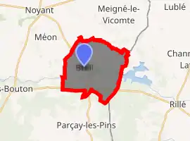
| |
 Breil  Breil | |
| Coordinates: 47°28′32″N 0°09′29″E | |
| Country | France |
| Region | Pays de la Loire |
| Department | Maine-et-Loire |
| Arrondissement | Saumur |
| Canton | Beaufort-en-Vallée |
| Commune | Noyant-Villages |
| Area 1 | 15.09 km2 (5.83 sq mi) |
| Population (2017)[1] | 256 |
| • Density | 17/km2 (44/sq mi) |
| Time zone | UTC+01:00 (CET) |
| • Summer (DST) | UTC+02:00 (CEST) |
| Postal code | 49490 |
| Elevation | 60–119 m (197–390 ft) (avg. 81 m or 266 ft) |
| 1 French Land Register data, which excludes lakes, ponds, glaciers > 1 km2 (0.386 sq mi or 247 acres) and river estuaries. | |
Population
| Year | Pop. | ±% |
|---|---|---|
| 1793 | 614 | — |
| 1800 | 641 | +4.4% |
| 1806 | 687 | +7.2% |
| 1821 | 749 | +9.0% |
| 1831 | 769 | +2.7% |
| 1836 | 760 | −1.2% |
| 1841 | 730 | −3.9% |
| 1846 | 720 | −1.4% |
| 1851 | 720 | +0.0% |
| 1856 | 711 | −1.2% |
| 1861 | 695 | −2.3% |
| 1866 | 720 | +3.6% |
| 1872 | 674 | −6.4% |
| 1876 | 653 | −3.1% |
| 1881 | 631 | −3.4% |
| 1886 | 621 | −1.6% |
| 1891 | 588 | −5.3% |
| 1896 | 585 | −0.5% |
| 1901 | 592 | +1.2% |
| 1906 | 596 | +0.7% |
| 1911 | 593 | −0.5% |
| 1921 | 531 | −10.5% |
| 1926 | 555 | +4.5% |
| 1931 | 577 | +4.0% |
| 1936 | 562 | −2.6% |
| 1946 | 541 | −3.7% |
| 1954 | 587 | +8.5% |
| 1962 | 524 | −10.7% |
| 1968 | 459 | −12.4% |
| 1975 | 414 | −9.8% |
| 1982 | 308 | −25.6% |
| 1990 | 289 | −6.2% |
| 1999 | 309 | +6.9% |
| 2006 | 274 | −11.3% |
| 2009 | 274 | +0.0% |
The inhabitants are known as Breillois.
Sights
Breil is most famous for its Chateau in the Parc du Lathan, where a major Fête de la Chasse (Hunting Fair) is held each August 15. Breil is near the Lac de Rillé, a lake stretching from Rillé to Gué Morin,a hamlet in Breil, where the River Lathan was dammed in 1978 principally for irrigating the valley of the Authion.
References
- Téléchargement du fichier d'ensemble des populations légales en 2017, INSEE
- Arrêté préfectoral 7 December 2016 (in French)
| Wikimedia Commons has media related to Breil (Maine-et-Loire). |
| Authority control |
|---|
This article is issued from Wikipedia. The text is licensed under Creative Commons - Attribution - Sharealike. Additional terms may apply for the media files.