Bua Lai District
Bua Lai (Thai: บัวลาย, pronounced [būa̯ lāːj]) is a district (amphoe) in the northeastern part of Nakhon Ratchasima Province, northeastern Thailand.
Bua Lai
บัวลาย | |
|---|---|
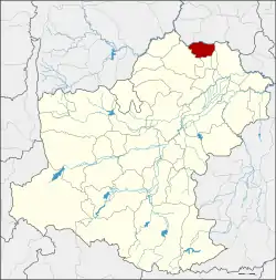 District location in Nakhon Ratchasima Province | |
| Coordinates: 15°39′46″N 102°31′38″E | |
| Country | Thailand |
| Province | Nakhon Ratchasima |
| Seat | Mueang Phalai |
| Area | |
| • Total | 133.1 km2 (51.4 sq mi) |
| Population (2000) | |
| • Total | 25,061 |
| • Density | 188.3/km2 (488/sq mi) |
| Time zone | UTC+7 (ICT) |
| Postal code | 30120 |
| Geocode | 3030 |
History
The area of Bua Lai was separated from Bua Yai District and made a minor district (king amphoe) on 1 July 1997.[1] Most of the people of Bua Lai originally migrated there from Maha Sarakham and Roi Et Provinces.
On 15 May 2007, all of Thailand's 81 minor districts were upgraded to full districts.[2] With publication in the Royal Gazette on 24 August the upgrade became official.[3]
Geography
Neighboring districts are (from the north clockwise): Waeng Noi and Phon of Khon Kaen Province and Prathai, Sida, and Bua Yai.
Administration
The district is divided into four subdistricts (tambons). The township (thesaban tambon) Nong Bua Lai covers parts of the tambon Bua Lai.
| 1. | Mueang Phalai | เมืองพะไล | |
| 2. | Non Chan | โนนจาน | |
| 3. | Bua Lai | บัวลาย | |
| 4. | Nong Wa | หนองหว้า |
References
- ประกาศกระทรวงมหาดไทย เรื่อง แบ่งเขตท้องที่อำเภอบัวใหญ่ จังหวัดนครราชสีมา ตั้งเป็นกิ่งอำเภอบัวลาย (PDF). Royal Gazette (in Thai). 114 (Special 51 ง): 9. June 25, 1997.
- แถลงผลการประชุม ครม. ประจำวันที่ 15 พ.ค. 2550 (in Thai). Manager Online.
- พระราชกฤษฎีกาตั้งอำเภอฆ้องชัย...และอำเภอเหล่าเสือโก้ก พ.ศ. ๒๕๕๐ (PDF). Royal Gazette (in Thai). 124 (46 ก): 14–21. August 24, 2007.