Cabo Matapalo
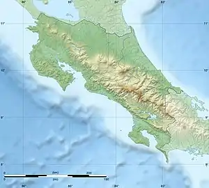
The village of Cabo Matapalo is at the outermost point of the Osa Peninsula, in the southern Pacific coast area of Costa Rica.
 Costa Rica | |

| |
| Location | Cabo Matapalo Costa Rica |
|---|---|
| Coordinates | 8°22′47.6″N 83°17′36.6″W |
| Construction | metal skeletal tower |
| Tower shape | square pyramidal skeletal tower with light |
| Light source | solar power |
| Characteristic | Fl W 10s. |
| Admiralty number | G3282 |
| NGA number | 15649 [1][2] |
Known for its remoteness, Matapalo is a hidden paradise amongst jungle and ocean. The Matapalo region has beautiful beaches, amazing surf points and lush natural scenery thanks to its closeness to Corcovado National Park. Matapalo's exuberant wild life makes it very easy to spot macaws flying over your head, and howler monkeys among many other species.
References
- Costa Rica Pacific Coast The Lighthouse Directory. University of North Carolina at Chapel Hill. Retrieved 7 September 2016
- List of Lights, Buoys and Fog Signals Pacific Coast. Retrieved 7 September 2016
This article is issued from Wikipedia. The text is licensed under Creative Commons - Attribution - Sharealike. Additional terms may apply for the media files.