California State Route 284
State Route 284 (SR 284) is a state highway in the U.S. state of California that serves as a spur route off of State Route 70 in Chilcoot in Plumas County, connecting to Frenchman Lake.
| ||||
|---|---|---|---|---|
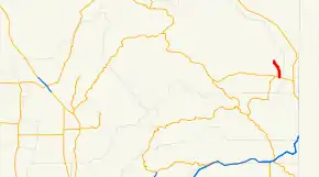 SR 284 highlighted in red | ||||
| Route information | ||||
| Defined by Streets and Highways Code § 584 | ||||
| Maintained by Caltrans | ||||
| Length | 8.302 mi[1] (13.361 km) | |||
| Major junctions | ||||
| South end | ||||
| North end | Frenchman Lake | |||
| Location | ||||
| Counties | Plumas | |||
| Highway system | ||||
| ||||

Route description
The route begins at State Route 70 at Chilcoot. It then continues north to its north end at the Frenchman Lake Recreation Area at Frenchman Lake.
SR 284 is not part of the National Highway System,[2] a network of highways that are considered essential to the country's economy, defense, and mobility by the Federal Highway Administration.[3]
Major intersections
Except where prefixed with a letter, postmiles were measured on the road as it was in 1964, based on the alignment that existed at the time, and do not necessarily reflect current mileage. R reflects a realignment in the route since then, M indicates a second realignment, L refers an overlap due to a correction or change, and T indicates postmiles classified as temporary (for a full list of prefixes, see the list of postmile definitions).[1] Segments that remain unconstructed or have been relinquished to local control may be omitted. The entire route is in Plumas County.
| Location | Postmile [1][4][5] | Destinations | Notes | ||
|---|---|---|---|---|---|
| Chilcoot | 0.00 | South end of SR 284 | |||
| | 8.30 | Frenchman Lake Recreation Area | North end of SR 284 | ||
| 1.000 mi = 1.609 km; 1.000 km = 0.621 mi | |||||
See also
 California Roads portal
References
- California Department of Transportation. "State Truck Route List". Sacramento: California Department of Transportation. Archived from the original (XLS file) on June 30, 2015. Retrieved June 30, 2015.
- Federal Highway Administration (March 25, 2015). National Highway System: California (North) (PDF) (Map). Scale not given. Washington, DC: Federal Highway Administration. Retrieved July 30, 2017.
- Natzke, Stefan; Neathery, Mike & Adderly, Kevin (June 20, 2012). "What is the National Highway System?". National Highway System. Washington, DC: Federal Highway Administration. Retrieved July 1, 2012.
- California Department of Transportation (July 2007). "Log of Bridges on State Highways". Sacramento: California Department of Transportation.
- California Department of Transportation, All Traffic Volumes on CSHS, 2005 and 2006
External links
| Wikimedia Commons has media related to California State Route 284. |