Camas Creek (Clark and Jefferson counties, Idaho)
Camas Creek is a 63-mile (101 km) long[3] stream in southeastern Idaho, United States, that is a tributary of Mud Lake.
| Camas Creek | |
|---|---|
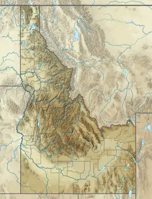 Location of the mouth of Camas Creek in Idaho  Camas Creek (Clark and Jefferson counties, Idaho) (the United States) | |
| Location | |
| Country | United States |
| State | Idaho |
| Counties | Clark County, Idaho, Jefferson County, Idaho |
| Physical characteristics | |
| Source | |
| • location | near Kilgore, Clark County, Idaho |
| • coordinates | 44°21′52″N 111°53′36″W[1] |
| • elevation | 6,287 ft (1,916 m)[2] |
| Mouth | Mud Lake |
• location | northeast of Mud Lake, Jefferson County, Idaho |
• coordinates | 43°53′24″N 112°21′32″W[1] |
• elevation | 4,783 ft (1,458 m)[1] |
| Length | 63 mi (101 km)[3] |
| Basin size | 1,011 sq mi (2,620 km2)[4] |
Description
Beginning at an elevation of 6,287 feet (1,916 m)[2] near Kilgore in northeastern Clark County, it flows southwest into Jefferson County and receives its largest tributary, Beaver Creek. It then passes through the Camas National Wildlife Refuge, and reaches its mouth northeast of the town of Mud Lake,[5] at an elevation of 4,783 feet (1,458 m).[1] Camas Creek has a 1,011-square-mile (2,618 km2) watershed.[4]
References
- "Camas Creek". Geographic Names Information System. United States Geological Survey. 21 Jun 1979. Retrieved 12 Feb 2013.
- Source elevation derived from Google Earth search using GNIS source coordinates.
- "National Hydrography Dataset". United States Geological Survey. Retrieved 12 Feb 2013.
- "Beaver-Camas – 17040214 8 Digit Hydrologic Unit Profile" (PDF). Natural Resources Conservation Service. Feb 2007. Retrieved 12 Feb 2013.
- Idaho Road and Recreation Atlas (Map) (2nd ed.). 1:250,000. Benchmark Maps. 2010. pp. 58, 67. ISBN 978-0-929591-06-3. OCLC 567571371.
External links
![]() Media related to Camas Creek (Clark and Jefferson counties, Idaho) at Wikimedia Commons
Media related to Camas Creek (Clark and Jefferson counties, Idaho) at Wikimedia Commons
| Authority control |
|
|---|
This article is issued from Wikipedia. The text is licensed under Creative Commons - Attribution - Sharealike. Additional terms may apply for the media files.