Cannock
Cannock (/ˈkænək/) is a town and the administrative centre of the Cannock Chase district, as of the 2011 census, it has a population of 29,018[1], and is one the most populous towns in the district of Cannock Chase in the county of Staffordshire in the West Midlands region of England.
| Cannock | |
|---|---|
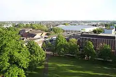 Cannock from top of St. Luke's Church Tower | |
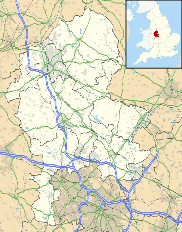 Cannock Location within Staffordshire | |
| Area | 9.24 km2 (3.57 sq mi) |
| Population | 29,018 (2011 Census) |
| • Density | 3,140/km2 (8,100/sq mi) |
| OS grid reference | SJ980101 |
| District | |
| Shire county | |
| Region | |
| Country | England |
| Sovereign state | United Kingdom |
| Post town | CANNOCK |
| Postcode district | WS11 |
| Dialling code | 01543 |
| Police | Staffordshire |
| Fire | Staffordshire |
| Ambulance | West Midlands |
| UK Parliament | |
Cannock lies to the north of the West Midlands conurbation on the M6, A34 and A5 roads, and to the south of The Chase, an Area of Outstanding Natural Beauty (AONB). Cannock is served by a railway station on the Chase Line. The town comprises four district council electoral wards and the Cannock South ward includes the civil parish of Bridgtown, but the rest of Cannock is unparished.
Cannock forms part of the Cannock Built-up Area (population 86,121 in the 2011 census)[2] which also includes Cheslyn Hay, Great Wyrley, Hednesford, Huntington, Heath Hayes and Wimblebury.[3]
History
Cannock was in the Domesday Book of 1086. It was called Chnoc c.1130, Cnot in 1156, Canot in 1157, and Canoc in 1198. Cannock is probably Old English cnocc meaning 'hillock', modified by Norman pronunciation by the insertion of a vowel to Canoc. The name may refer to Shoal Hill, north-west of the town.[4]
Cannock was a small rural community until mining increased heavily during the mid-to-late 19th century. The area then continued to grow rapidly with many industries coming to the area because of its proximity to the Black Country and its coal reserves. Cannock's population continued to increase steadily in the 20th century and its slight fall since the 1981 census has been more than compensated for by house-building in the adjoining village of Heath Hayes. The last colliery to close in the town was Mid Cannock in 1967,[5] and the last remaining colliery to close in the Cannock Chase area was Littleton (in Huntington) in 1993.[6] There is now no heavy industry in the area, and Cannock is home to many commuters working in the surrounding towns and cities.
Cannock Chase German war cemetery is located nearby containing 4,885 German military dead from the First and Second World Wars. It is managed by the Commonwealth War Graves Commission.
Geography
Cannock is on a south-west facing slope, falling from the highest point on Cannock Chase (244 m) at Castle Ring, to about 148 m in the town centre and 111 m near Wedges Mills. The soil is light with a gravel and clay subsoil, and there are extensive coal measures.
Climate
Cannock has a moderate, temperate climate. See Penkridge weather station for details of average temperature and rainfall figures taken between 1981 and 2010 at the Met Office weather station in Penkridge (around 5 miles (8 km) north-west of Cannock).
Location
Cannock is about 20 miles (30 km) by road north-north-west of Birmingham, 80 miles (130 km) south-south-east of Manchester and 130 miles (210 km) north-west of London. It is 9 to 10 miles (14 to 16 km) by road from many of the nearest towns and cities (Aldridge, Lichfield, Stafford, Walsall, Willenhall and Wolverhampton), but Hednesford (2 miles (3 km)), Burntwood and Penkridge (5 miles (8 km)), Bloxwich and Brownhills (6 miles (10 km)) and Rugeley (7 miles (11 km)) are nearer.
Destinations from CANNOCK | |
|---|---|
Demography
In the decade to 2011 the number of dwellings rose by 7.8% to 13,152. The ward with the biggest increase (16.1%) was Cannock South.[7][8] Of the town's 12,690 households in the 2011 census, 31.5% were one-person households including 13.9% where that person was 65 or over. 63.6% were one family with no others (9.0% all pensioners, 30.9% married or same-sex civil partnership couples, 12.3% cohabiting couples and 11.3% lone parents).[9] 27.7% of households had dependent children[9] including 5.5% with no adults in employment.[10] 59.3% of households owned their homes outright or with a mortgage or loan.[1]
Of the town's 23,717 residents in the 2011 census aged 16 and over, 33.5% were single (never married), 45.2% married, 0.15% in a registered same-sex civil partnership, 2.6% separated, 10.4% divorced and 8.2% widowed.[11] 33.4% had no formal qualifications and 42.9% had level 2+ qualifications, meaning 5+ GCSEs (grades A*-C) or 1+ 'A' levels/ AS levels (A-E) or equivalent minimum.[12]
72.7% of the 10,509 men aged 16 to 74 were economically active, including 45.1% working full-time, 5.6% working part-time and 12.6% self-employed. The male unemployment rate (Male unemployment)(of those economically active) was 9.9%.[13] 60.7% of the 10,724 women aged 16 to 74 were economically active, including 26.8% working full-time, 23.5% working part-time and 3.1% self-employed. The female unemployment rate (of those economically active) was 7.5%.[14]
Of people in employment aged 16 to 74, 13.5% worked in basic industries (ONS categories A, B, and D-F including 11.1% in construction), 14.2% in manufacturing, and 72.2% in service industries (ONS categories G-U including 19.5% in wholesale and retail trade and vehicle repair, 11.6% in health and social work, 7.4% in education, 6.2% in transport and storage, 5.8% in public administration, 5.6% in accommodation and catering, and 4.7% in administrative and support service activities).[15] While 27.7% of households did not have access to a car or van,[16] 76.1% of people in employment travelled to work by car or van.[17]
75.5% of residents described their health as good or very good.[1] The proportion who described themselves as White British was 95.6%, with all white ethnic groups making up 97.4% of the population. The ethnic make-up of the rest of the population was 1.0% mixed/multiple ethnic groups, 0.69% Indian/Pakistani/Bangladeshi, 0.34% Chinese, 0.17% other Asian, 0.35% Black and 0.065% other.[18] 3.1% of Cannock's residents were born outside the United Kingdom.[19]
Media
Cannock has a free weekly local newspaper, the Cannock & Rugeley Chronicle (an edition of the Cannock & Lichfield Chronicle).[20] Another free weekly, the Chase Post (an edition of the Cannock Chase & Burntwood Post),[21] ceased publication in November 2011.[22]
The Express & Star is a paid-for local newspaper, published in Wolverhampton on weekdays.[23] Televised local news is provided through Midlands Today and Central Tonight, which also serve the wider area of the West Midlands.
Cannock is served by the national radio stations, and West Midlands "regional" licences Planet Rock, Smooth Radio West Midlands and Heart West Midlands. The town is also covered by Free Radio Black Country and Shropshire on 97.2 and BBC WM on 95.6 FM.
Cannock is served by its own community radio station, called Cannock Chase Radio, based in Wynns Venture Centre.
Transport

Cannock is located close to the M6, M6 Toll and M54 motorways.
Cannock railway station closed in 1965 as part of the Beeching cuts but reopened in 1989. It is part of the Rugeley – Cannock – Walsall – Birmingham line operated by West Midlands Trains. Over the years, usage of this station, and the line overall, have increased to unprecedented levels. Services initially were hourly services between Birmingham New Street and Stafford (cut back to Rugeley Trent Valley in 2008). By 2013, usage had become significant enough to warrant electrification of the railway line, which was completed in 2019.[24]
The majority of bus services were operated by Arriva Midlands which had a garage to the south of the town centre. Following the sale of Cannock depot to D&G Bus, from January 2021 all services from the garage are now operated by D&G Bus under the revived "Chaserider" brand.[25] In April 2019, National Express West Midlands launched a new timetable on their X51 service to run all day linking Cannock with Birmingham for the first time in several years. Previously this was a peak-time only service. As a result of this, Arriva subsequently withdrew their service 1 which followed the same route between Cannock and Bloxwich.
In May 2019, West Midlands Trains began operating electric trains from this station. The vast majority of services are to Rugeley Trent Valley in the north, southbound trains operate to Birmingham International and London Euston. The journey time to Birmingham is around 36 minutes. On Sundays, trains operate as far south as Coventry.
Education
Cannock Chase High School is a non-denominational mixed comprehensive with just over 1000 pupils aged 11–18.
Cardinal Griffin Catholic College is a voluntary aided Roman Catholic secondary school with around 950 pupils aged 11–18.
Chase Grammar School (called Lyncroft House School 1980–1996 then Chase Academy until January 2013) is an independent co-educational boarding school with a day nursery and over 200 pupils up to age 19 including many international students.
South Staffordshire College closed its Cannock Campus in July 2017, but reopened it the following summer as the new Cannock Chase Skills and Innovation Hub with courses starting there from September 2018.
Notable people

- Walter Colman (1600 in Cannock – 1645) a Franciscan [26] friar
- Henry Sacheverell (1674–1724) a High Church Anglican clergyman, onetime Rector of Cannock and polemical preacher
- Frank Edward Tylecote CBE (1879 in Cannock – 1965), physician, Professor of Medicine at Manchester University, and early researcher into link between smoking and lung cancer
- Vernon Rylands Parton (1897 in Cannock – 1974), prolific inventor of chess variants, including Alice Chess
- Jennie Lee (1904–1988), MP for Cannock 1945–1970, Minister in the Department of Education and Science and the driving force for the creation of the Open University [27]
- Raymond Furnell (1936–2006), curate of Cannock 1965–69 and the Dean of York 1994-2003
- Carole Ashby (born 1955 in Cannock) an English actress and former pin-up girl
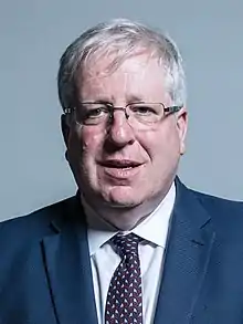
- Sir Patrick McLoughlin (born 1957) a Conservative politician, MP for the Derbyshire Dales, went to school in Cannock
- Steve Edge (born 1972 in Cannock) an English actor, writer and former comedian
- Chris Overton (born 1988 in Cannock) an English actor and filmmaker
Writing
- Arthur Hopcraft (1932–2004) author, reporter & TV scriptwriter, wrote perceptively of his upbringing in Cannock
- Jed Mercurio (born 1966) a British television writer, producer, director and novelist; brought up in Cannock
Music

- Elgar Howarth (born 1935 in Cannock) an English conductor, composer and trumpeter
- Mel Galley (1948 in Cannock – 2008) former Whitesnake guitarist and songwriter
- Glenn Hughes (born 1952 in Cannock) former bassist/vocalist with Deep Purple
- Robert Lloyd (born 1959 in Cannock) the lead singer with The Nightingales and formerly with The Prefects
- Balaam and the Angel a Scottish rock band founded in Cannock in 1984
- Chris Overton (born 1988 in Cannock) an English actor and filmmaker
Sport


- Alec Talbot (1902 in Cannock – 1975) professional footballer, 260 caps mainly for Aston Villa F.C.
- Tom Galley (1915 in Cannock - 2000) professional footballer, over 200 caps mainly for Wolverhampton Wanderers F.C.
- Harry Kinsell (1921 in Cannock – 2000) professional footballer, over 200 caps mostly for West Brom and West Ham
- Gordon Lee (born 1934 in Cannock), former professional footballer and football manager
- Malcolm Beard (born 1942 in Cannock), former professional footballer 350 caps, mostly for Birmingham City F.C.
- Jim Rhodes (1946 in Cannock – 2015) professional golfer
- Paul Cooper (born 1953 in Cannock) former professional football goalkeeper, over 500 caps mostly for Ipswich Town,
- Geoff Palmer (born 1954 in Cannock), former professional footballer, over 460 caps, mostly for Wolves
- Bobby Hosker (born 1955 in Cannock) former professional footballer, over 300 pro appearances
- Vernon Allatt (born 1959 in Cannock) an English former footballer, over 250 pro appearances
- Steve James (born 1961 in Cannock) former professional snooker player
- Dave Norton (born 1965 in Cannock), former professional footballer, over 430 pro appearances
- Mick Gosling (born 1972), winner of Britain's Strongest Man contest in 2005
- Richard Gosling (born 1974 ) winner of Britain's Strongest Man contest in 2003
- Kevin Pietersen (born 1980), South African-born English cricketer, played for Cannock Cricket Club in 2000
- Andy Bishop (born 1982 in Cannock), professional footballer, over 450 pro appearances
- Kris Taylor (born 1984 in Cannock), professional footballer, over 340 pro appearances
- Riley Parsons (born 2000 in Cannock), professional snooker player
See also
References
- "Cannock East (Ward): Key figures for 2011 Census: Key Statistics". Office for National Statistics. 30 January 2013. Archived from the original on 1 May 2015. Retrieved 13 February 2013.
"Cannock North (Ward): Key figures for 2011 Census: Key Statistics". Office for National Statistics. 30 January 2013. Archived from the original on 1 May 2015. Retrieved 13 February 2013.
"Cannock South (Ward): Key figures for 2011 Census: Key Statistics". Office for National Statistics. 30 January 2013. Archived from the original on 1 May 2015. Retrieved 13 February 2013.
"Cannock West (Ward): Key figures for 2011 Census: Key Statistics". Office for National Statistics. 30 January 2013. Archived from the original on 1 May 2015. Retrieved 13 February 2013. - "2011 Census – Built-up areas". ONS. Retrieved 9 August 2013.
- "2011 Census – Cannock BUA map". ONS. Retrieved 12 August 2013.
- Nicolaisen, W. F. H.; Gelling, Margaret; Richards, Melville (1970). The names of towns and cities in Britain. London: B. T. Batsford. p. 66. ISBN 0-7134-0113-3.
- "Coal Mining in Cannock Chase a Rough Time Line". Cannock Chase Mining Historical Society. Retrieved 21 November 2011.
- "Cannock Chase Coalfield & its Coal". BBC News. Retrieved 21 November 2011.
-
"Cannock East (Ward): Dwellings, 2001 (UV55)". Office for National Statistics. Retrieved 17 February 2013.
"Cannock North (Ward): Dwellings, 2001 (UV55)". Office for National Statistics. Retrieved 17 February 2013.
"Cannock South (Ward): Dwellings, 2001 (UV55)". Office for National Statistics. Retrieved 17 February 2013.
"Cannock West (Ward): Dwellings, 2001 (UV55)". Office for National Statistics. Retrieved 17 February 2013. -
"Cannock East (Ward): Dwellings, 2011 (QS418EW)". Office for National Statistics. Retrieved 17 February 2013.
"Cannock North (Ward): Dwellings, 2011 (QS418EW)". Office for National Statistics. Retrieved 17 February 2013.
"Cannock South (Ward): Dwellings, 2011 (QS418EW)". Office for National Statistics. Retrieved 17 February 2013.
"Cannock West (Ward): Dwellings, 2011 (QS418EW)". Office for National Statistics. Retrieved 17 February 2013. -
"Cannock East (Ward): Household Composition, 2011 (KS105EW)". Office for National Statistics. 30 January 2013. Retrieved 14 February 2013.
"Cannock North (Ward): Household Composition, 2011 (KS105EW)". Office for National Statistics. 30 January 2013. Retrieved 14 February 2013.
"Cannock South (Ward): Household Composition, 2011 (KS105EW)". Office for National Statistics. 30 January 2013. Retrieved 14 February 2013.
"Cannock West (Ward): Household Composition, 2011 (KS105EW)". Office for National Statistics. 30 January 2013. Retrieved 14 February 2013. -
"Cannock East (Ward): Adults not in Employment and Dependent Children etc., 2011 (KS106EW)". Office for National Statistics. 30 January 2013. Retrieved 14 February 2013.
"Cannock North (Ward): Adults not in Employment and Dependent Children etc., 2011 (KS106EW)". Office for National Statistics. 30 January 2013. Retrieved 14 February 2013.
"Cannock South (Ward): Adults not in Employment and Dependent Children etc., 2011 (KS106EW)". Office for National Statistics. 30 January 2013. Retrieved 14 February 2013.
"Cannock West (Ward): Adults not in Employment and Dependent Children etc., 2011 (KS106EW)". Office for National Statistics. 30 January 2013. Retrieved 14 February 2013. -
"Cannock East (Ward): Marital and Civil Partnership status, 2011 (KS103EW)". Office for National Statistics. 30 January 2013. Retrieved 14 February 2013.
"Cannock North (Ward): Marital and Civil Partnership status, 2011 (KS103EW)". Office for National Statistics. 30 January 2013. Retrieved 14 February 2013.
"Cannock South (Ward): Marital and Civil Partnership status, 2011 (KS103EW)". Office for National Statistics. 30 January 2013. Retrieved 14 February 2013.
"Cannock West (Ward): Marital and Civil Partnership status, 2011 (KS103EW)". Office for National Statistics. 30 January 2013. Retrieved 14 February 2013. -
"Cannock East (Ward): Qualifications and Students, 2011 (KS501EW)". Office for National Statistics. 30 January 2013. Retrieved 14 February 2013.
"Cannock North (Ward): Qualifications and Students, 2011 (KS501EW)". Office for National Statistics. 30 January 2013. Retrieved 14 February 2013.
"Cannock South (Ward): Qualifications and Students, 2011 (KS501EW)". Office for National Statistics. 30 January 2013. Retrieved 14 February 2013.
"Cannock West (Ward): Qualifications and Students, 2011 (KS501EW)". Office for National Statistics. 30 January 2013. Retrieved 14 February 2013. -
"Cannock East (Ward): Economic Activity – Males, 2011 (KS602EW)". Office for National Statistics. 30 January 2013. Retrieved 15 February 2013.
"Cannock North (Ward): Economic Activity – Males, 2011 (KS602EW)". Office for National Statistics. 30 January 2013. Retrieved 15 February 2013.
"Cannock South (Ward): Economic Activity – Males, 2011 (KS602EW)". Office for National Statistics. 30 January 2013. Retrieved 15 February 2013.
"Cannock West (Ward): Economic Activity – Males, 2011 (KS602EW)". Office for National Statistics. 30 January 2013. Retrieved 15 February 2013. -
"Cannock East (Ward): Economic Activity – Females, 2011 (KS603EW)". Office for National Statistics. 30 January 2013. Retrieved 15 February 2013.
"Cannock North (Ward): Economic Activity – Females, 2011 (KS603EW)". Office for National Statistics. 30 January 2013. Retrieved 15 February 2013.
"Cannock South (Ward): Economic Activity – Females, 2011 (KS603EW)". Office for National Statistics. 30 January 2013. Retrieved 15 February 2013.
"Cannock West (Ward): Economic Activity – Females, 2011 (KS603EW)". Office for National Statistics. 30 January 2013. Retrieved 15 February 2013. -
"Cannock East (Ward): Industry, 2011 (KS605EW)". Office for National Statistics. 30 January 2013. Retrieved 15 February 2013.
"Cannock North (Ward): Industry, 2011 (KS605EW)". Office for National Statistics. 30 January 2013. Retrieved 15 February 2013.
"Cannock South (Ward): Industry, 2011 (KS605EW)". Office for National Statistics. 30 January 2013. Retrieved 15 February 2013.
"Cannock West (Ward): Industry, 2011 (KS605EW)". Office for National Statistics. 30 January 2013. Retrieved 15 February 2013. -
"Cannock East (Ward): Car or Van Availability, 2011 (KS404EW)". Office for National Statistics. 30 January 2013. Retrieved 22 February 2013.
"Cannock North (Ward): Car or Van Availability, 2011 (KS404EW)". Office for National Statistics. 30 January 2013. Retrieved 22 February 2013.
"Cannock South (Ward): Car or Van Availability, 2011 (KS404EW)". Office for National Statistics. 30 January 2013. Retrieved 22 February 2013.
"Cannock West (Ward): Car or Van Availability, 2011 (KS404EW)". Office for National Statistics. 30 January 2013. Retrieved 22 February 2013. -
"Cannock East (Ward): Method of Travel to Work, 2011 (QS701EW)". Office for National Statistics. 30 January 2013. Retrieved 22 February 2013.
"Cannock North (Ward): Method of Travel to Work, 2011 (QS701EW)". Office for National Statistics. 30 January 2013. Retrieved 22 February 2013.
"Cannock South (Ward): Method of Travel to Work, 2011 (QS701EW)". Office for National Statistics. 30 January 2013. Retrieved 22 February 2013.
"Cannock West (Ward): Method of Travel to Work, 2011 (QS701EW)". Office for National Statistics. 30 January 2013. Retrieved 22 February 2013. -
"Cannock East (Ward): Ethnic Group, 2011 (KS201EW)". Office for National Statistics. 30 January 2013. Retrieved 14 February 2013.
"Cannock North (Ward): Ethnic Group, 2011 (KS201EW)". Office for National Statistics. 30 January 2013. Retrieved 14 February 2013.
"Cannock South (Ward): Ethnic Group, 2011 (KS201EW)". Office for National Statistics. 30 January 2013. Retrieved 14 February 2013.
"Cannock West (Ward): Ethnic Group, 2011 (KS201EW)". Office for National Statistics. 30 January 2013. Retrieved 14 February 2013. -
"Cannock East (Ward): Country of Birth, 2011 (KS204EW)". Office for National Statistics. 30 January 2013. Retrieved 14 February 2013.
"Cannock North (Ward): Country of Birth, 2011 (KS204EW)". Office for National Statistics. 30 January 2013. Retrieved 14 February 2013.
"Cannock South (Ward): Country of Birth, 2011 (KS204EW)". Office for National Statistics. 30 January 2013. Retrieved 14 February 2013.
"Cannock West (Ward): Country of Birth, 2011 (KS204EW)". Office for National Statistics. 30 January 2013. Retrieved 14 February 2013. - "Cannock & Lichfield Chronicle". The Newspaper Society. Retrieved 30 August 2011.
- "Cannock Chase & Burntwood Post". The Newspaper Society. Retrieved 30 August 2011.
- "Stafford Post and Chase Post print final editions". BBC News. 17 November 2011. Retrieved 21 November 2011.
- "West Midlands Express & Star". The Newspaper Society. Archived from the original on 21 November 2007. Retrieved 30 August 2011.
- "First passenger train travels on newly-electrified Chase Line". Express & Star. Retrieved 1 January 2021.
- "D&G Bus revives Chaserider name in Arriva Cannock purchase". Route One. Retrieved 1 January 2021.
- Dictionary of National Biography, 1885-1900, Volume 11, Colman, Walter retrieved 20 June 2018
- "About the OU: History of the OU". The Open University. Retrieved 19 November 2009.
- Town Twinning - Cannock Chase retrieved 19 January 2019
- German Wiki, Datteln
External links
| Wikimedia Commons has media related to Cannock. |
| Wikivoyage has a travel guide for Cannock. |
| Wikisource has the text of the 1911 Encyclopædia Britannica article Cannock. |
Staffordshire Portal | |
| Unitary authorities | |
| Boroughs or districts | |
| Major settlements | |
| Rivers | |
| Canals | |
| Topics | |
| Authority control |
|---|