Capitan Formation
The Capitan Formation is a geologic formation found in western Texas and southeastern New Mexico. It is a fossilized reef dating to the Guadalupian Age of the Permian period.
| Capitan Formation Stratigraphic range: Guadalupian | |
|---|---|
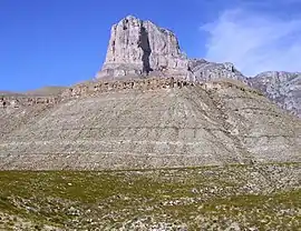
 The Capitan Formation underlies El Capitan in Guadalupe Mountains National Park. | |
| Type | Formation |
| Underlies | Artesia Group, Castile Formation |
| Overlies | Goat Seep Dolomite, Delaware Mountain Group |
| Thickness | 1,800 ft (550 m) |
| Lithology | |
| Primary | Limestone |
| Other | dolomite |
| Location | |
| Coordinates | 31.8773°N 104.8668°W |
| Region | Texas New Mexico |
| Country | United States |
| Type section | |
| Named for | El Capitan Peak |
| Named by | G.B. Richardson |
| Year defined | 1904 |
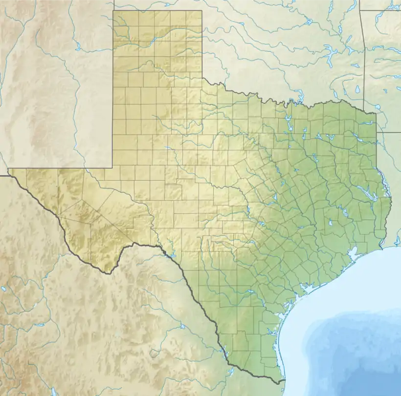
 Capitan Formation (the United States)  Capitan Formation (Texas) | |
The formation underlies El Capitan in Guadalupe Mountains National Park,[1] and the formation and its associated basin, shelf margin, and backreef formations have been described as "the largest, best-preserved, most accessible, and most intensively studied Paleozoic reef complex in the world."[2]
History of investigation
The Guadalupe Mountains were first described in the reports of 1849 and 1850 United States military expeditions to the area. George Shumard was the first geologist to study the area, in 1855, and described an "upper white limestone" containing fossils. These included fusilinids and brachiopods, that were identified correctly by his brother, B.F. Shumard, as Permian in age. However, debate on whether the beds were Carboniferous or Permian in age continued until at least 1920.[3] The work of Darton and Reeside in 1926[4] established the accepted framework for the stratigraphy of the area, and identified the Capitan Formation as late Permian in age.[3]
The Capitan Formation itself was first named by G.B. Richardson in 1904 for exposures in the Guadalupe Mountains. Richardson was impressed by the great mass of seemingly uniform limestone, forming vertical cliffs over 1,000 feet (300 m) tall, and noted that much of the limestone was dolomitized. He was also impressed with the abundant fossils found in the middle beds of the formation, forming a fossil assemblage unlike anything else known at that time. Richardson interpreted the Guadalupe Mountains as an east-dipping monocline with a fault on the steep western boundary, and believed El Capitan itself was a product of erosion.[5][6]
Interest in the formation was rekindled by the discovery in May 1923 of the Big Lake oil field in Texas and the drilling of the first commercial oil well in southeastern New Mexico in 1924. This culminated in the publication by E. Russell Lloyd in 1929 of his interpretation of the Capitan Limestone and associated formations as a gigantic fossil coral reef. Lloyd traced the reef nearly to Carlsbad and noted that the dissimilarity of the formations on the two sides of the reef, now known as the basin and backreef shelf facies.[7] Two months later, a “Symposium on Pennsylvanian and Permian stratigraphy of southwestern United States” appeared in the August, 1929 issue of the Bulletin of the American Association of Petroleum Geologists,[8] which provided a flood of new details on the Capitan reef.[3]
As part of that symposium, Philip B. King and R.E. King presented their conclusion that the Tessey, Gilliam, and Vidrio Limestones of the Glass Mountains of west Texas were correlative with the Capitan Formation, and redesigned them as members of the formation.[9][10] However, by 1937, King had concluded that the Tessey Limestone was not part of the Capital Formation and removed it as a member.[11] By 1942 he had restricted the definition of the Capitan Formation to reef limestone, consistent with the stratigraphic conventions in the Guadalupe Mountains, and removed the Gilliam and most of the Vidrio Limestone from the formation.[12]
Description
The Capital Formation consists of compact, massive, light grey to white limestone with minor dolomite. Its total thickness is 1,000–2,000 feet (300–610 m).[13] On the backreef side of the formation, the Capitan rests on the Goat Seep Dolomite and grades into and is overlain by the Artesia Group, while on the basin side, the Capitan rests on the Delaware Mountain Group and is overlain by the Castile Formation.[13][14][15] The formation thus forms a narrow belt curving around the western side of the Delaware Basin that interfingers with backreef formations on the northwestern to southwestern side and with basin formations on the southeastern to northeastern side.[13]
The formation is a giant fossil reef, extending at least from the Carlsbad area[7] to the Glass Mountains of Texas.[9] At its greatest development, the reef may have been built up to 200–300 feet (61–91 m) above the sea floor.[11]
Fossils
Richardson (1904) found that the upper and lower beds of the formation were relatively unfossiliferous, but the middle section contained an abundant fossil assemblage unlike any other known at that time.[5]
Fusulinida
- Fusilina elongata
Porifera
- Numerous species
Anthozoa
- A few species
Bryozoa
- Acanthocladia
- Goniocladia
Brachiopoda
- Streptorhynchus
- Orthotetes
- Geyerella
- Orthothetina
- Chonetes
- Productus occidentalis
- P. subhotridus
- P. popei
- P. mexicanus
- Marginifera pileolus
- Spirifer mexicanus
- Spirifer sev sp.
- Martinia
- Squamularia guadalupensis
- Ambocoelia
- Spiriferina billingsi
- Hustedia meekana
- Pugnax swallowiana
- Rhynchonella indentata
- Terebratuloids
- Leptodus
- Richthofenia permiana
Mollusca
- Schizodus securas
- Aviculopecten]
- Lima
- Camptonectes
- Streblopteria
- Myalina squamosa
- Myoconcha
- Indeterminate gastropods
King found that the Vidrio Limestone Member had been highly dolomitized, destroying most of its fossil contents, but he recognized fossils of coralline algae, cup corals, crinoid stems, fusilinids, echinoid spines, and brachiopods.[11]
Footnotes
- "Geologic Formations." Gualadupe Mountains National Park
- Kues and Giles 2004, p.125
- Kues 2006
- Darton and Reeside 1926
- Richardson 1904
- Richardson 1908
- Lloyd 1929
- Lahee 1929
- King and King 1929
- King 1930
- King 1937
- King 1942
- King 1948
- Kues 2006, p.128
- Kues and Giles 2004, p.100
References
- Darton, N. H.; Reeside, J. B. (30 September 1926). "Guadalupe Group". Geological Society of America Bulletin. 37 (3): 413–428. doi:10.1130/GSAB-37-413.
- King, P.B. (1930). "The geology of the Glass Mountains, Texas; Part 1, Descriptive geology". University of Texas Bulletin. 3038.
- King, P.B. (1937). "Geology of the southern Guadalupe Mountains, Texas". U.S. Geological Survey Professional Paper. 187. doi:10.3133/pp187.
- King, Philip B. (1948). "Geology of the Southern Guadalupe Mountains, Texas". U.S. Geological Survey Professional Paper. 215. doi:10.3133/pp215.
- King, P.B. (1942). "Permian of West Texas and Southeastern New Mexico: PART 1". AAPG Bulletin. 26. doi:10.1306/3D933466-16B1-11D7-8645000102C1865D.
- King, Philip B.; King, Robert E. (1929). "Stratigraphy of Outcropping Carboniferous and Permian Rocks of Trans-Pecos Texas". AAPG Bulletin. 13. doi:10.1306/3D93286B-16B1-11D7-8645000102C1865D.
- Kues, Barry S. (2006). "Geological studies of the Guadalupe Mountains area, New Mexico and West Texas, to 1928" (PDF). New Mexico Geological Society Field Conference Series. 57: 127–144. Retrieved 20 September 2020.
- Kues, B.S.; Giles, K.A. (2004). "The late Paleozoic Ancestral Rocky Mountain system in New Mexico". In Mack, G.H.; Giles, K.A. (eds.). The geology of New Mexico. A geologic history: New Mexico Geological Society Special Volume 11. pp. 95–136. ISBN 9781585460106.
- Lahee, Frederic H. (August 1929). "Foreword: SYMPOSIUM ON PENNSYLVANIAN AND PERMIAN STRATIGRAPHY OF SOUTHWESTERN UNITED STATES". Bulletin of the American Association of Petroleum Geologists. 13 (8). Retrieved 20 September 2020.
- Lloyd, E. Russell (1929). "Capitan Limestone and Associated Formations of New Mexico and Texas". AAPG Bulletin. 13. doi:10.1306/3D932855-16B1-11D7-8645000102C1865D.
- "Geologic Formations". Guadalupe Mountains National Park, Texas. National Park Service. Retrieved 19 September 2020.
- Richardson, G.B. (1904). "Report of a reconnaissance in Trans-Pecos Texas north of the Texas and Pacific Railway". University of Texas Mineral Survey Bulletin. 9. Retrieved 19 September 2020.
- Richardson, G B. (Jun 1908). "Paleozoic Formations in Trans-Pecos Texas". American Journal of Science (1880-1910). 25 (150): 474. Retrieved 20 September 2020.