Carcross
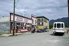
Carcross, originally known as Caribou Crossing, is an unincorporated community in Yukon, Canada, on Bennett Lake and Nares Lake. It is home to the Carcross/Tagish First Nation. At the 2016 census it had a population of 301.[1]
Carcross
Caribou Crossing | |
|---|---|
.jpg.webp) Carcross, Yukon | |
 Carcross  Carcross | |
| Coordinates: 60°10′03″N 134°42′26″W | |
| Country | Canada |
| Territory | Yukon |
| Area | |
| • Land | 16.14 km2 (6.23 sq mi) |
| Elevation | 659 m (2,161 ft) |
| Population (2016)[1] | |
| • Total | 301 |
| • Density | 18.7/km2 (48/sq mi) |
| • Change 2011-16 | |
| Time zone | UTC−07:00 (MST) |
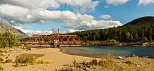
It is 74 km (46 mi) south-southeast by the Alaska Highway and the Klondike Highway from Whitehorse. The south end of the Tagish Road is in Carcross. Carcross is also on the White Pass and Yukon Route railway.
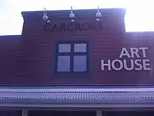
Carcross is mainly known for its world class mountain biking on the near-by Montana Mountain, and for the nearby Carcross Desert, often referred to as the "world's smallest desert."[3]
History
Caribou Crossing was a fishing and hunting camp for Inland Tlingit and Tagish people. 4,500-year-old artifacts from First Nations people living in the area have been found in the region.
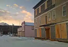
Originally known as Naataase Heen (Tagish for ‘water running through the narrows’),[3] Caribou Crossing was named after the migration of huge numbers of caribou across the natural land bridge between Lake Bennett and Nares Lake. That caribou herd was decimated during the Klondike Gold Rush, but a recovery program raised the number of animals to about 450. The modern village began in 1896, during the Klondike Gold Rush. At the time, Caribou Crossing was a popular stopping place for prospectors going to and from the gold fields of Dawson City.
Caribou Crossing was also a station for the Royal Mail and the Dominion Telegraph Line, and it served as a communications point on the Yukon River.
In 1904, Caribou Crossing was renamed Carcross as a result of some mail mix-ups with the Cariboo Regional District in nearby British Columbia.
Silver mining was promoted nearby in Conrad, Yukon in the early 1900s, but there was little to be found and mining efforts soon ended.[4] Mineral exploration continues today,[5] but tourism is far more important to the economy of the community.[3]
In 2016, Prince William, Duke of Cambridge and Catherine, Duchess of Cambridge visited Carcross for a day trip.[6]
Population
| Year | Population | +/- % | Source | Ref. |
|---|---|---|---|---|
| 2019 | 512 |
+70.1% |
Government of the Yukon, 2019 estimates | [7] |
| 2016 | 301 |
-31.0% |
Canada 2016 Census | [1] |
| 2012 | 436 |
+50.9% |
Government of the Yukon, 2012 estimates | [8] |
| 2011 | 289 |
-32.9% |
Canada 2011 census | [9][10] |
| 2008 | 431 |
+30.2% |
Government of the Yukon, 2008 estimates | [11] |
| 2006 | 331 |
+117.8% |
Canada 2006 census | [12] |
| 2001 | 152 |
-22.4% |
Canada 2001 census | [13] |
| 1996 | 196 |
-- |
Canada 1996 census | [13] |
Climate
Carcross has a dry-summer subarctic climate (Köppen climate classification: Dsc), typical of this part of Yukon.
Summer days are mild to warm with crisp, cool nights due to low humidity during summers. Winters are cold by Canadian standards, but not so much by Yukon standards. Annual snowfall averages 50 inches (127 cm) with peak snowpack reaching 16 inches (40.6 cm) during March.[14]
Carcross has one of the lowest amounts of precipitation days out of anywhere in Canada, only having 76 precipitation days, with the rainiest month September only averaging 9 days with precipitation, and the driest month April only averaging 2 days with precipitation.
| Climate data for Carcross | |||||||||||||
|---|---|---|---|---|---|---|---|---|---|---|---|---|---|
| Month | Jan | Feb | Mar | Apr | May | Jun | Jul | Aug | Sep | Oct | Nov | Dec | Year |
| Record high °C (°F) | 8.9 (48.0) |
18.9 (66.0) |
13.5 (56.3) |
21.0 (69.8) |
28.0 (82.4) |
31.7 (89.1) |
32.5 (90.5) |
31.7 (89.1) |
26.7 (80.1) |
20.0 (68.0) |
13.3 (55.9) |
14.0 (57.2) |
32.5 (90.5) |
| Average high °C (°F) | −13.2 (8.2) |
−7.8 (18.0) |
−0.6 (30.9) |
7.3 (45.1) |
12.0 (53.6) |
17.0 (62.6) |
21.7 (71.1) |
20.6 (69.1) |
13.5 (56.3) |
5.6 (42.1) |
−3.7 (25.3) |
−7.3 (18.9) |
3.6 (38.5) |
| Daily mean °C (°F) | −18.2 (−0.8) |
−13.9 (7.0) |
−7.8 (18.0) |
−0.7 (30.7) |
5.6 (42.1) |
10.6 (51.1) |
14.2 (57.6) |
13.0 (55.4) |
7.9 (46.2) |
1.1 (34.0) |
−7.7 (18.1) |
−11.6 (11.1) |
−2.4 (27.7) |
| Average low °C (°F) | −22.7 (−8.9) |
−20.0 (−4.0) |
−14.8 (5.4) |
−8.4 (16.9) |
0.0 (32.0) |
4.0 (39.2) |
6.7 (44.1) |
5.1 (41.2) |
2.3 (36.1) |
−3.4 (25.9) |
−11.4 (11.5) |
−15.7 (3.7) |
−8.2 (17.2) |
| Record low °C (°F) | −51.2 (−60.2) |
−48.3 (−54.9) |
−42.2 (−44.0) |
−32.8 (−27.0) |
−12.5 (9.5) |
−6.7 (19.9) |
−3.3 (26.1) |
−11.7 (10.9) |
−18.0 (−0.4) |
−30.0 (−22.0) |
−40.0 (−40.0) |
−55.0 (−67.0) |
−55.0 (−67.0) |
| Average precipitation mm (inches) | 28.6 (1.13) |
23.4 (0.92) |
9.6 (0.38) |
5.5 (0.22) |
14.9 (0.59) |
28.5 (1.12) |
29.9 (1.18) |
28.1 (1.11) |
32.9 (1.30) |
27.0 (1.06) |
28.9 (1.14) |
22.5 (0.89) |
279.8 (11.02) |
| Average rainfall mm (inches) | 0.5 (0.02) |
0.0 (0.0) |
0.2 (0.01) |
1.5 (0.06) |
14.8 (0.58) |
28.5 (1.12) |
29.9 (1.18) |
28.0 (1.10) |
30.1 (1.19) |
17.1 (0.67) |
1.4 (0.06) |
0.2 (0.01) |
152.2 (5.99) |
| Average snowfall cm (inches) | 28.1 (11.1) |
23.4 (9.2) |
9.4 (3.7) |
4.0 (1.6) |
0.1 (0.0) |
0.0 (0.0) |
0.0 (0.0) |
0.1 (0.0) |
2.8 (1.1) |
9.9 (3.9) |
27.4 (10.8) |
22.4 (8.8) |
127.6 (50.2) |
| Average precipitation days (≥ 0.2 mm) | 7.5 | 6.0 | 3.5 | 2.1 | 4.7 | 6.4 | 8.1 | 7.4 | 9.0 | 7.9 | 7.3 | 6.5 | 76.3 |
| Average rainy days (≥ 0.2 mm) | 0.2 | 0.0 | 0.1 | 0.6 | 4.8 | 6.4 | 8.1 | 7.4 | 8.5 | 5.0 | 0.4 | 0.1 | 41.7 |
| Average snowy days (≥ 0.2 cm) | 7.3 | 6.0 | 3.4 | 1.5 | 0.1 | 0.0 | 0.0 | 0.0 | 0.7 | 3.5 | 7.1 | 6.5 | 35.9 |
| Source: 1981-2010 Environment Canada,[15] Source 2: May and June temp. averages | |||||||||||||
Economy

Carcross relies on tourism to support the local economy. It lies on the Klondike Highway between Whitehorse and Skagway, Alaska and offers a variety of historic attractions and outdoor activities. Popular with road traffic including tour buses and RVs, in 2007 the White Pass railway also resumed service to Carcross railway station.
Just north of the town is the Carcross Desert, often referred to as the "world's smallest desert."[3] There are two small airports located in the area, Carcross Airport is adjacent to the town and Carcross Water Aerodrome located on Tagish Lake.
Alaska cruises stopping in Skagway will offer day tours to Carcross. The day tours offer stops at the Yukon sign, the Caribou Crossing Wildlife Museum, Dog Sledding Zoo and the actual town of Carcross.[16]
Transportation

Carcross lies on the popular Klondike Highway.
The city is served by Carcross Airport, which has no scheduled commercial flights. The closest Canadian airport with large airline service is Whitehorse Airport, which has domestic airline service as well as flights to Europe and the United States. Tourist buses serving cruise ships passengers at the port of Skagway, Alaska, USA make day trips to Carcross.[17]
Notable people
- Louise Profeit-LeBlanc
- Keish (Skookum Jim)
- Angela Sidney
- Kevin Barr
Media
- FM 90.5 - VF2039, First Nations community radio
- FM 97.5 - CIKO, school radio
- FM 105.5 - VF2360, TIS/weather
References
- "Statistics Canada. Census Profile, 2016 Census". Retrieved 24 August 2017.
- Elevation at Carcross Airport as per Canada Flight Supplement. Effective 0901Z 16 July 2020 to 0901Z 10 September 2020.
- MacEacheran, Mike (22 June 2018). "The unlikely home of the world's smallest desert". BBC Travel. BBC. Retrieved 24 June 2018.
- Lundberg, Murray (1996). Fractured Veins & Broken Dreams: Montana Mountain and the Windy Arm stampede. Whitehorse, Yukon: Pathfinder Publications. ISBN 978-0-9681672-0-5.
- "Osiris drilling extends Sunrise, Conrad". North of 60° Mining News. 21 September 2018.
- Croft, Dave (4 October 2016). "'Top of my bucket list': Royal hugs thrill Yukon moms". CBC News.
- "Yukon Bureau of Statistics Monthly Statistical Review: Population by Community" (PDF). Yukon Bureau of Statistics. November 2019. p. 2. Retrieved December 17, 2019.
- Community Populations by Age Groups, March 2012
- "Statistics Canada. 2011 Population and dwelling counts. Carcross, Settlement Yukon (Census subdivision)". Retrieved 23 October 2012.
- The drop in population is due to a change in the boundary. See Population and dwelling counts. Carcross, Note A
- Community Populations by Age Groups, June 2008
- "Statistics Canada. 2006 Population and dwelling counts. Carcross, Settlement Yukon (Settlement)". Retrieved 23 October 2012.
- "Statistics Canada. 2001 Population and dwelling counts. Carcross, Settlement Yukon (Settlement)". Retrieved 23 October 2012.
- Canada, Environment and Climate Change (2013-09-25). "Canadian Climate Normals 1981-2010 Station Data - Climate - Environment and Climate Change Canada". climate.weather.gc.ca. Retrieved 2020-06-10.
- "Carcross" (CSV (2874 KB)). Canadian Climate Normals 1981–2010. Environment Canada. Climate ID: 2100200. Retrieved 2014-02-20.
- http://www.cariboucrossing.ca/
- https://www.yukonalaskatouristtours.com/schedule.html
External links
| Wikimedia Commons has media related to Carcross, Yukon. |
| Regions | |
|---|---|
| Municipalities | |
| Communities | |
| Ghost towns | |
| Parks | |
| |