Castle Mountain (Carbon County, Montana)
Castle Mountain (12,617 feet (3,846 m)) is in the Beartooth Mountains in the U.S. state of Montana,[3] about 20 miles (32 km) ENE of Cooke City-Silver Gate. It is located in the Gallatin National Forest and Custer National Forest, just outside the northern boundary of Yellowstone National Park in the Absaroka-Beartooth Wilderness.
| Castle Mountain | |
|---|---|
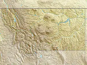 Castle Mountain Location in Montana  Castle Mountain Location in the United States | |
| Highest point | |
| Elevation | 12,617 ft (3,846 m) [1] |
| Prominence | 2,652 ft (808 m) [1] |
| Coordinates | 45°05′56″N 109°37′50″W [2] |
| Geography | |
| Location | Carbon County, Montana, U.S. |
| Parent range | Beartooth Mountains |
| Topo map | USGS Castle Mountain |
The peak is the third tallest in the Beartooth Mountains, and the highest point in Carbon County, Montana.
References
- "Castle Mountain, Montana". Peakbagger.com. Retrieved August 1, 2016.
- "Castle Mountain". Geographic Names Information System. United States Geological Survey. Retrieved August 1, 2016.
- Castle Mountain, MT (Map). TopoQwest (United States Geological Survey Maps). Retrieved August 1, 2016.
This article is issued from Wikipedia. The text is licensed under Creative Commons - Attribution - Sharealike. Additional terms may apply for the media files.