Chabbie River
The Chabbie River is a tributary of the Turgeon River flowing through Canada, in:
- Cochrane District, Northeastern Ontario;
- Eeyou Istchee Baie-James (municipality), in Jamésie, in the administrative region of Nord-du-Québec in Québec.
| Chabbie | |
|---|---|
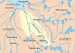 Harricana River basin in yellow | |
| Location | |
| Country | Canada |
| Province | Ontario |
| District | Cochrane |
| Physical characteristics | |
| Source | |
| • location | Cochrane District, Ontario |
| • coordinates | 49°43′16″N 79°56′39″W |
| • elevation | 309 m (1,014 ft) |
| Mouth | Turgeon River |
• location | Cochrane District, Ontario |
• coordinates | 49°30′15″N 79°30′52″W |
• elevation | 270 m (890 ft) |
| Length | 52.7 km (32.7 mi)[1] |
Forestry is the main economic activity of the sector; recreational tourism activities, second.
The surface of the river is usually frozen from early November to mid-May, but safe circulation on the ice generally occurs from mid-November to the end of April.
Geography
The main hydrographic slopes adjacent to the Chabbie River are:
- North side: Turcotte River, Little Turcotte River;
- East Side: Turcotte River, Turgeon River;
- South side: Burntbush River, Kabika River (Ontario), Patten River;
- West side: Burntbush River, Burntbush River, Tweed North River.
The Chabbie River originates at the mouth of a forest brook (altitude: 309 metres (1,014 ft)) feeding on a small marsh area in the eastern part of the Cochrane District , in Ontario.
The mouth of the small head lake is located at:
- 26.4 kilometres (16.4 mi) west of the boundary between Ontario and Quebec;
- 35.8 kilometres (22.2 mi) northwest of the mouth of the Chabbie River (confluence with the Turgeon River);
- 73.1 kilometres (45.4 mi) southwest of the mouth of the Turgeon River (in Quebec);
- 55.3 kilometres (34.4 mi) southeast of a southern bay of Kesagami Lake in Ontario.
From the mouth of the small head lake, the Chabbie River runs on 52.7 kilometres (32.7 mi) according to the following segments:
- 11.8 kilometres (7.3 mi)) to south-east, then south-westerly, to the mouth of the "North Chabbie Lake" which flows through {convert|0.7|km} to the South-East;
- 10.4 kilometres (6.5 mi) to the south-east including through a small unidentified lake (length: 1.0 kilometre (0.62 mi)) and the northern part of Lake Chabbie to the northeast to its mouth;
- 3.9 kilometres (2.4 mi) southeasterly to the north boundary of Noseworthy Township;
- 2.9 kilometres (1.8 mi)southeasterly to the west boundary of Bradette Township;
- 21.4 kilometres (13.3 mi) to the southeast in Bradette Township, then eastward to the boundary between Ontario and Quebec;
- 0.3 kilometres (0.19 mi)eastward in the Township of Dieppe in Quebec to the mouth.[2]
The Chabbie River flows on the west bank of the Turgeon River. This confluence is located at:
- 0.3 kilometres (0.19 mi) east of the boundary between Quebec and Ontario;
- 69.6 kilometres (43.2 mi) southwest of the mouth of the Turgeon River (confluence with the Harricana River);
- 87 kilometres (54 mi) southeast of a southern bay of Kesagami Lake in Ontario.
Toponymy
The term "Turcotte" is a surname of family of French origine.
See also
- Northeastern Ontario
- Turcotte River, a watercourse
- Turgeon River, a watercourse
- Harricana River, a watercourse
- James Bay, a body of water
References
- Atlas of Canada
- Distances measured from the Atlas of Canada (published on the Internet) of the Department of Natural Resources Canada.