Changhan District
Changhan (Thai: จังหาร, pronounced [t͡ɕāŋ.hǎːn]) is a district (amphoe) in the northwestern part of Roi Et Province, northeastern Thailand.
Changhan
จังหาร | |
|---|---|
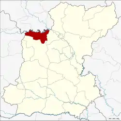 District location in Roi Et Province | |
| Coordinates: 16°8′18″N 103°36′54″E | |
| Country | Thailand |
| Province | Roi Et |
| Seat | Changhan |
| Area | |
| • Total | 165.1 km2 (63.7 sq mi) |
| Population (2005) | |
| • Total | 47,832 |
| • Density | 47.4/km2 (123/sq mi) |
| Time zone | UTC+7 (ICT) |
| Postal code | 45000 |
| Geocode | 4517 |
Geography
Neighboring districts are (from the east clockwise): Chiang Khwan and Mueang Roi Et of Roi Et Province; Mueang Maha Sarakham of Maha Sarakham Province; Khong Chai and Kamalasai of Kalasin Province.
History
The minor district (king amphoe) Changhan was established on 1 April 1989, when five tambon were split off from Mueang Roi Et District.[1] Tambon Yang Nai was split from tambon Pa Fa in July 1989, and Phakwaen from Muang Lat in July 1990. On 8 September 1995 the minor district was upgraded to a full district.[2]
Administration
The district is divided into eight sub-districts (tambons), which are further subdivided into 110 villages (mubans). There are no municipal (thesaban) areas; there are eight tambon administrative organizations (TAO).
| No. | Name | Thai name | Villages | Pop. | |
|---|---|---|---|---|---|
| 1. | Din Dam | ดินดำ | 17 | 7,560 | |
| 2. | Pa Fa | ปาฝา | 12 | 5,462 | |
| 3. | Muang Lat | ม่วงลาด | 12 | 5,682 | |
| 4. | Changhan | จังหาร | 19 | 7,089 | |
| 5. | Dong Sing | ดงสิงห์ | 18 | 9,458 | |
| 6. | Yang Yai | ยางใหญ่ | 10 | 4,228 | |
| 7. | Phak Waen | ผักแว่น | 13 | 5,036 | |
| 8. | Saen Chat | แสนชาติ | 9 | 3,317 |
References
- ประกาศกระทรวงมหาดไทย เรื่อง แบ่งท้องที่อำเภอเมืองร้อยเอ็ด จังหวัดร้อยเอ็ด ตั้งเป็นกิ่งอำเภอจังหาร (PDF). Royal Gazette (in Thai). 106 (40 ง): 1886. March 14, 1989.
- พระราชกฤษฎีกาตั้งอำเภอด่านมะขามเตี้ย อำเภอแก่งหางแมว อำเภอภักดีชุมพล อำเภอเวียงแก่น อำเภอแม่วาง อำเภอถ้ำพรรณรา อำเภอบ่อเกลือ อำเภอโนนสุวรรณ อำเภอห้วยราช อำเภอแม่ลาน อำเภอบางแก้ว อำเภอป่าพะยอม อำเภอหนองม่วงไข่ อำเภอยางสีสุราช อำเภอจังหาร อำเภอบ้านธิ อำเภอภูสิงห์ อำเภอบางกล่ำ อำเภอวังม่วง และอำเภอนายูง พ.ศ. ๒๕๓๘ (PDF). Royal Gazette (in Thai). 112 (32 ก): 1–3. August 8, 1995.