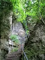
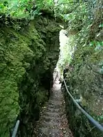
Chink (Isle of Wight)
The Chink is a scenic rock cleft between Bonchurch and Luccombe, Isle of Wight, with steps descending from St Boniface Down to the Bonchurch Landslips below.
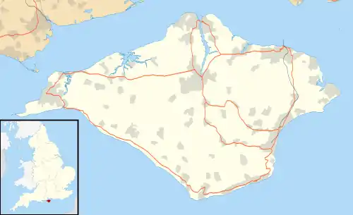
Its upper end is at the northern end of clifftop parkland accessed from the Leeson Road (A3055) car park, where there is a Southern Vectis bus route 3 stop.
The Chink was known in Victorian times as part of the development of the Bonchurch Landslips as a picturesque woodland walk.[1]
One of several such paths with carved steps connecting the clifftop to the Isle of Wight Undercliff, it follows a joint through the Upper Greensand crags capping the cliffs above the Landslip.[2] The path continues down through the Landslip as footpath V65, which joins the coastal path V65A at its foot.[3]
A similar rock cleft, the better-known Devil's Chimney, is about 200 yards south.
References
- Historic Environment Action Plan: The Undercliff, Isle of Wight County Archaeology and Historic Environment Service, October 2008 (retrieved 13 July 2013)
- Isle of Wight Council, Isle of Wight Shoreline Management Plan 2 / Appendix D / Natural and Built Environment Baseline / (Thematic Review), December 2010 (retrieved 13 July 2013)
- Isle of Wight Council, Rights of Way Maps, Map 82, Shanklin Down / Luccombe / The Landslip