Chittenango Creek
Chittenango Creek is a small river in central New York, United States.[1] The creek partially forms the boundary between Onondaga County and Madison County.
| Chittenango Creek | |
|---|---|
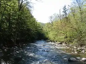 Chittenango Creek, looking downstream at Chittenango Falls State Park | |
 Location of the mouth of Chittenango Creek in New York State  Chittenango Creek (the United States) | |
| Location | |
| Country | United States |
| State | New York |
| Region | Central New York |
| Physical characteristics | |
| Source | Nelson Swamp |
| • location | Town of Fenner, Madison County |
| • coordinates | 42°57′31″N 75°45′13″W[1] |
| Mouth | Oneida Lake |
• location | Bridgeport |
• coordinates | 43°11′01″N 75°59′36″W[1] |
The Chittenango Creek watershed comprises about 290 square miles (750 km2) of drainage in Onondaga and Madison counties. The median annual flow is estimated at about 300 cubic feet per second (8.5 m3/s).
Course
Chittenango Creek originates in Nelson Swamp in the town of Fenner in Madison County.[2][1] It receives the outflow for Cazenovia Lake near the village of Cazenovia. From there it flows northward, passing over a 167-foot (51 m) waterfall in Chittenango Falls State Park[3] before flowing through the village of Chittenango. The creek flows out into Oneida Lake near the community of Bridgeport.
Tributaries
- Butternut Creek
- Limestone Creek
- Meadow Brook
See also
References
- "Chittenango Creek". Geographic Names Information System. United States Geological Survey. Retrieved January 25, 2016.
- "Chittenango Creek". NYS Department of Environmental Conservation. Retrieved January 26, 2016.
- "Chittenango Falls State Park". NYS Office of Parks, Recreation & Historic Preservation. Retrieved January 25, 2016.