Churchill Lake
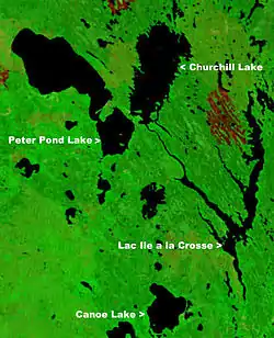
Churchill Lake is a glacial lake in north west Saskatchewan, Canada. Frobisher Lake flows in from the north while Peter Pond Lake flows in from the east through the Kisis Channel. Highway 155 crosses this channel at the village of Buffalo Narrows .
| Churchill Lake | |
|---|---|
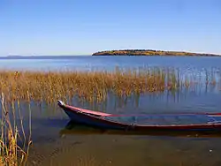 Churchill Lake at Buffalo Narrows | |
 Churchill Lake | |
 | |
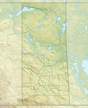
| Location | Saskatchewan |
| Coordinates | 55°55′N 108°20′W |
| Type | glacial lake |
| Primary inflows | Peter Pond Lake, Frobisher Lake, MClusky River |
| Primary outflows | Churchill River to Lac Île-à-la-Crosse |
| Catchment area | 7,874 km2 (3,040 sq mi) |
| Basin countries | Canada |
| Surface area | 559 km2 (216 sq mi) |
| Average depth | 9 m (30 ft) |
| Max. depth | 24 m (79 ft) |
| Water volume | 4.88 km3 (1.17 cu mi) |
| Shore length1 | 212 km (132 mi) |
| Surface elevation | 421 m (1,381 ft) |
| Settlements | Buffalo Narrows |
| References | [2][3] |
| 1 Shore length is not a well-defined measure. | |
It is part of the Churchill River drainage basin. As the source of the Churchill River the length of the river (1,609 km (1,000 mi)) is measured from the north end of the lake to the Hudson Bay. The lake can freeze from as early as November and remain frozen till May.[2]
Historic map
.jpg.webp)
John Franklin's Coppermine Expedition map of 1819–1822 shows details of the fur trade route from Île-à-la-Crosse to Methye Portage. Churchill Lake is shown as Clear Lake with its northern reaches still unknown. Also not yet surveyed are the waters of Wasekamio Lake, Turnor Lake then Frobisher Lake that flow from the north into Churchill Lake. From the northwest Lac La Loche (Methye Lake) then Peter Pond Lake (Buffalo Lake) flow into Churchill Lake. Clearwater Lake (or Clear Lake) was renamed Churchill Lake in 1944 [4] and Buffalo Lake was renamed Peter Pond Lake in 1932.[4]
Fish Species
The lake's fish species include: walleye, sauger, yellow perch, northern pike, lake trout, lake whitefish, cisco, white sucker, longnose sucker and burbot.[5]
See also
- List of lakes in Saskatchewan
References
- "NASA Visible Earth (BURN SCARS IN SASKATCHEWAN, CANADA) Note: Dark to light rust coloured areas are burn scars from forest fires". August 24, 2002. Retrieved 2014-09-14.
- "World Lake Database (Churchill Lake)". Archived from the original on 2015-09-20. Retrieved 2012-10-13.
- "The Atlas of Canada". Archived from the original on 2012-10-06. Retrieved 2012-10-13.
- "Geographical Names Query (Churchill Lake)". Retrieved 16 April 2013.
- "Fish Species of Saskatchewan" (PDF). Archived from the original (PDF) on 2011-07-19. Retrieved 2012-10-13.