Colma Creek
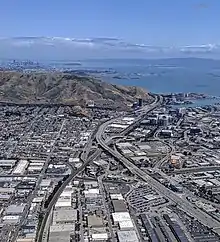
Colma Creek is a small creek that flows to the San Francisco Bay from its source in the Crocker Hills portion of San Bruno Mountain State and County Park, north of San Mateo County's Guadalupe Canyon Parkway,[3] with contribution from April Brook on San Bruno Mountain proper, south of the Parkway.[4] It flows southwest and makes a 90 degree bend in Daly City to flow southeastward, through Daly City, Colma, and South San Francisco to the bay. Its small delta is between South San Francisco and the San Francisco International Airport.[2]
| Colma Creek | |
|---|---|
 | |
| Location | |
| Country | United States |
| State | California |
| City | South San Francisco |
| Physical characteristics | |
| Source | Northern San Bruno Mountain |
| • location | San Mateo County[1] |
| • coordinates | 37°40′27″N 122°27′29″W |
| Mouth | San Francisco Bay (Pacific Ocean) |
• location | San Mateo County[1] |
• coordinates | 37°38′40″N 122°23′33″W |
• elevation | 0 ft (0 m) |
| Discharge | |
| • location | South San Francisco–San Francisco International Airport[2] |
The creek has a tributary stream named Twelvemile Creek, which joins it from the southwest along Westborough Blvd. in South San Francisco.[4]
History
The large delta the creek once supported was an important stop for migratory waterfowl and other wildlife. However, like many urban creeks, Colma Creek has been surrounded by flood control walls, buried in some parts, and had much of its large delta filled in by developers. Most of the lower parts of the creek are devoid of native vegetation due to the flood control project, reducing the habitat of the endangered California clapper rail and other species that use the creek.
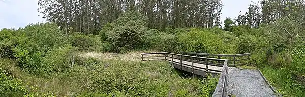
The headwaters of the creek are lined with non-native trees like eucalyptus, cypress, and Himalayan blackberry, displacing the native riparian plants like dogwood and willow. The creek sometimes runs dry due to the non-native vegetation lowering the water table at the source. In 2005, Shelterbelt Builders developed a habitat restoration plan to return the creek to its former state by removing invasive and non-native plants and replanting native, riparian plants at the source.[3] In addition, in South San Francisco, new wetland was created to mitigate wetland lost to floodwall construction and improvements. The California clapper rail is expected to reinhabit the new salt and freshwater wetland, along with other species displaced by the flood control works.[5]
Watercourse gallery
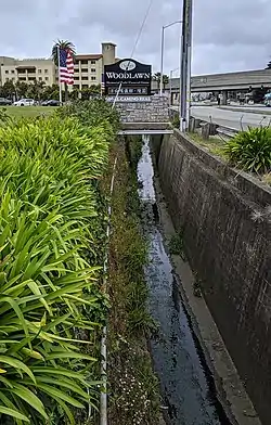
- On the west side of El Camino Real in front of Woodlawn Memorial Park, Colma, looking northwest
 By the South San Francisco BART station, looking northwest along the border with Colma
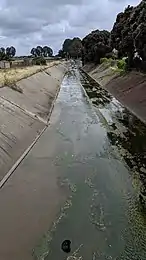 At Chestnut Ave, looking southeast, just above where Twelve Mile Creek joins from the right
_at_Antoinette_Lane.jpg.webp) Twelve Mile Creek at Antoinette Lane, South San Francisco, looking southwest, upstream
Twelve Mile Creek at Antoinette Lane, South San Francisco, looking southwest, upstream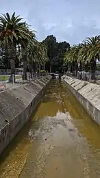 At Orange Memorial Park, South San Francisco, looking northwest into the park
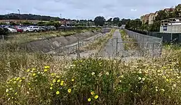
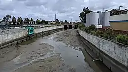 At S. Linden Ave, South San Francisco, as the creek approaches the railroad tracks and US 101 on its way to the bay
References
- "Feature Detail Report for: Colma Creek (San Mateo County, California)". Geographic Names Information System. United States Geological Survey. January 19, 1981. Retrieved December 18, 2007.
- "Colma Creek, USGS San Francisco South (CA) Topo Map". USGS Quad maps. TopoQuest.com. Retrieved 2008-06-29.
- "Colma Creek Restoration Plan, Shelterbelt Builders, Inc".
- "Colma Creek Watershed". Museumca.org. Retrieved 2007-08-16.
- "San Mateo County Department of Public Works". Archived from the original on 2007-08-15. Retrieved 2007-08-16.