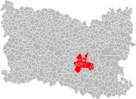
Communauté de communes des Pays d'Oise et d'Halatte
The Communauté de communes des Pays d'Oise et d'Halatte is a communauté de communes located in the Oise département and in the Hauts-de-France région of France.
Pays d'Oise et d'Halatte | |
|---|---|
 | |
| Country | France |
| Region | Hauts-de-France |
| Department | Oise |
| No. of communes | 17 |
| Established | 1998 |
| Seat | Pont-Sainte-Maxence |
| Government | |
| • President | Christian Massaux |
| Area | |
| • Total | 139.47 km2 (53.85 sq mi) |
| Population (2014) | |
| • Total | 34,181 |
| • Density | 245/km2 (630/sq mi) |
History
The Communauté de communes des Pays d'Oise et d'Halatte was created in January 1998. It includes 17 communes with a population of about 34,000 inhabitants.
Territory
Geography
The communauté de communes is located in the heart of the Oise valley, 60 km north from Paris, between Creil and Compiègne, 6 km away from the A1 highway and 40 km away from the Charles De Gaulle airport.
About half of its territory is located within the scope of the Parc naturel régional Oise-Pays de France,[1] and seven of its municipalities are located on the Oise River.
The territory, with an area of 14,002 hectares, has about 34,000 inhabitants.[2]
Composition
The communauté de communes consists of the following 17 communes:[3][4]
| Name | Area (km²) | Population |
|---|---|---|
| Pont-Sainte-Maxence | 14.76 | 12,669 |
| Les Ageux | 5.00 | 1,134 |
| Angicourt | 4.96 | 1,485 |
| Bazicourt | 3.82 | 325 |
| Beaurepaire | 5.07 | 62 |
| Brenouille | 4.31 | 2,081 |
| Cinqueux | 6.79 | 1,539 |
| Monceaux | 6.60 | 786 |
| Pontpoint | 19.11 | 3,240 |
| Rhuis | 2.70 | 140 |
| Rieux | 2.33 | 1,550 |
| Roberval | 4.83 | 371 |
| Sacy-Le-Petit | 7.45 | 548 |
| Sacy-Le-Grand | 17.70 | 1,450 |
| Saint-Martin-Longueau | 3.62 | 1,476 |
| Verneuil-en-Halatte | 22.26 | 4,673 |
| Villeneuve-sur-Verberie | 8.16 | 652 |
See also
References
- "Schéma régional de cohérence écologique : Les continuités écologiques dans le SCOT de la CCPOH" (PDF).
- "Statistics".
- BANATIC, Périmètre des EPCI à fiscalité propre. Accessed 2017-06-28.
- INSEE