Connecticut Route 145
Route 145 is a state highway in the western part of the Connecticut River Estuary region of Connecticut. It connects Clinton center, through the village of Winthrop, to the town of Chester.
| ||||
|---|---|---|---|---|
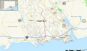 Map of Middlesex County in southern Connecticut with Route 145 highlighted in red | ||||
| Route information | ||||
| Maintained by ConnDOT | ||||
| Length | 9.91 mi[1] (15.95 km) | |||
| Existed | 1932[2]–present | |||
| Major junctions | ||||
| South end | ||||
| North end | ||||
| Location | ||||
| Counties | Middlesex | |||
| Highway system | ||||
| ||||

Route description
Route 145 begins at an intersection with US 1 in Clinton and heads northeast, into Westbrook. In Westbrook, it turns north, intersecting with I-95 and passing by the Messerschmidt Pond Wildlife Area, before continuing into the town of Deep River. In Deep River, it continues north through the Winthrop section of the town, briefly overlapping Route 80 before continuing into Chester. In Chester, it continues north and northeast, curving around Chester Airport before ending at an intersection with Route 148 within the Cockaponset State Forest.[1]
History
Route 145 was established in 1932,[2] following a loop around the Clinton Country Club and passing by the beach communities of Grove Beach and Clinton Beach within the town of Clinton. In 1959, it was extended as a tail north through Westbrook to the former Route 144 (now a town road called Bushy Hill Road) in Deep River. In 1942 or 1943, its northern end was relocated and extended northward to Route 80. In 1962, it was extended to its current northern terminus at Route 148 and the portion south of US 1 became town roads. Part of old Route 145 called Grove Beach Road between current Route 145 and US 1 is still a state road with unsigned designation State Road 625.[3]
Junction list
The entire route is in Middlesex County.
| Location | mi[1] | km | Destinations | Notes | |
|---|---|---|---|---|---|
| Clinton | 0.00 | 0.00 | |||
| Westbrook | 1.37 | 2.20 | SSR 625 (Grove Beach Road North) | ||
| 1.98 | 3.19 | Exit 64 on (I-95/Conn. Tpk.) | |||
| Deep River | 6.64 | 10.69 | Western terminus of CT 80 overlap | ||
| 6.99 | 11.25 | Eastern terminus of CT 80 overlap | |||
| Chester | 9.91 | 15.95 | |||
1.000 mi = 1.609 km; 1.000 km = 0.621 mi
| |||||
References
- Connecticut State Highway Log Archived 2015-07-26 at WebCite
- "Road Conditions in Connecticut". The Hartford Daily Courant. May 27, 1932. p. 14. Retrieved December 24, 2019 – via Newspapers.com.

- Connecticut Routes, Route 145