Core Creek (Neshaminy Creek tributary)
Core Creek is a tributary of the Neshaminy Creek in Bucks County, Pennsylvania. Rising in Lower Makefield Township, it flows in the Stockton Formation until it meets its confluence with the Neshaminy in Middletown Township. At one time it powered seven mills along its length.
| Core Creek Coar Creek, Koar Creek, Ye Old Mans Creek | |
|---|---|
 | |
| Location | |
| Country | United States |
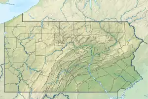
| State | Pennsylvania |
| County | Bucks |
| Township | Lower Makefield, Middletown |
| Physical characteristics | |
| Source | |
| • coordinates | 40°15′30″N 74°54′51″W |
| • elevation | 280 feet (85 m) |
| Mouth | |
• coordinates | 40°11′22″N 74°55′40″W |
• elevation | 66 feet (20 m) |
| Length | 7.24 miles (11.65 km) |
| Basin size | 9.77 square miles (25.3 km2) |
| Basin features | |
| Progression | Core Creek → Neshaminy Creek → Delaware River → Delaware Bay |
| River system | Delaware Bay |
| Landmarks | Garden of Reflection, Core Creek Park |
| Waterbodies | Silver Lake, Lake Luxembourg |
| Slope | 29.56 feet per mile (5.598 m/km) |
Statistics
The watershed of Core Creek is approximately 9.77 square miles (25.3 km2), part of the Delaware River watershed, and meets at the Neshaminy Creek's 14.30 river mile. The Geographic Names Information System I.D. is 1172452. [1] The U.S. Department of the Interior, U.S. Geological Survey I.D. is 02543.[2]
History
An old document in the Library of the Bucks County Historical Society at one time dated "the 3 day of ye 7th month of 1696," the report of a jury appointed by the Court of Bucks County to lay out "a road (viz a cart road) from new towne [Newtown] to ye ferry at Gilbert Wheeler's." At one time there were seven mills along the creek.[3]
Course
Core Creek rises in the northwestern portion of Lower Makefield Township, oriented east, the southeast, then is oriented southwest for some distance, passing into Middletown Township until it passes through Core Creek Park as it passes through Lake Luxembourg, created in 1975. After the lake, it continues southwest until it meets with the Neshaminy Creek. [4]
Geology
Core creek lies within the Stockton Formation, a bedrock of sandstone, arkosic sandstone, shale, siltstone, and mudstone deposited during the Triassic. [5]
Municipalities
Crossings and Bridges
| Crossing | NBI Number | Length | Lanes | Spans | Material/Design | Built | Reconstructed | Latitude | Longitude |
|---|---|---|---|---|---|---|---|---|---|
| Pennsylvania Route 413 (Langhorne Newtown Road) | 40951 | 20 metres (66 ft) | 3 | 1 | Prestressed box beam or girders-multiple | 2000 | - | 40°11'26.6"N | 74°55'36"W |
| Park Road | |||||||||
| Woodbourne Road | 7245 | 13 metres (43 ft) | 2 | 1 | Prestressed concrete box beam or girder-single or spread | 1976 | - | 40°12'42.2"N | 74°54'26.89"W |
| Pennsylvania Route 332 (Newtown Yardley Road, Newtown Bypass) | 7007 | 43 metres (141 ft) | 4 | 1 | Prestressed concrete stringer/multi-beam or girder | 1990 | - | 40°13'54"N | 74°54'6"W |
| Lindenhurst Road | 7307 | 13 metres (43 ft) | 2 | 1 | Prestressed concrete box beam or girders-single or spread | 1966 | - | 40°14'7.8"N | 74°53'46.5"W |
| Quarry Road | |||||||||
| Woodside Road | |||||||||
| Lindenhurst Road | 41240 | 6 metres (20 ft) | 2 | 2 | Culvert | 2001 | - | 40°15'24.5"N | 74°53'50.48"W |
| Pennsylvania Route 532 (Washington Crossing Road) |
See also
References
- "GNIS Feature Search". geonames.usgs.gov. U.S. Geological Survey, U.S. Department of the Interior. Retrieved 1 November 2017.
- paGazetteerOfStreams, lycomingedu, p48, I.D. 02561 (PDF)
- MacReynolds, George, Place Names in Bucks County, Pennsylvania, Doylestown, Bucks County Historical Society, Doylestown, PA, 1942, P84.
- "U.S. Geological Survey, The National Map". TNM Download. U.S. Department of the Interior. Retrieved 1 November 2017.
- "Pennsylvania Geological Survey". PaGEODE. Pennsylvania Department of Conservation and Natural Resources. Retrieved 2 November 2017.
- "The National Bridge Inventory Database". National Bridges. Retrieved 4 November 2017.