Corner Peak
Corner Peak (63°35′S 58°39′W) is a pyramidal peak, 930 metres (3,050 ft) high, with considerable rock exposed on its northern face. Located in the northeastern Srednogorie Heights, 8 nautical miles (15 km) east-southeast of Cape Roquemaurel, it marks a corner in the broad glacial valley of Malorad Glacier which rises immediately to the southeast and fans out northwest to form a piedmont ice sheet on the northwest side of the Trinity Peninsula. It was named by the Falkland Islands Dependencies Survey following a 1946 survey.[1]
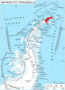
Location of Trinity Peninsula.
Map
- Trinity Peninsula. Scale 1:250000 topographic map No. 5697. Institut für Angewandte Geodäsie and British Antarctic Survey, 1996.
References
- "Corner Peak". Geographic Names Information System. United States Geological Survey. Retrieved 2011-11-26.
![]() This article incorporates public domain material from the United States Geological Survey document: "Corner Peak". (content from the Geographic Names Information System)
This article incorporates public domain material from the United States Geological Survey document: "Corner Peak". (content from the Geographic Names Information System)
This article is issued from Wikipedia. The text is licensed under Creative Commons - Attribution - Sharealike. Additional terms may apply for the media files.