County of Dagmar
The county of Dagmar is a cadastral division of Queensland north-west of Cairns. It contains the town of Julatten.[1]
| Dagmar Queensland | |||||||||||||||
|---|---|---|---|---|---|---|---|---|---|---|---|---|---|---|---|
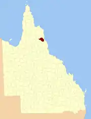 Location within Queensland | |||||||||||||||
| |||||||||||||||
On 7 March 1901, the Governor issued a proclamation legally dividing Queensland into counties under the Land Act 1897.[2] Its schedule described Dagmar thus:
Bounded on the north-west by the county of Chelmsford; on the south-west and south by the Mitchell and Hodgkinson Rivers upwards to Deep Creek, by that creek upwards to its head, and by the northern watershed of the Hodgkinson River easterly to the western watershed of the Barron River; and on the east and north-east by the Coast Range northerly to the county of Chelmsford.
Parishes
Dagmar is subdivided into parishes, listed as follows:
| Parish | LGA | Coordinates |
|---|---|---|
| Buringan | Mareeba | 16°39′S 144°48′E |
| Cudgee | Mareeba | 16°36′S 145°01′E |
| Garioch | Mareeba | 16°40′S 145°23′E |
| Gorilbee | Mareeba | 16°33′S 144°42′E |
| Kanawarra | Mareeba | 16°25′S 145°08′E |
| Koobaba | Mareeba | 16°25′S 145°00′E |
| Layland | Mareeba | 16°48′S 145°06′E |
| Mappe | Mareeba | 16°31′S 145°04′E |
| Mar | Mareeba | 16°48′S 145°20′E |
| Northedge | Mareeba | 16°42′S 145°12′E |
| Riflemead | Mareeba | 16°35′S 145°16′E |
| Southedge | Mareeba | 16°56′S 145°19′E |
| Talgijah | Mareeba | 16°29′S 144°52′E |
| Tregoora | Mareeba | 16°31′S 144°31′E |
| Watangay | Mareeba | 16°47′S 144°56′E |
References
- Cook District, County of Dagmar Maps - N9 Series at Queensland Archives.
- "A Proclamation". Queensland Government Gazette. 75. 8 March 1901. pp. 967–980.
This article is issued from Wikipedia. The text is licensed under Creative Commons - Attribution - Sharealike. Additional terms may apply for the media files.