Crown Peak
Crown Peak (63°34′S 58°33′W) is an ice-covered peak, 1,185 metres (3,890 ft) high, topped by a conspicuous crown-shaped ice formation. It forms the highest summit and the south end of the Marescot Ridge on the northwest side of the Trinity Peninsula. The peak lies 10 nautical miles (19 km) east of Cape Roquemaurel, 4.2 km west of Lardigo Peak and 7.17 km northeast of Mount Ignatiev. It was named by the Falkland Islands Dependencies Survey following their survey of the area in 1946.[1]
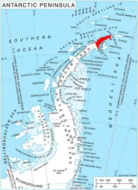
Location of Trinity Peninsula shown in red.
Map
- Trinity Peninsula. Scale 1:250000 topographic map No. 5697. Institut für Angewandte Geodäsie and British Antarctic Survey, 1996.
References
- "Crown Peak". Geographic Names Information System. United States Geological Survey. Retrieved 2011-12-06.
![]()
This article is issued from Wikipedia. The text is licensed under Creative Commons - Attribution - Sharealike. Additional terms may apply for the media files.