Currant Mountain
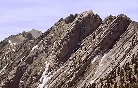
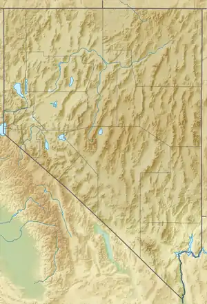
Currant Mountain is the highest mountain in the White Pine Range in White Pine County, Nevada, United States. It is the twenty-first-highest mountain in the state,[3] and also ranks as the sixteenth-most topographically prominent peak in the state.[4] Its summit consists of a series of three spires on a thin limestone ridge, with the southern spire being the highest at 11,518 feet (3,511 m). To the west are the Duckwater (Shoshone) tribal lands and the northern arm of large Railroad Valley. To the east is the northern part of White River Valley. The peak is located about 37 miles (60 km) southwest of the community of Ely near the Nye County border, within the Currant Mountain Wilderness of the Humboldt-Toiyabe National Forest.
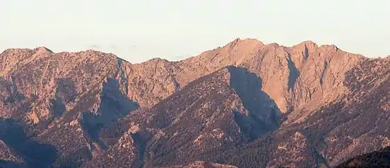
Currant Mountain, looking west at sunrise.
| Currant Mountain | |
|---|---|
 | |
| Highest point | |
| Elevation | 11,518 ft (3,511 m) NAVD 88[1] |
| Prominence | 4,575 ft (1,394 m) [2] |
| Coordinates | 38°54′35″N 115°25′29″W [1] |
| Geography | |
 Currant Mountain White Pine County, Nevada, U.S. | |
| Parent range | White Pine Range |
| Topo map | USGS Currant Mountain |
| Climbing | |
| Easiest route | From the south ridge: Steep hike & scramble |
References
- "Currant Mt". NGS data sheet. U.S. National Geodetic Survey. Retrieved 2008-11-21.
- "Currant Mountain, Nevada". Peakbagger.com. Retrieved 2008-04-03.
- "Nevada 11,000-foot Peaks". Peakbagger.com. Retrieved 2014-10-22.
- "Nevada Peaks with 2000 feet of Prominence". Peakbagger.com. Retrieved 2014-10-23.
External links
- "Currant Mountain". Geographic Names Information System. United States Geological Survey. Retrieved 2008-11-21.
- "Currant Mountain". SummitPost.org. Retrieved 2011-05-07.
 Media related to Currant Mountain at Wikimedia Commons
This article is issued from Wikipedia. The text is licensed under Creative Commons - Attribution - Sharealike. Additional terms may apply for the media files.